Cold temperatures in Montana and North Dakota
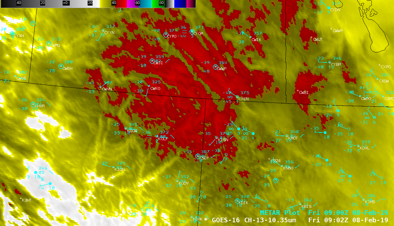
GOES-16 “Clean” Infrared Window (10.3 µm) images, with hourly plots of surface reports [click to play animation | MP4]
A sequence of VIIRS Infrared Window (11.45 µm) images from Suomi NPP and NOAA-20 (below) showed similar surface brightness temperatures, with some pixels as cold as -48ºC (-54ºF). The color enhancement applied to the VIIRS images is the same as that used on the GOES-16 images above, with the red colors beginning at the -40ºC breakpoint (violets begin at -50ºC). While there is not a direct correspondence between satellite-sensed surface infrared brightness temperatures and air temperatures measured in an above-ground instrument shelter, with improving satellite spatial resolution the difference is often within 1-3ºC (or 2-5ºF).
![VIIRS Infrared Window (11.45 µm) images from Suomi NPP (at 0753 and 0937 UTC) and NOAA-20 (at 0844 UTC) [click to enlarge]](https://cimss.ssec.wisc.edu/satellite-blog/wp-content/uploads/sites/5/2019/02/190208_suomiNPP_noaa20_viirs_infrared_MT_ND_anim.gif)
VIIRS Infrared Window (11.45 µm) images from Suomi NPP (at 0753 and 0937 UTC) and NOAA-20 (at 0844 UTC) [click to enlarge]
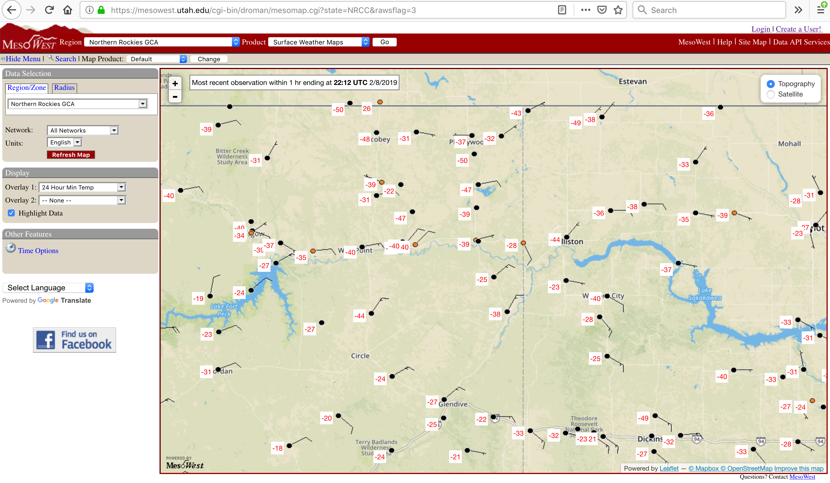
Highs & lows from across the area today. The cold spots this morning were the stations 13 mi. NNW of Four Buttes & 2 mi. WSW of Antelope, both checking in at -50!
The "warm" spots this afternoon were 16 mi. NNE of Mosby at 15, & 5 mi. west of Landusky at 14. #mtwx #cold #brrr pic.twitter.com/UCPScKGS7b
— NWS Glasgow (@NWSGlasgow) February 9, 2019
The all-time record low minimum for any @NDAWNmesonet set at Hofflund this morning was a -47.3?F (-44.0?C) reading looking at the raw data, so there was no rounding down to get to -47?. #impressive
— Daryl Ritchison (@DarylRitchison) February 8, 2019