By Scott Bachmeier •
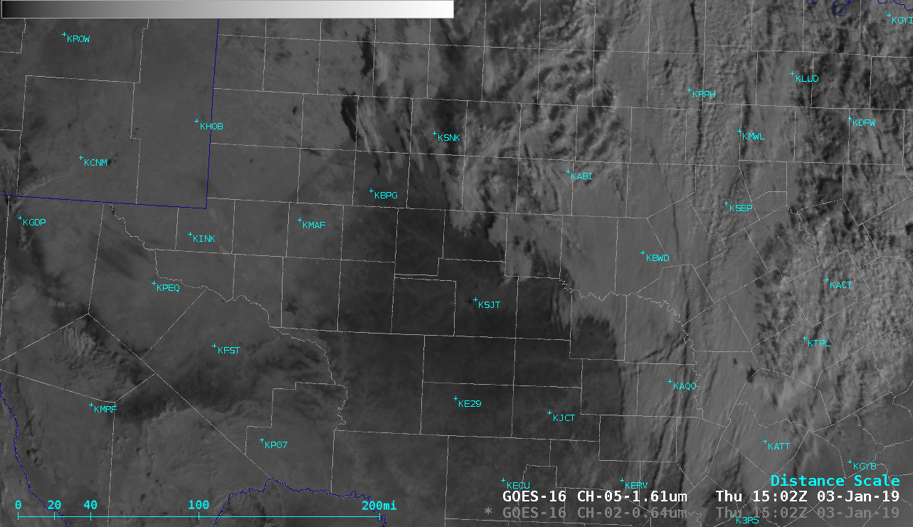
Portions of West Texas received a light accumulation of ice from freezing rain/drizzle/fog during the daytime and evening hours on 02 January 2019. On the following morning prior to melting, in a comparison of GOES-16 (GOES-East) “Red” Visible (0.64 µm) and Near-Infrared “Snow/Ice” (1.61 µm) images (above) the semi-transparent glaze of ice that covered the surface was not apparent in the Visible imagery but exhibited a darker appearance in the Snow/Ice imagery (since snow and ice efficiently absorb energy at the 1.61 µm wavelength). Some localized white patches of light snow cover could also be seen, primarily in the Big Spring (KBPG) and Snyder (KSNK) areas.Categories: GOES-16, Winter weather