Why Mesoscale Sectors Matter: Hurricane Norman

GOES-16 Mesoscale Sectors over Hurricane Norman (left) and a tropical wave (right), along with a CONUS image
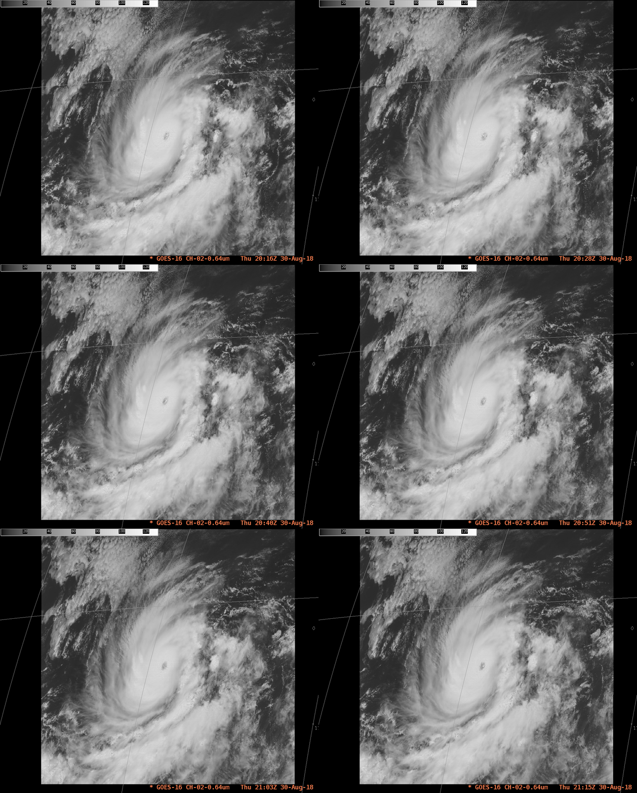
Pacific Hurricane Norman, a potent storm with sustained winds of 150 mph, exists outside of GOES-16’s CONUS (Contiguous United States) domain. In fact, on 30 August 2018, both GOES-16 Meso sectors were placed over the tropics to provide 1-minute imagery of tropical systems, both Norman over the Pacific, and a strong tropical easterly wave over the Atlantic and Caribbean. The toggle above shows the two positions (using visible imagery at 0.64 µm) along with the CONUS domain (using the clean window, band 13 at 10.3 µm).
The Mesoscale Sector allows 1-minute imagery over Norman. Otherwise, full-disk imagery with a time cadence of every 15 minutes would be used. The hour-long animation, below, shows the evolution of the storm and its environment.
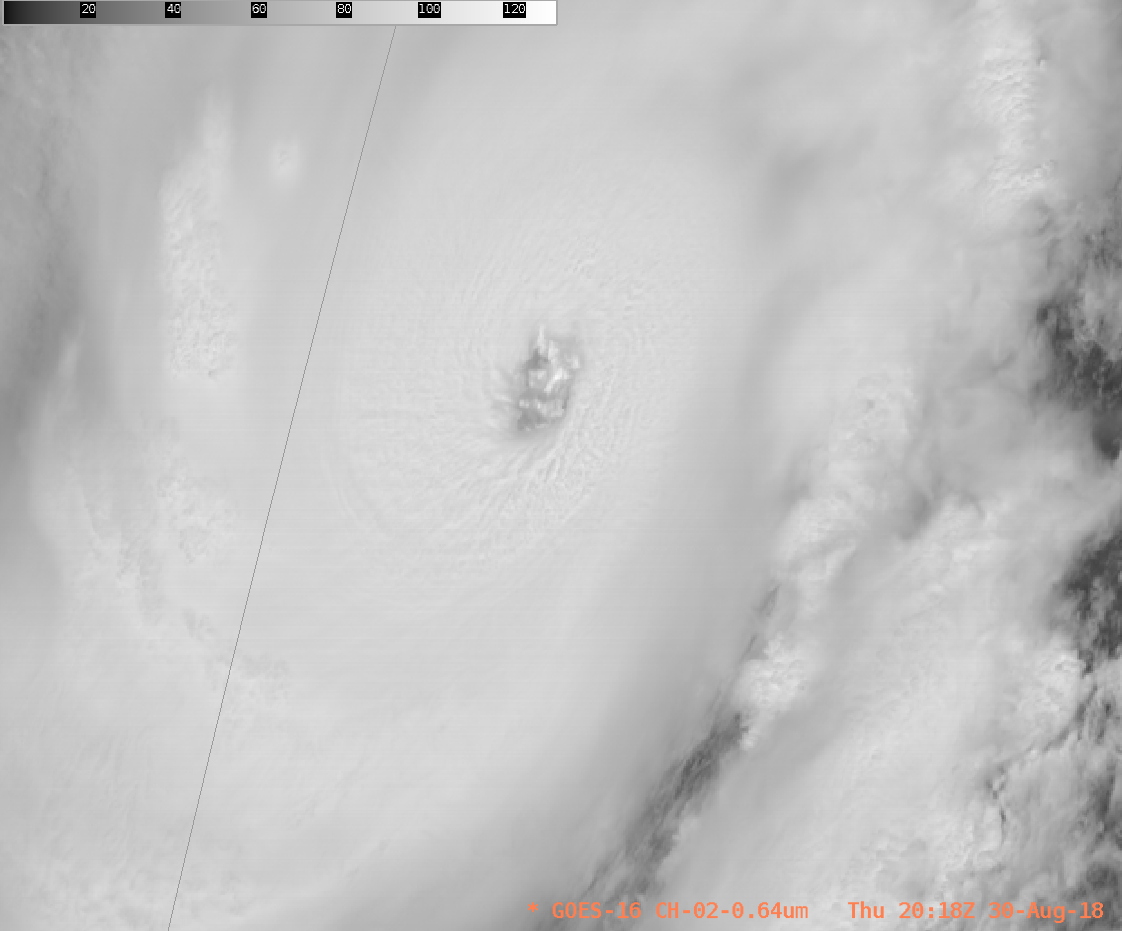
A closer view of the eye, below, (Click to play animated gif), shows a well-developed eye with embedded low clouds. Because Norman is near 120 W, the view angle is oblique and only the western edge of the eyewall can be viewed.
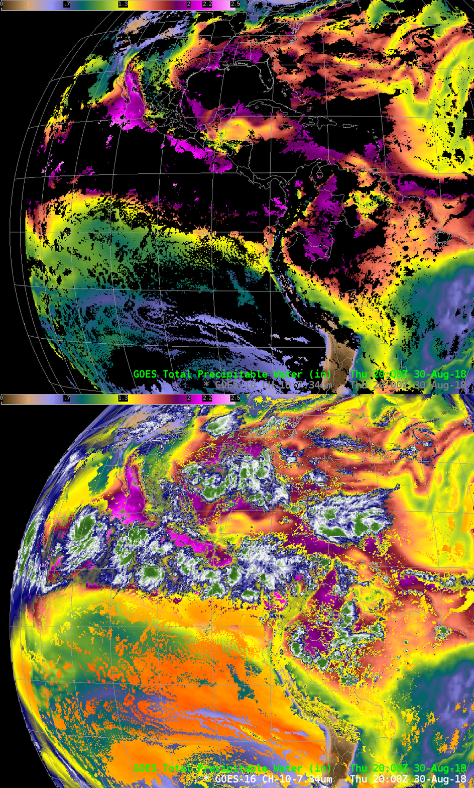
Norman appears to be at the northern edge of deep tropical moisture, based on the toggle below of GOES-16 Clear Sky Total Precipitable Water and the GOES-16 infrared Low-Level Water Vapor image (7.34 µm). The projected path of Norman is mostly Westward so the storm will remain within deep tropical moisture for the next several days. It is forecast to remain a strong hurricane.

GOES-16 ABI Clear-Sky Total Precipitable Water toggled with GOES-16 Infrared Low-Level Water Vapor (7.34 µm) in cloudy skies, 2000 UTC on 30 August 2018 (Click to enlarge)
For more information on Norman, please consult the website of the National Hurricane Center or the SSEC/CIMSS Tropical Weather Website.


