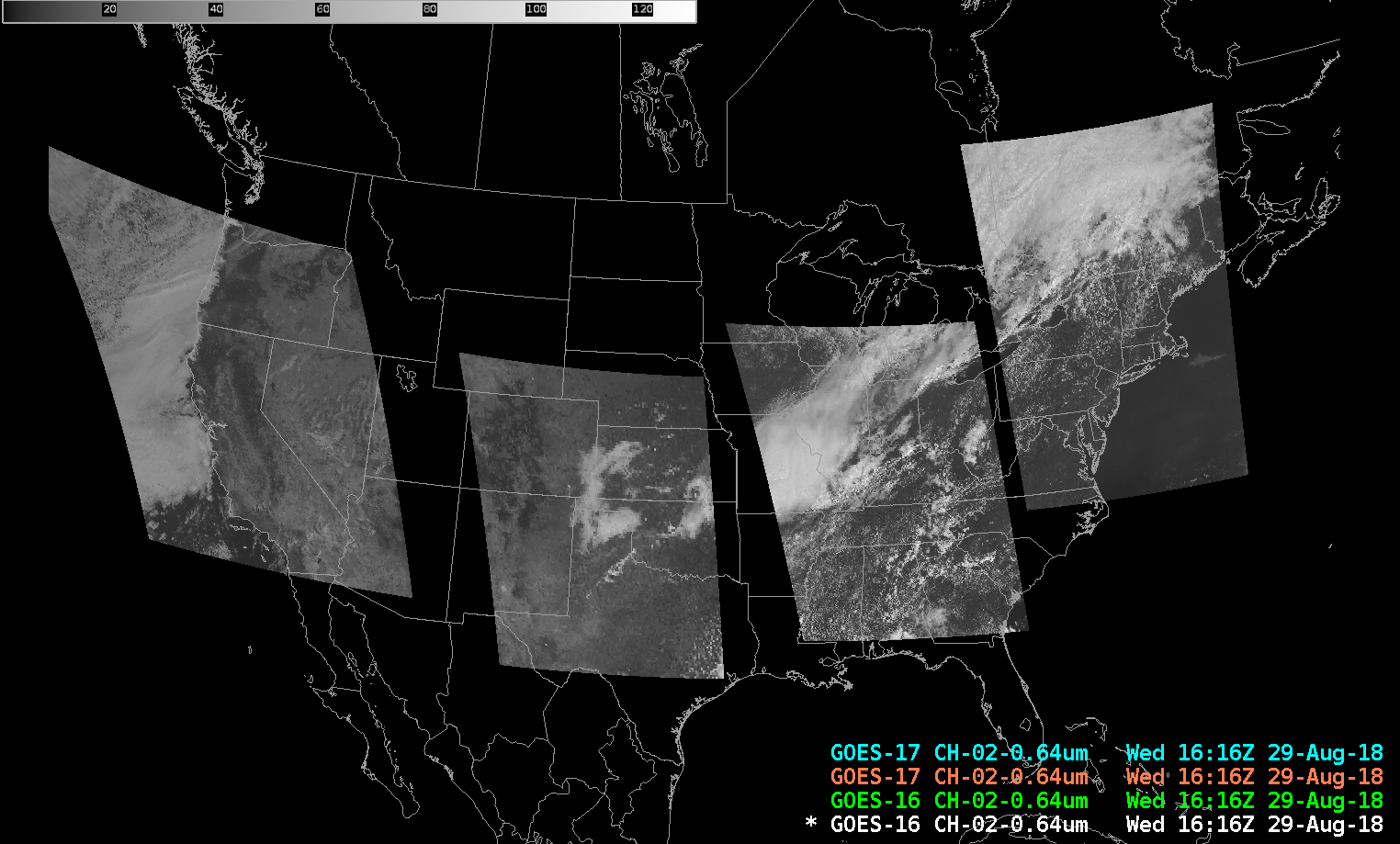
Stereoscopic Views of Convection every minute in Mesoscale Domains
GOES-17 images shown here are preliminary and non-operational
The presence of GOES-17 data means that 4 mesoscale sectors, each taking 1-minute imagery, are over the United States. In the example above, from 1616 UTC on 29 August 2018, there is no overlap. (Note: Three of the Four are in their default locations; the Mesoscale sector over the northeast United States has been shifted north to monitor convection over New England).
On 28 August 2018, however, two mesoscale sectors overlapped over the central United States, and sampled convection developing over Oklahoma (that subsequently caused wind damage in Roger Mills County in western Oklahoma). The Stereoscopic View of that convection is shown below. To view the convection in three dimensions, cross your eyes until you see 3 images, and focus on the image in the center. An animated gif (215 Megabytes!!) is available here.


