Stereoscopic views of convection over Georgia, North Dakota and Mexico
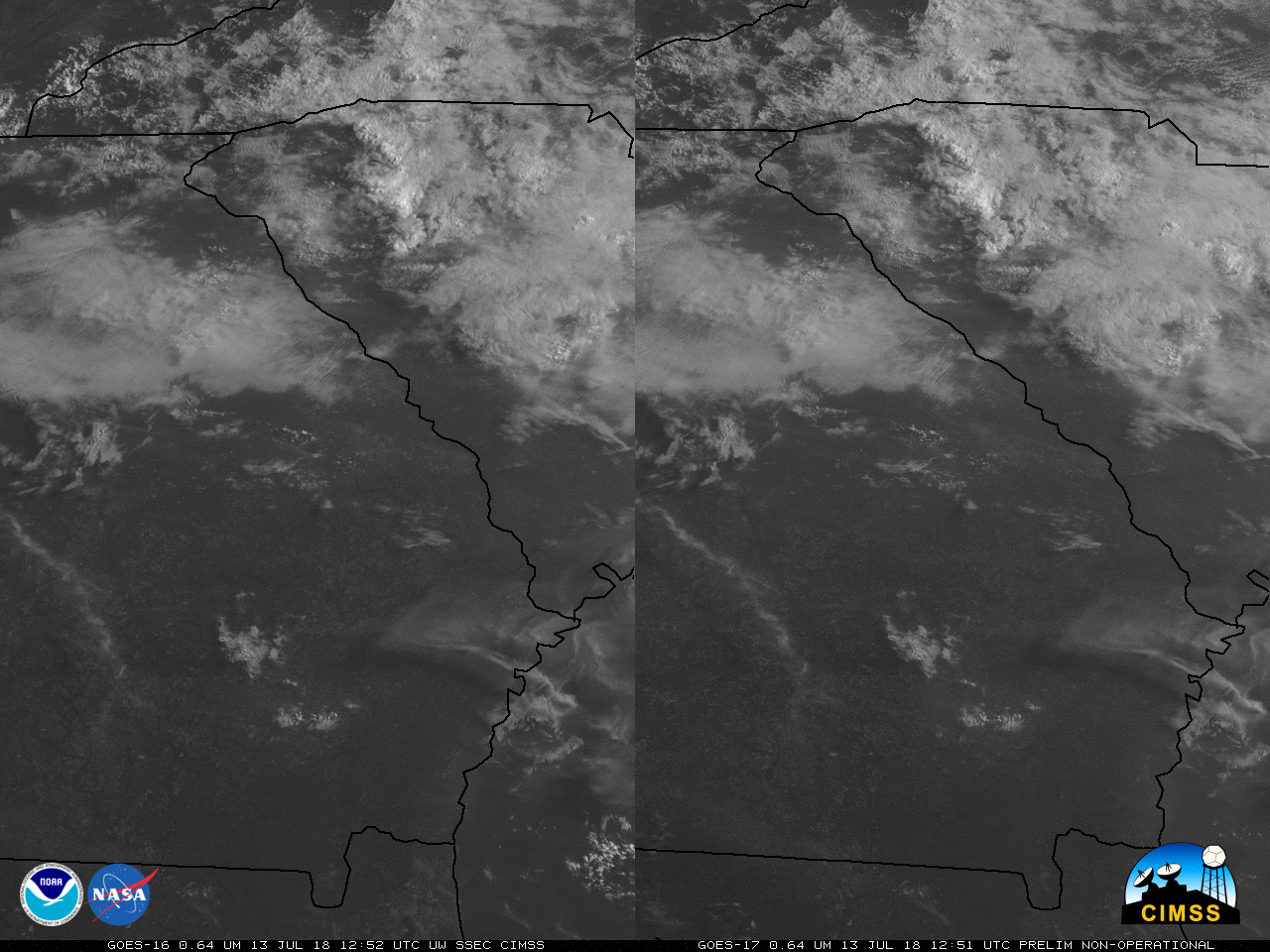
GOES-16 Visible and GOES-17 Visible (0.64 µm) Imagery over Georgia, 1252-2057 UTC on 13 July 2018 (Click to play mp4 animation)
GOES-17 imagery shown here are preliminary and non-operational
GOES-16 and GOES-17 visible imagery shows pseudo-stereoscopic imagery of developing convection on 13 July (over Georgia, click here for animated gif) and on 14 July (over North Dakota, including a cell that caused a tornado, below (animated gif), and Mexico, at bottom (animated gif)).
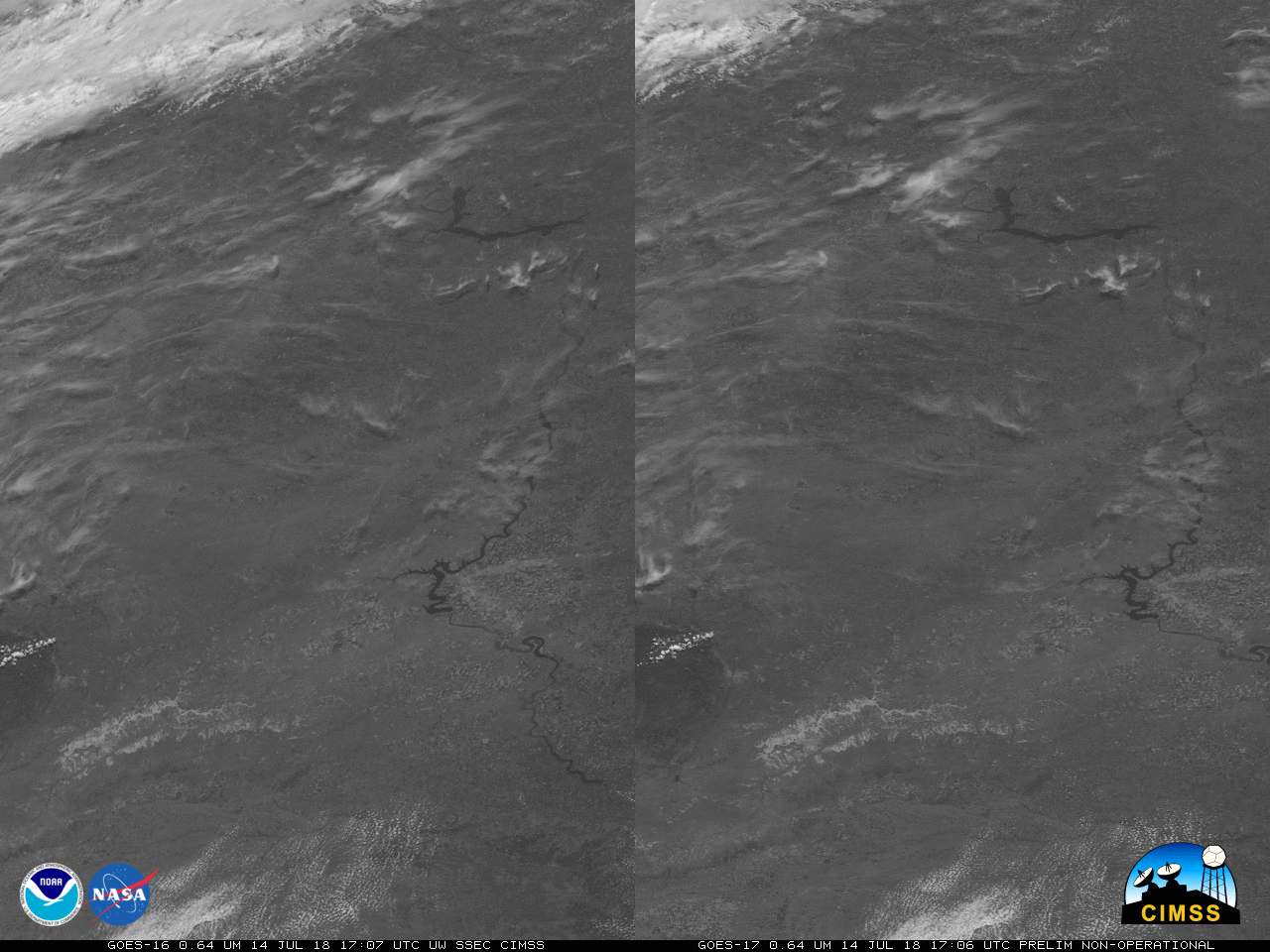
GOES-16 Visible and GOES-17 Visible (0.64 µm) Imagery over North Dakota, 1402-2357 UTC on 14 July 2018 (Click to play mp4 animation)
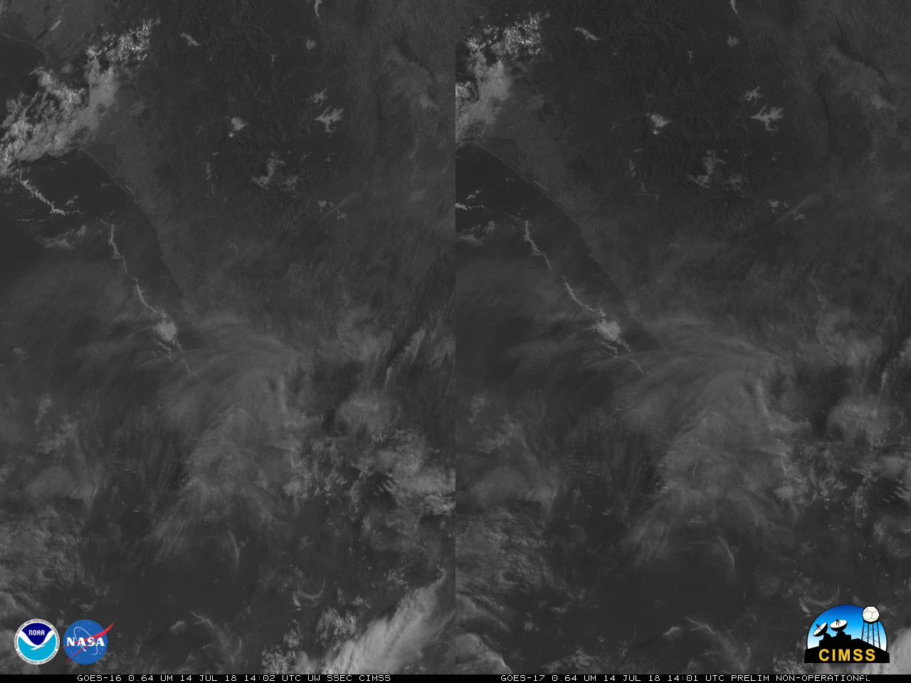
GOES-16 Visible and GOES-17 Visible (0.64 µm) Imagery over western Mexico, 1402-2357 UTC on 14 July 2018 (Click to play mp4 animation)
To view these images in three dimensions, cross your eyes until 3 images are present, and focus on the image in the middle.