Occluded cyclone in southern Canada
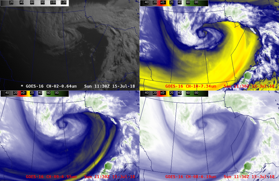
GOES-16 “Red” Visible (0.64 µm, upper left), Low-level Water Vapor (7.3 µm, upper right), Mid-level Water Vapor (6.9 µm, lower left) and Upper-level Water Vapor (6.2 µm, lower right) images [click to play animation]
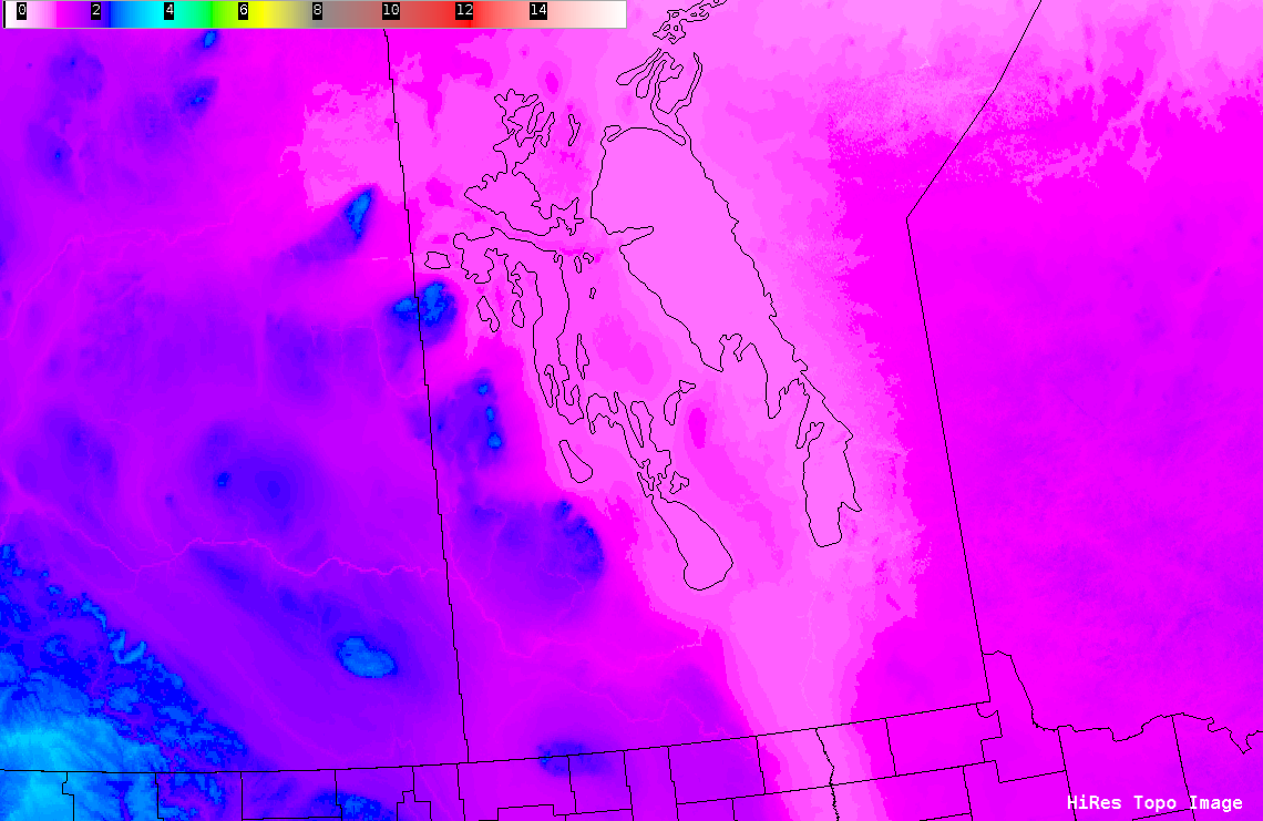
A closer examination of the GOES-16 images (below) revealed the presence of waves over southwestern Manitoba on the Water Vapor imagery — these appeared to vertically-propagating waves which formed due to the interaction of strong boundary layer winds with the topography of that area (some land features rise to 2600 feet). These waves then began breaking and propagating slowly westward late in the animation.
![GOES-16 "Red" Visible (0.64 µm, upper left), Low-level Water Vapor (7.3 µm, upper right), Mid-level Water Vapor (6.9 µm, lower left) and Upper-level Water Vapor (6.2 µm, lower right) images [click to play animation]](https://cimss.ssec.wisc.edu/satellite-blog/wp-content/uploads/sites/5/2018/07/180715_goes16_visible_water_vapor_Canada_cyclone_zoom_anim.gif)
GOES-16 “Red” Visible (0.64 µm, upper left), Low-level Water Vapor (7.3 µm, upper right), Mid-level Water Vapor (6.9 µm, lower left) and Upper-level Water Vapor (6.2 µm, lower right) images [click to play animation]
![NOAA-20 VIIRS True Color RGB image [click to enlarge]](https://cimss.ssec.wisc.edu/satellite-blog/wp-content/uploads/sites/5/2018/07/180715_1827utc_noaa20_truecolor.jpg)
NOAA-20 VIIRS True Color RGB image [click to enlarge]