Tropical Storm Chris
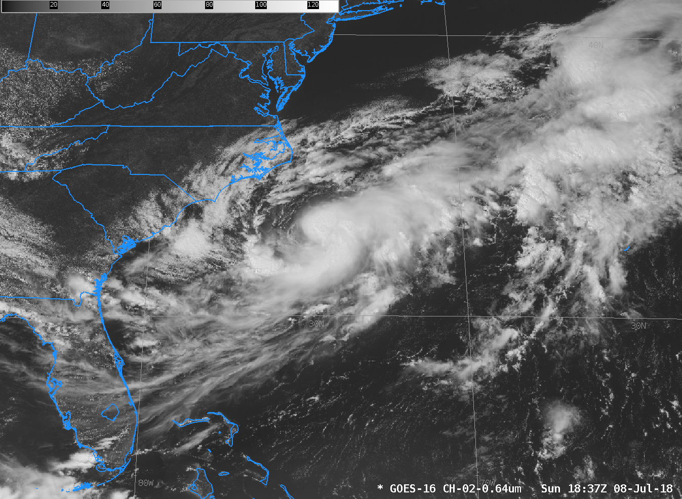
GOES-16 Visible Imagery (Band 2, 0.64 µm), from 1837 – 2332 UTC on 8 July 2018 (Click to animate)
Tropical Depression Number 3 was upgraded to Tropical Storm Chris at 0900 UTC 8 July. Chris has been mostly stationary on 8 July. The visible animation, above, from Sunday 8 July shows excellent upper-level outflow to the northeast and southwest of the storm, and persistent convection over the center. The Clean Window animation over the same time, below, shows a compact center with periodic overshooting tops.
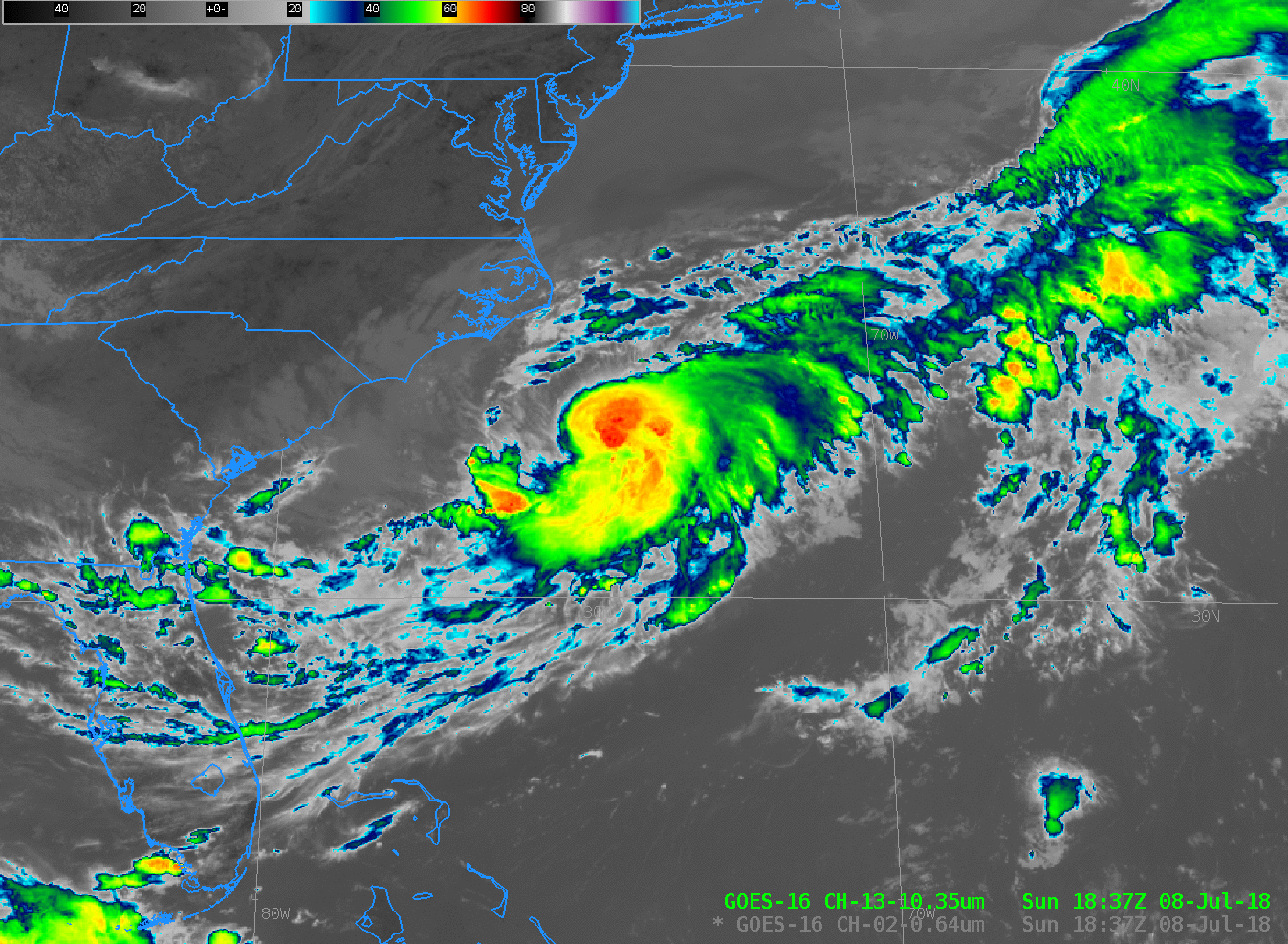
GOES-16 Clean Window Infrared Imagery (Band 13, 10.3 µm), from 1837 – 2332 UTC on 8 July 2018 (Click to animate)
The toggle below between 2212 UTC on 6 and 8 July shows the general increase in organization of Chris, with a slight northwestward motion over the two days. In addition, the front that was over the eastern United States on 6 July is out over the Atlantic on 8 July, and Chris is embedded within the southwestern tail of the front.
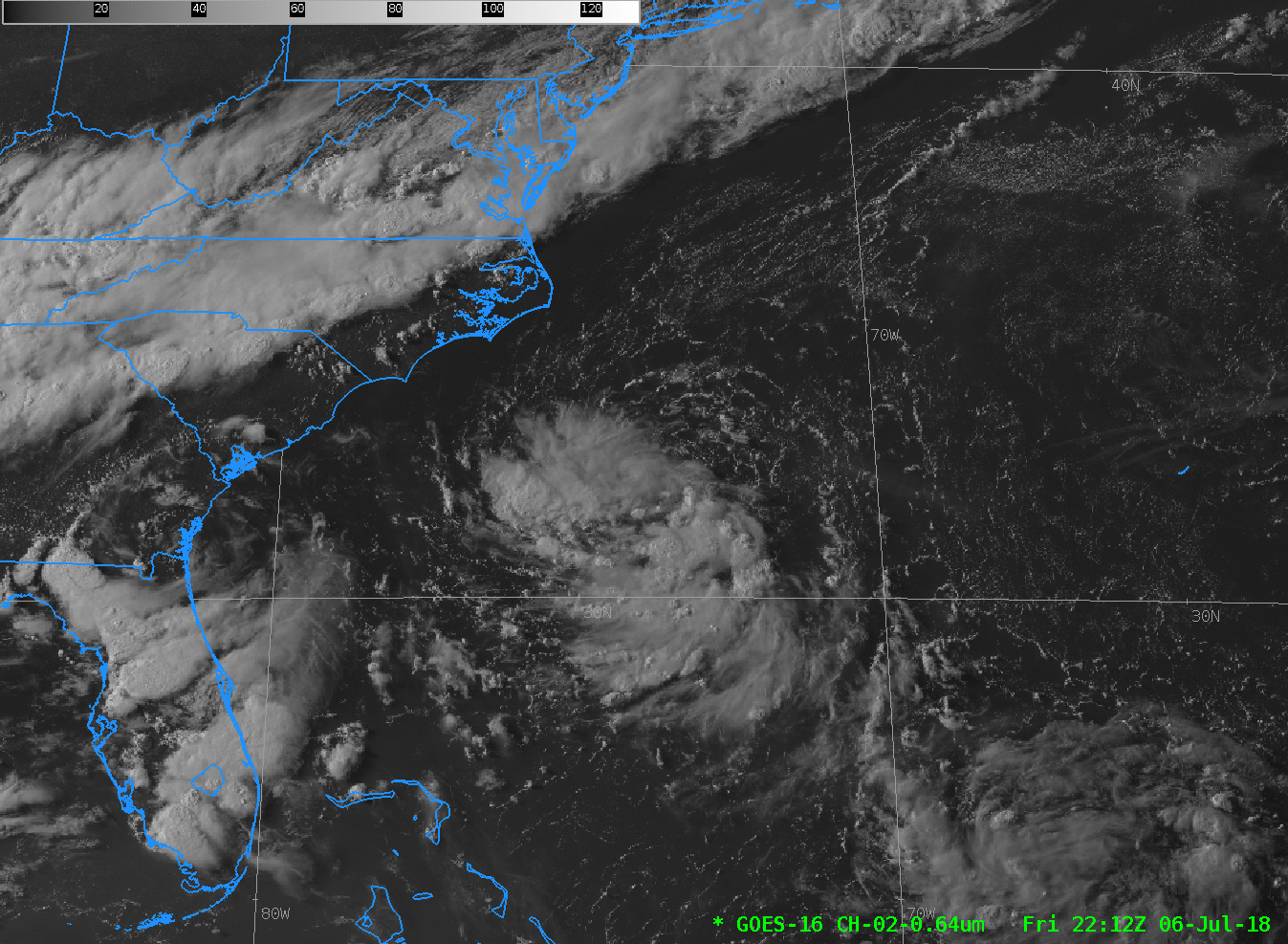
GOES-16 Visible Imagery (Band 2, 0.64 µm), at 2212 UTC on 6 July and 8 July 2018 (Click to enlarge)