Severe weather in Wyoming, Montana and South Dakota
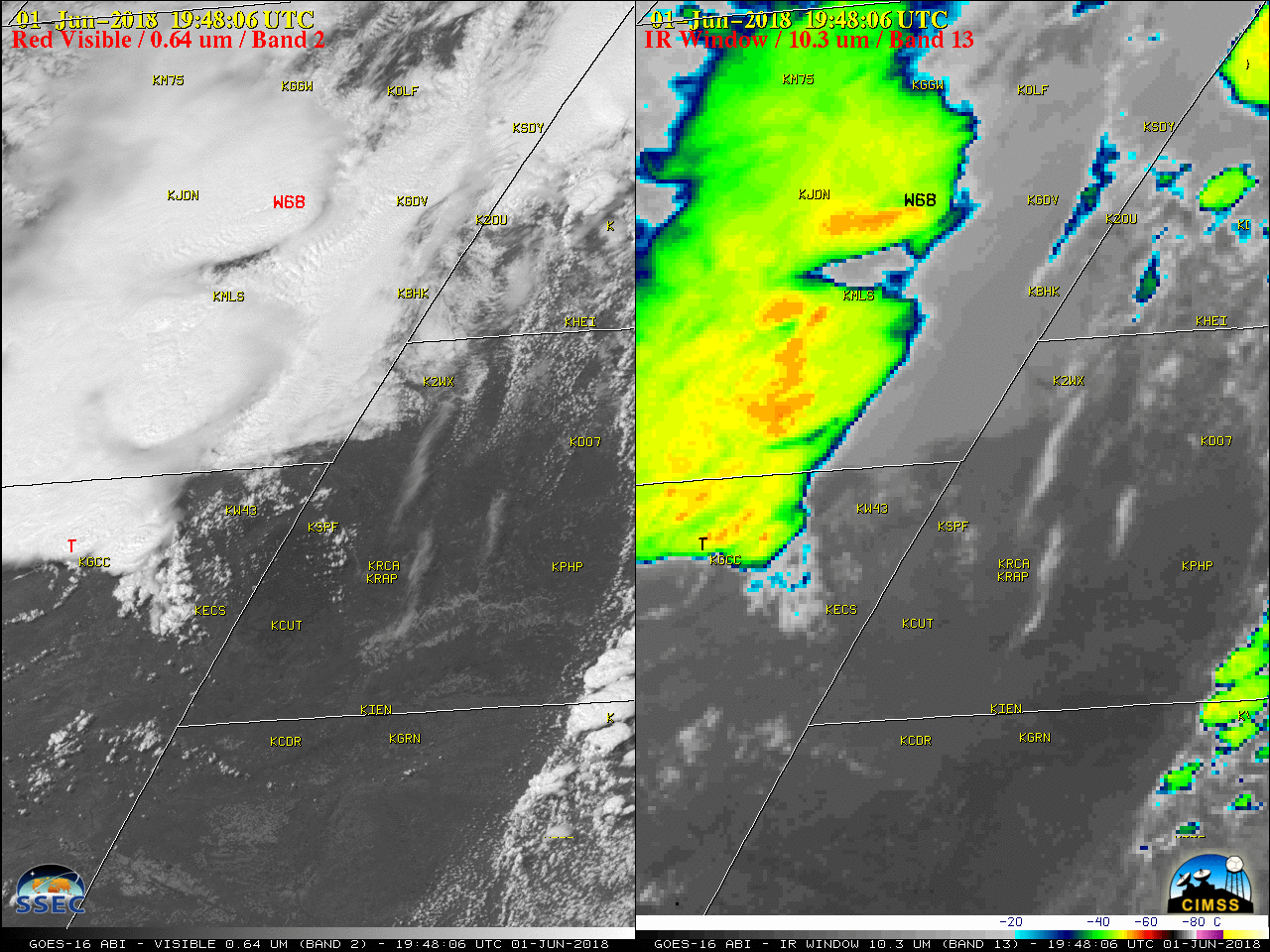
GOES-16 “Red” Visible (0.64 µm, left) and “Clean” Infrared Window (10.3 µm, right) images, with plots of SPC storm reports [click to play MP4 animation]
GOES-16 Mid-level (6.9 µm) images (below) revealed a shortwave trough that was moving eastward across the northern Rocky Mountains, enhancing forcing for ascent as it approached the region of developing convection.
![GOES-16 Mid-level Water Vapor (6.9 µm) images, with plots of SPC storm reports [click to play MP4 animation]](https://cimss.ssec.wisc.edu/satellite-blog/wp-content/uploads/sites/5/2018/06/G16_WV9_NWUS_01JUN2018_960x1280_B9_2018152_194728_0001PANEL_00094.GIF)
GOES-16 Mid-level Water Vapor (6.9 µm) images, with plots of SPC storm reports [click to play MP4 animation]
EF3 tornado confirmed in Wyoming yesterday. This is the fourth EF3 of the year. Still at record lows season to date for F/EF3+ tornadoes. h/t @BianchiWeather pic.twitter.com/Lfs0uwf4F2
— U.S. Tornadoes (@USTornadoes) June 3, 2018