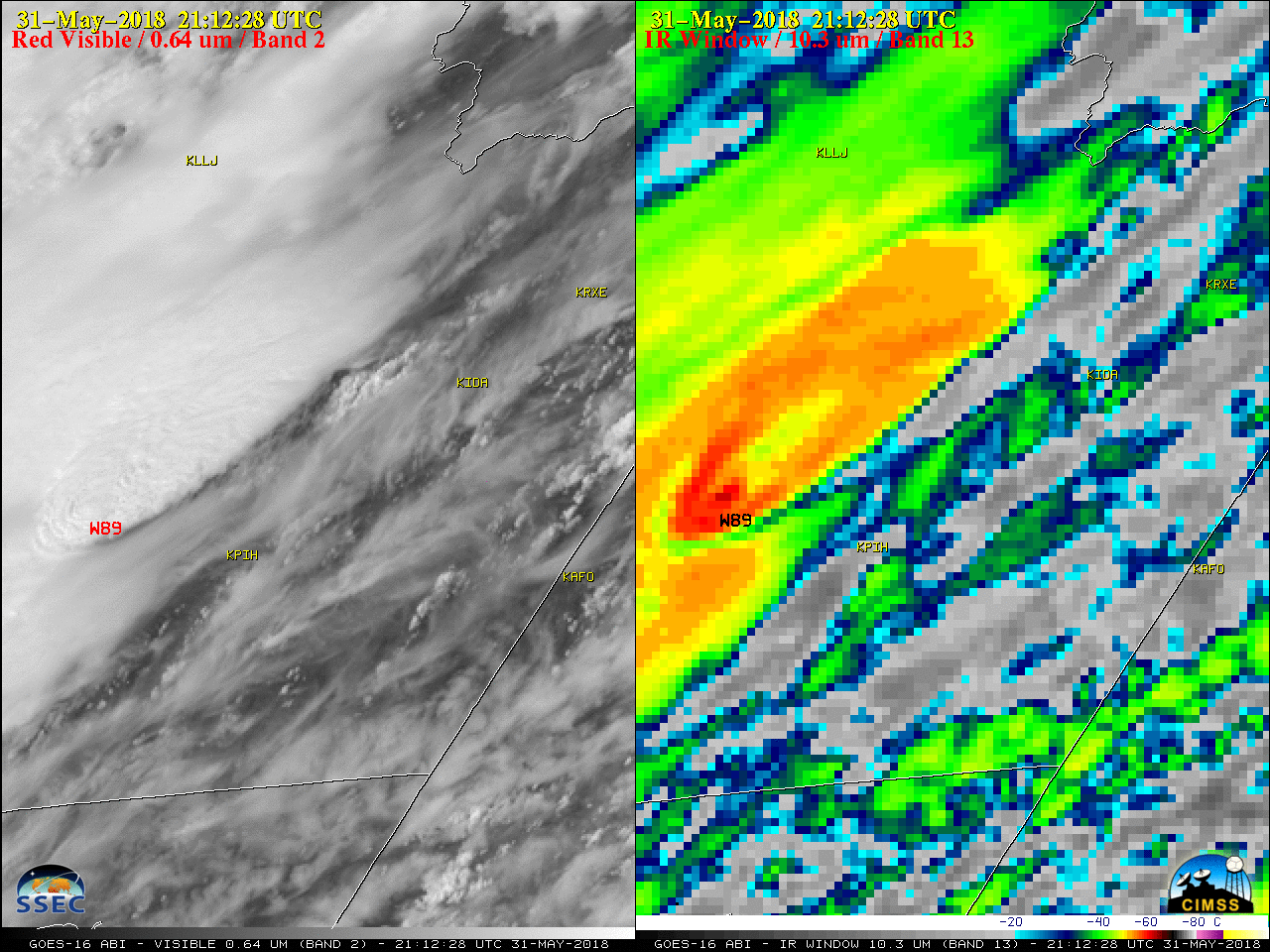
Severe weather across southeastern Idaho
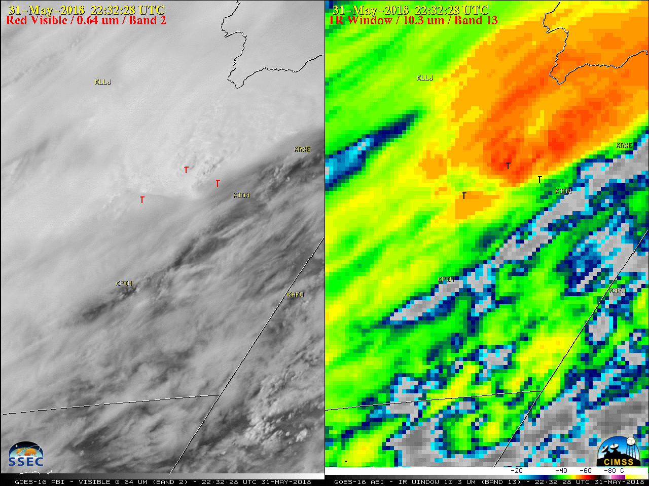
GOES-16 “Red” Visible (0.64 µm, left) and “Clean” Infrared Window (10.3 µm, right) images, with plots of SPC storm reports [click to play MP4 animation]
As a surface cold front was moving through Idaho, large-scale forcing for ascent was increasing across the region within the middle troposphere as an upper-level trough moved eastward over California and Nevada — and strong southwesterly flow ahead of this trough was evident over eastern Idaho on GOES-16 Low-level (7.3 µm), Mid-level (6.9 µm) and Upper-level (6.2 µm) Water Vapor images (below).
![GOES-16 Lower-level (7.3 µm, left), Mid-level (6.9 µm, center) and Upper-level (6.2 µm, right) Water Vapor images [click to play MP4 animation]](https://cimss.ssec.wisc.edu/satellite-blog/wp-content/uploads/sites/5/2018/05/G16_WATER_VAPOR_ID_SVR_31MAY2018_960x427_B1098_2018151_180228_0003PANELS_00037.GIF)
GOES-16 Lower-level (7.3 µm, left), Mid-level (6.9 µm, center) and Upper-level (6.2 µm, right) Water Vapor images [click to play MP4 animation]
The 2018 Severe Weather Season is off to a record pace in SE Idaho. Also, more Tornado Warnings have been issued by our office so far this year than for much of Texas. Charts and Maps courtesy of Iowa Environmental Mesonet. #idwx pic.twitter.com/8hzamBHZGQ
— NWS Pocatello (@NWSPocatello) June 2, 2018