Upwind-propagating bore over southern Lake Michigan

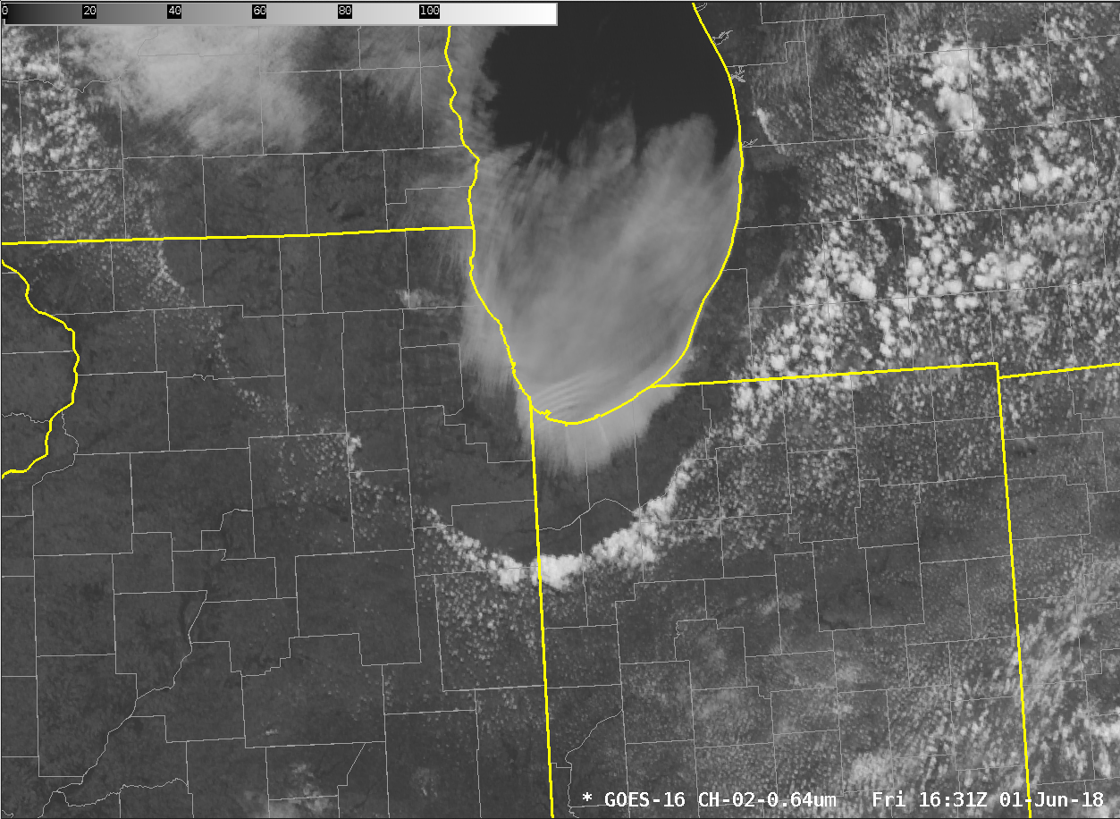
GOES-16 Visible (0.64 µm) Visible Imagery at 1-minute intervals from 1337 to 1658 UTC on 1 June 2018 (Click to play mp4 animation)
GOES-16 Visible Imagery on 1 June revealed an interesting feature behind a lake-enhanced cold front that swept south into Indiana and Illinois (another aspect of this feature is discussed here). Atmospheric waves developed in the cloud layer over the south shore of Lake Michigan and propagated upwind towards Chicago. The mp4 animation above (Click here for a full-res very large animated gif) shows 1-minute imagery from the western default GOES-16 Mesoscale sector. (At 1659 UTC, that sector was repositioned to the west to monitor convection in the northern Plain States).
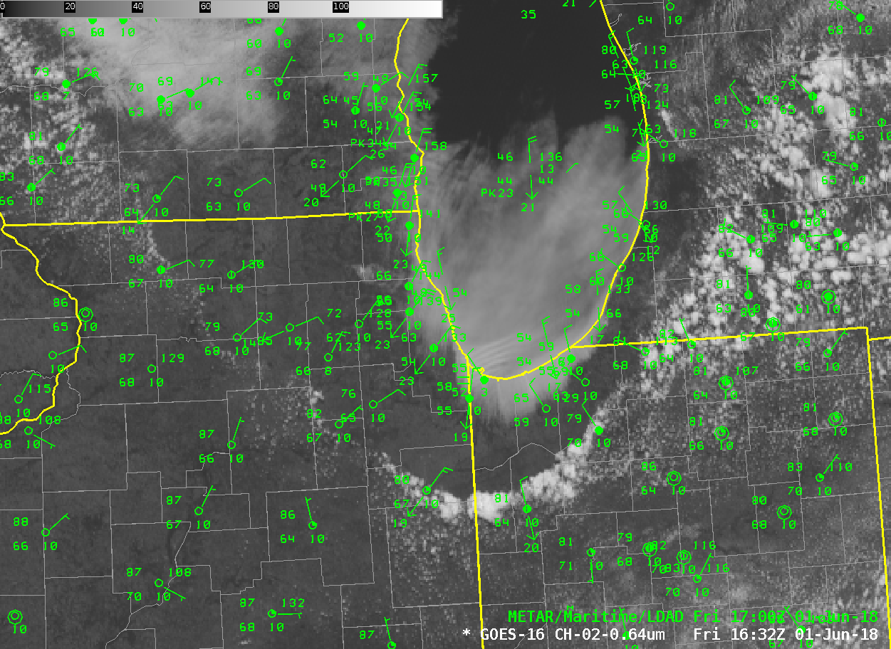
CONUS-scale imagery was able to sample the evolution of this system at 5-minute intervals, as shown below (Click here for an animation without the surface observations).
There is a considerable thermal gradient between the lake surface and the land over Indiana and Illinois. This Land Surface Baseline Product shows surface temperatures in the low 40s over the Lake and surface temperatures in the mid-80s over northwest Indiana. This strong thermal gradient likely influenced the development of these unusual waves. An aircraft sounding from 1535 UTC (here, courtesy TJ Turnage) shows the very strong inversion that was also important in the evolution of the waves.

GOES-16 Visible (0.64 µm) Visible Imagery at 5-minute intervals from 1102 to 1917 UTC on 1 June 2018, along with hourly surface plots (Click to play animated gif)
(Thanks to TJ Turnage, NWS GRR for alerting us to this event!)
Added, 5 June: Clark Evans, UW-Milwaukee, hypothesizes that the waves may have been forced by the (relatively) tall dunes in Indiana along the south shore of Lake Michigan. Those dunes may have been tall enough to block the flow under a very sharp inversion.

