Suomi NPP and NOAA-20 view Tropical Depression Alberto over the lower Ohio River Valley
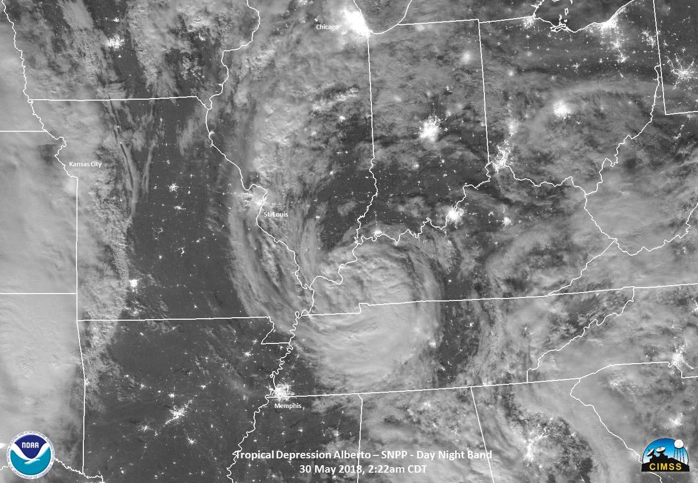
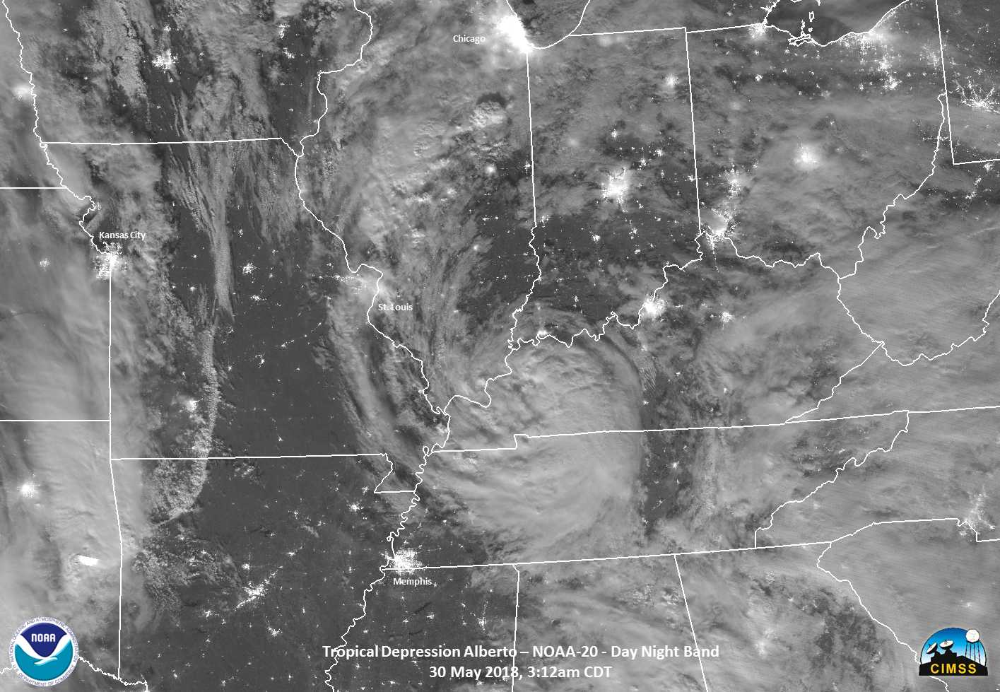
Day Night Band Visible (0.7 µm) Imagery from Suomi NPP (0722) and NOAA-20 (0812 UTC) over Tropical Depression Alberto (Click to enlarge)
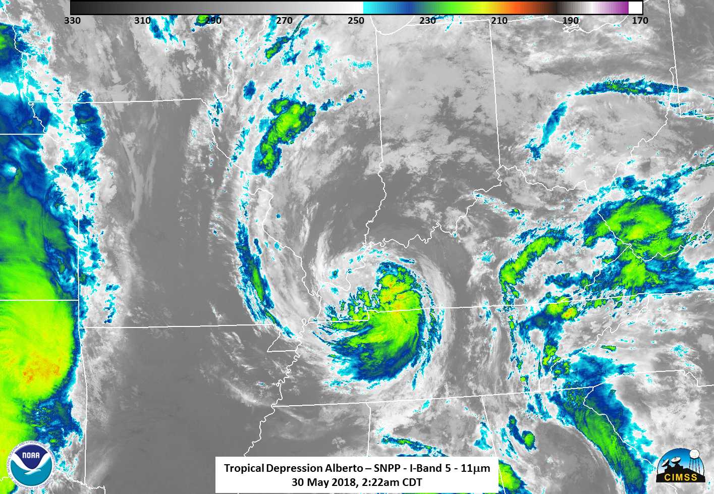
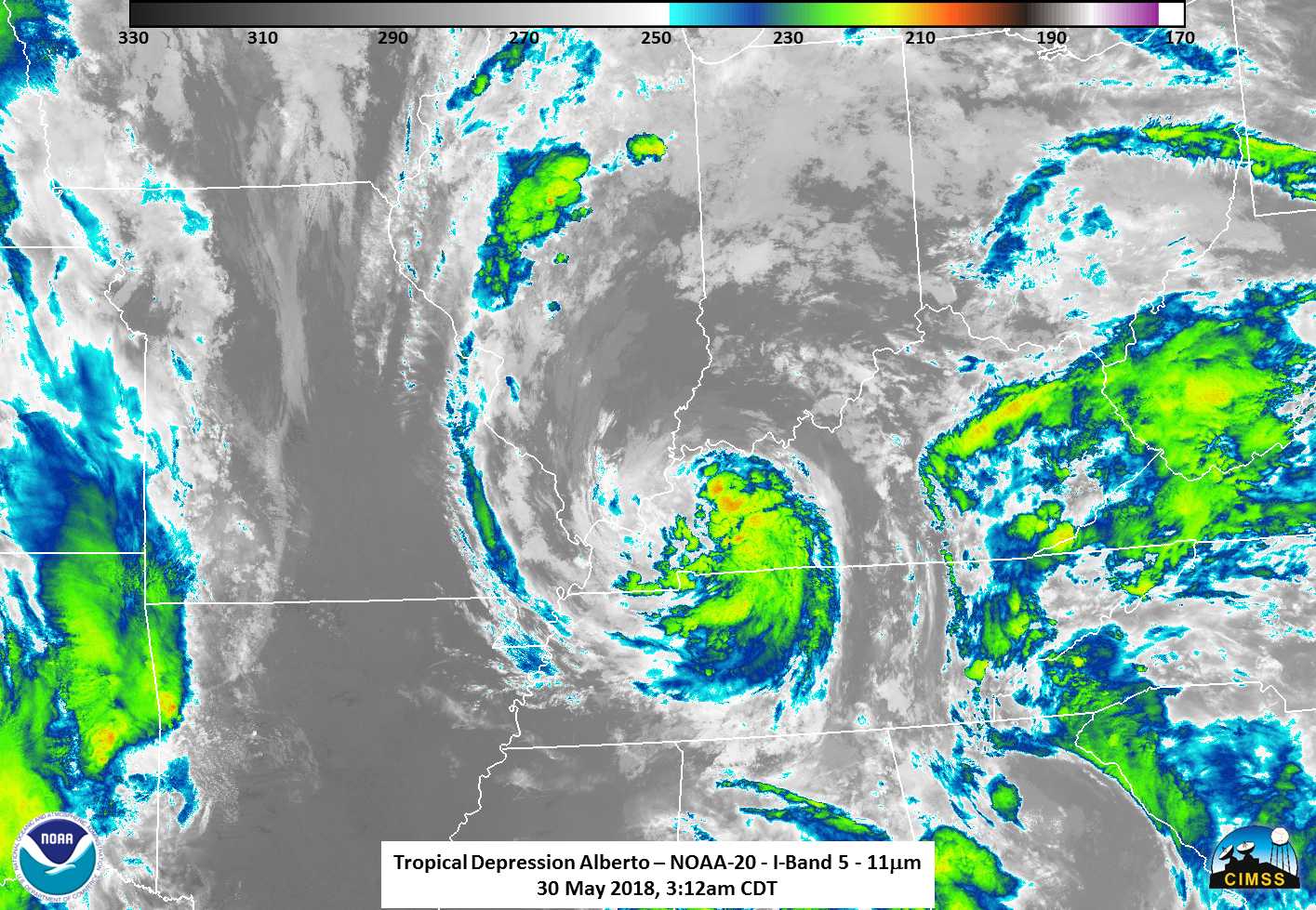
Suomi-NPP and NOAA-20 overflew tropical depression Alberto, at 0722 and 0812 UTC, respectively (orbit paths from this site), on 30 May 2018, and the near-Full moon provided ample illumination for the Day Night Band imagery, shown above. A motion to the northeast is apparent. Convection developed far to the north of the storm as well, south of Chicago, and a streak of lightning occurs over Oklahoma in the later image. (For individual Day Night Band images in the loop, click here for Suomi NPP and here for NOAA-20) A similar loop, below, shows the Window Channel (11.45 µm) from the VIIRS instrument on Suomi NPP and NOAA-20. A tip of the Hat to Will Straka, CIMSS, for the imagery.

VIIRS Window Channel (I05) Infrared (11.45 µm) Imagery from Suomi NPP (0722) and NOAA-20 (0812 UTC) over Tropical Depression Alberto (Click to enlarge)
Added: NOAA-20 was declared Operational on 30 May 2018. Welcome NOAA-20!