Fires in Saskatchewan
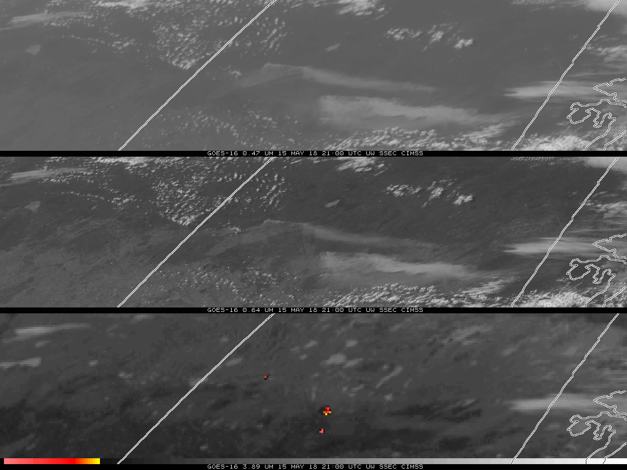
GOES-16 ABI Band 1 (“Blue Visible”, 0.47 µm, top), Band 2 (“Red Visible”, 0.64 µm, middle) and Band 7 (“Shortwave Infrared”, 3.9 µm, bottom) from 1345 to 2230 UTC on 15 May 2018 (Click to animate); Note that the yellow enhancement in the shortwave infrared starts at 305 K.
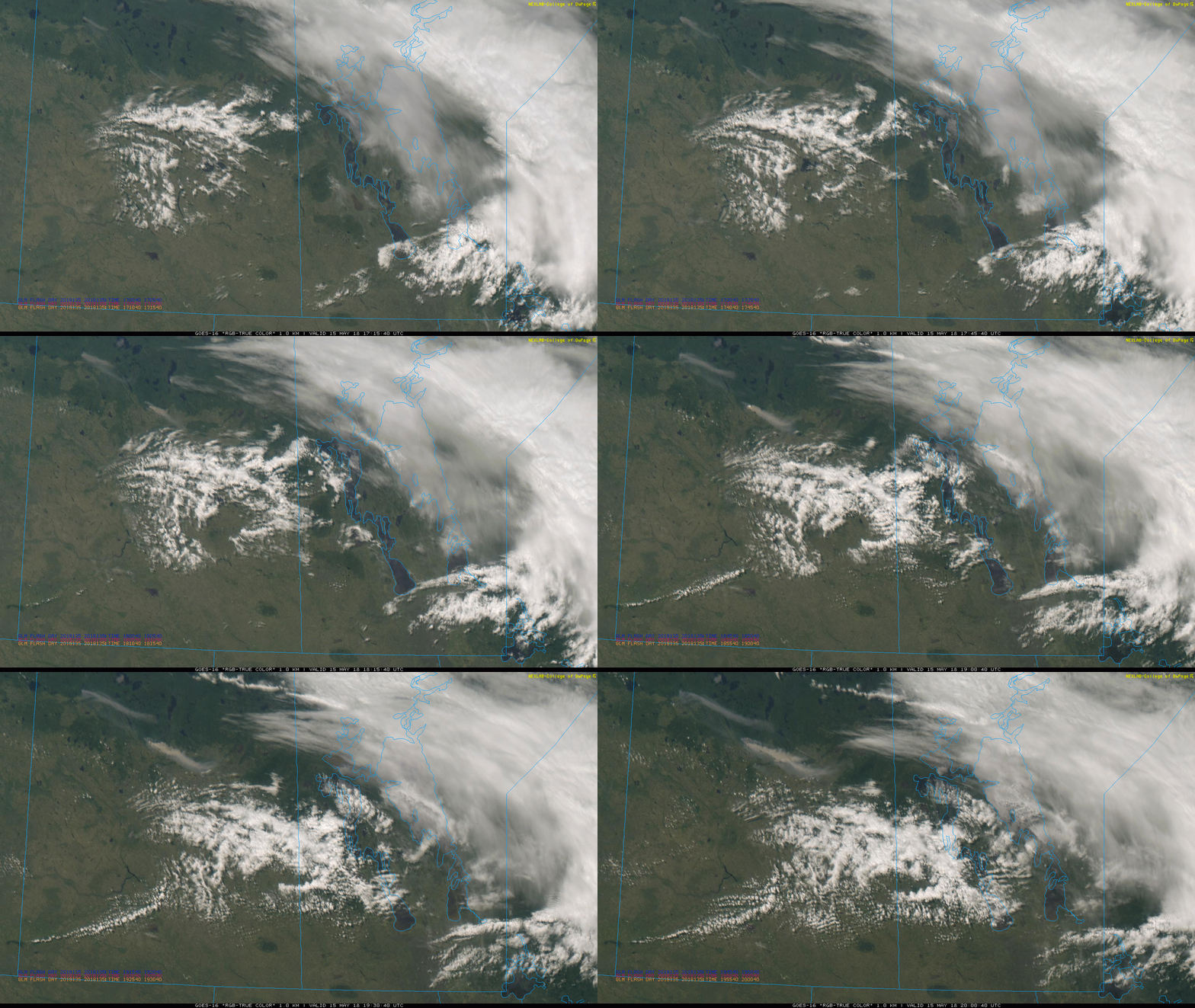
Fires that developed over the plains of Saskatchewan, near Meadow Lake in west-central Saskatchewan, and near Prince Albert in central Saskatchewan, showed up well in Visible and Infrared imagery, shown above. A wind shift that occurred as the fires burned changed the direction of the smoke plume. Prince Albert had visibilities that dropped to 3 statute miles. Meadow Lake had visibilities down to 4 statute miles.
True-Color imagery (Source: (Link), imagery provided by Paul Ford, ECC Canada), also shows the distinct smoke plumes from the fires.
The Dual-Pol S-band radar at Radisson captured the plume north of Prince Albert at 1900 UTC (See below; click here for the satellite imagery at that time). Very small Cross-Correlation coefficients are apparent in the smoke plume. The radar at 2010 UTC (link) suggests 3 separate fires, which agrees with the satellite imagery. (Click here for 2015 UTC Satellite Imagery).
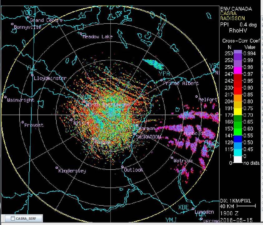
Cross-Correlation Scan from the dual pol, S-band at Radisson, Saskatchewan, 1900 UTC on 15 May 2018 (Click to enlarge)
Many Thanks to Paul Ford, ECC Canada, for the radar imagery, and for alerting us to this event. Saskatchewan fires can be tracked at this website. Most of Saskatchewan is currently under a fire ban.
========== ADDED ============

GOES-16 ABI Band 7 (“Shortwave Infrared”, 3.9 µm) from 1200 to 2345 UTC on 15 May 2018 (Click to enlarge)
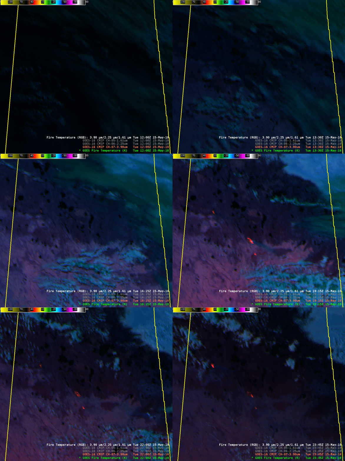
GOES-16 ABI Fire RGB, combining 3.9 µm, 2.2 µm and 1.6 µm imagery, from 1200 to 2345 UTC on 15 May 2018 (Click to enlarge)
The imagery below is zoomed in on the region of the three fires. (Map). The 3.9 µm is shown first, then the Fire RGB.
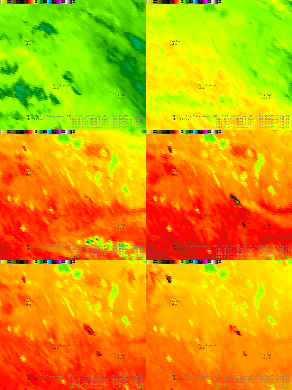
GOES-16 ABI Band 7 (“Shortwave Infrared”, 3.9 µm) from 1200 to 2345 UTC on 15 May 2018 (Click to enlarge)
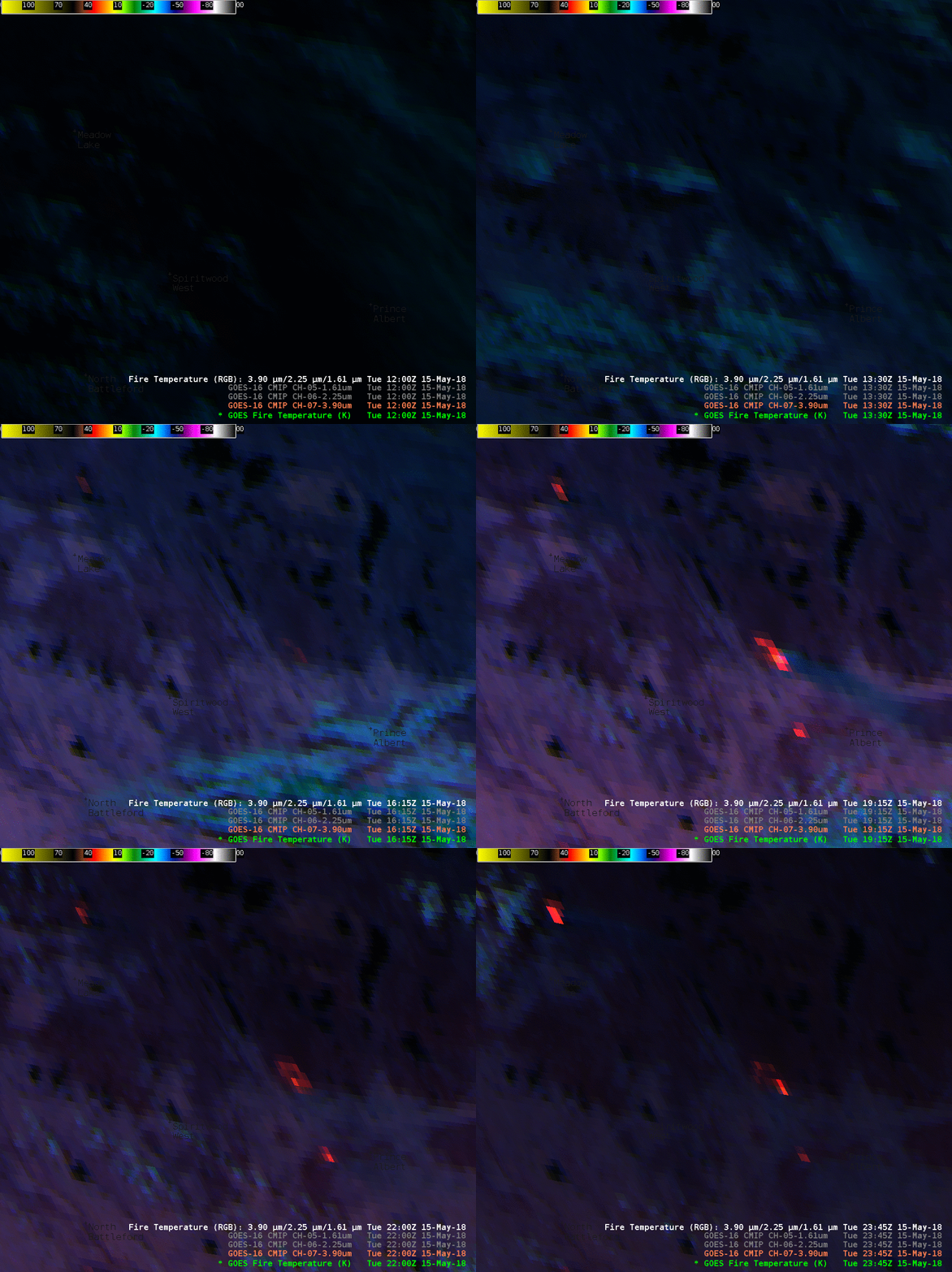
GOES-16 ABI Fire RGB, combining 3.9 µm, 2.2 µm and 1.6 µm imagery, from 1200 to 2345 UTC on 15 May 2018 (Click to enlarge)
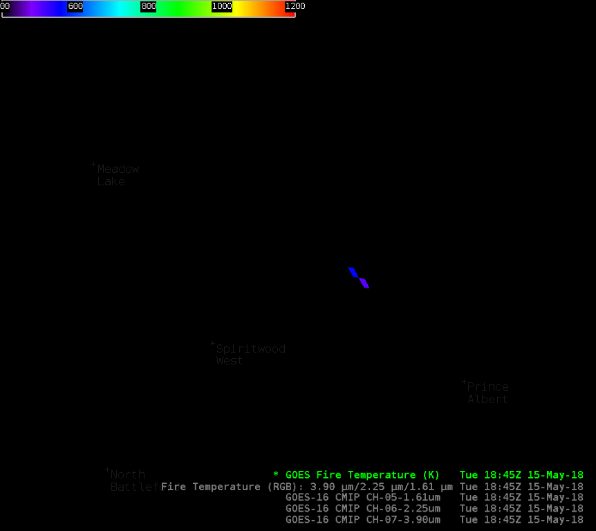
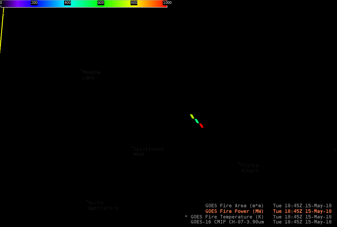
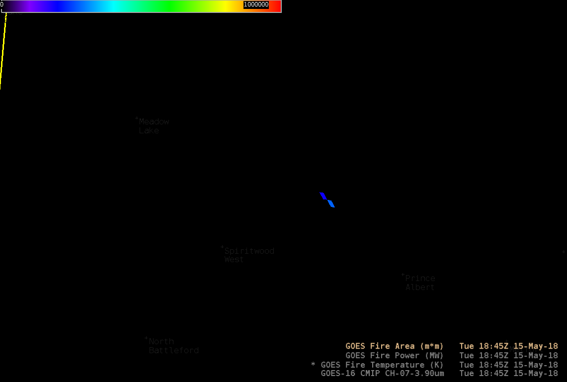
The RGB — like many — gives an excellent qualitative estimate of the fire. Quantitative estimates are available that more define the fire more comprehensively. The 1845 UTC Fire RGB suggests a very hot fire (the 3.9 µm imagery at 1845 UTC suggests the same thing). What do the Baseline fire products show? The Fire Temperature, Fire Power, and Fire Area products for 1845 UTC are shown below. (Animations are here: Fire Temperature, Fire Power, Fire Area) Hotter fire pixels are apparent at 1745 and 2015 UTC. Click for toggles of Band 7 (3.9 µm), Fire RGB and Baseline Fire Temperature at 1745 UTC, 1845 UTC, and 2015 UTC. These products might facilitate resource allocation in a way that single channels or RGB combinations cannot.


