Hail-producing storm on the High Plains of Colorado and Kansas
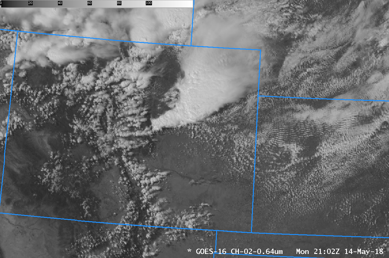
GOES-16 Red Visible (0.64 µm) from 1212 on 14 May 2018 through 0037 UTC on 15 May 2018 (Click to animate)
A Thunderstorm complex moved through eastern CO into western Kansas on 14 May 2018, producing 2 to 3 inch hail in Kit Carson and Cheyenne Counties in east-central Colorado and in Wallace County in northwest Kansas (SPC Storm Reports). Visible animation (0.64 µm) from GOES-16, above, shows the storms initiating near metropolitan Denver before moving eastward across the Plains.
GOES-16 ABI Clean Window imagery (10.3 µm), below, shows very cold overshooting tops associated with these storms, with brightness temperatures colder than -60º C. The area of coldest cloud tops shows a pronounced southeastward motion.
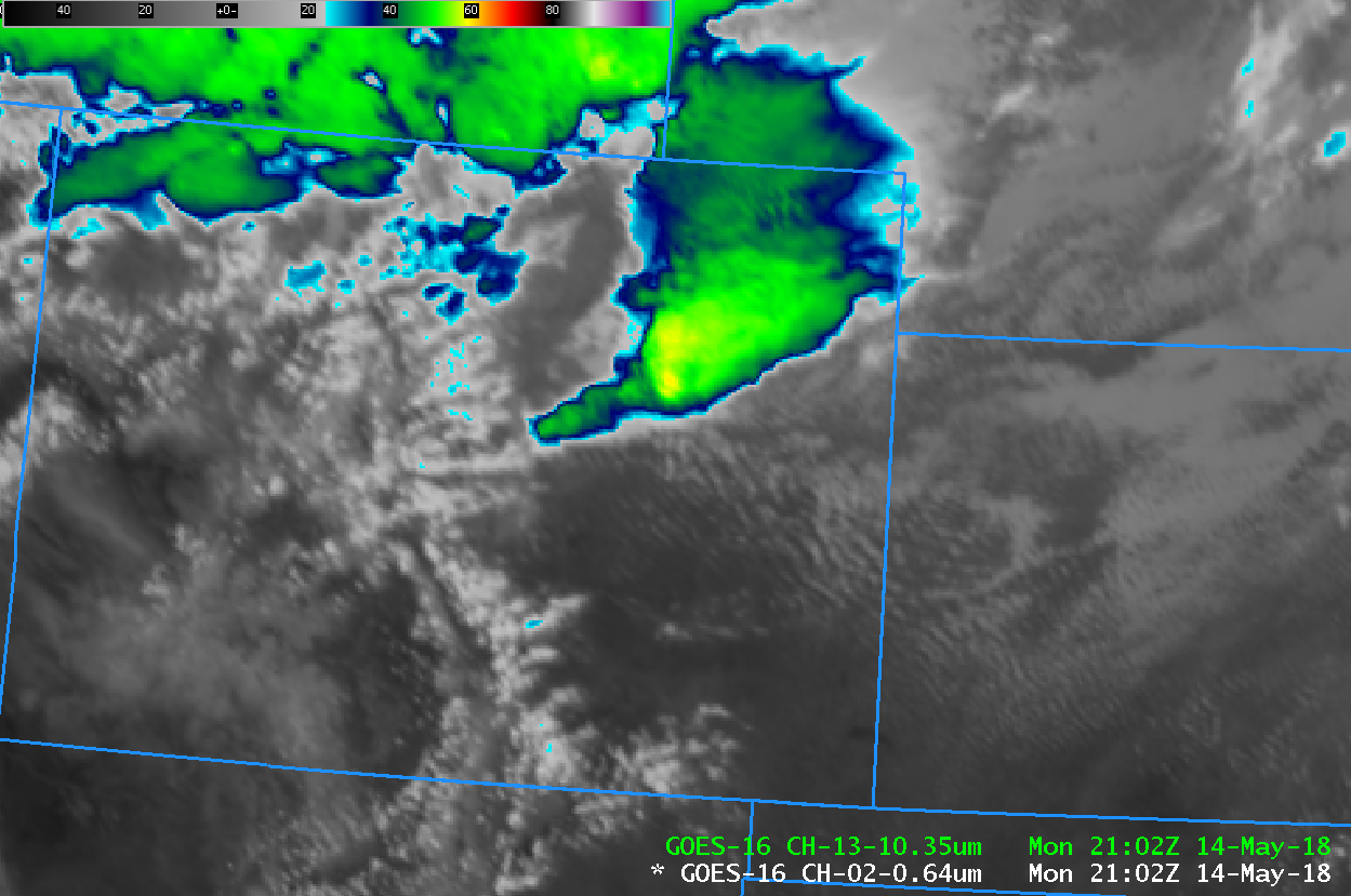
GOES-16 ABI “Clean Window” Infrared Imagery (10.3 µm), 1212 UTC 14 May 2018 to 0037 UTC on 15 May 2018 (Click to animate)
The GOES-16 ABI “Snow/Ice” Channel (at 1.61 µm) is important in diagnosing cloud-top properties in convection, in particular because glaciated clouds absorb solar energy at 1.61 µm (rather than reflecting it). Thus, glaciated cloud tops will look dark. That is the case with this system, shown below. Note that above-anvil cirrus banners are apparent in this animation as well towards the end, stretching west-southwest to east-northeast. These above-anvil banners are very well correlated with severe weather. This link shows a toggle between the Visible (0.64 µm) and Snow/Ice (1.61 µm) bands at 2302 UTC on 14 May, during the time when hail was occurring in eastern Colorado.
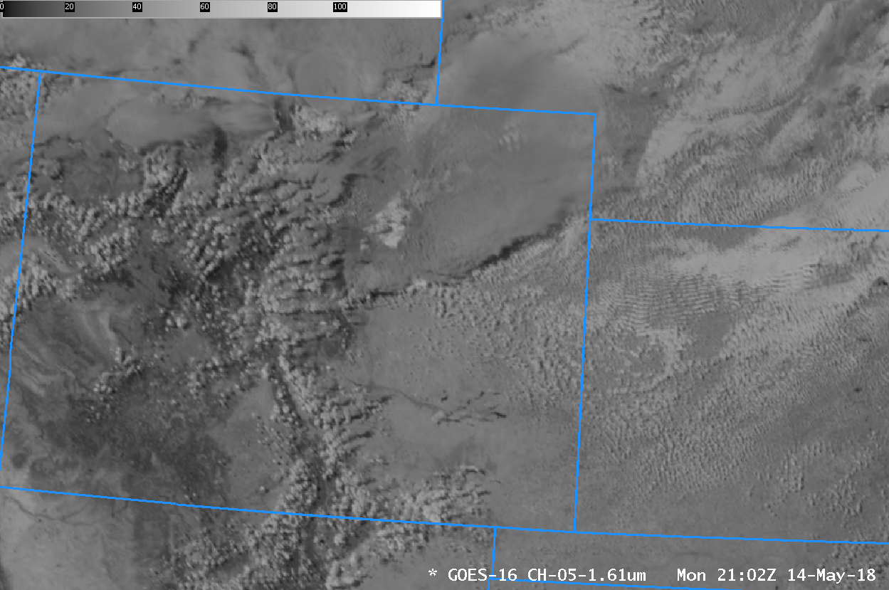
GOES-16 ABI “Snow/Ice” Near-Infrared Imagery (1.61 µm), 1212 UTC 14 May 2018 to 0037 UTC on 15 May 2018 (Click to animate)
One of the Derived Products available from GOES-16 is Lifted Index. This animation, from 1212 UTC on 14 May through 0037 UTC on 15 May shows widespread Lifted Indices of -3º to -5º in the inflow into this thunderstorm. (The clear-sky only Lifted Index is plotted on top of the Snow/Ice 1.61 µm Imagery). Note also that dewpoints over the High Plains of Colorado and Kansas were fairly high for that region: 40s and 50s Fahrenheit. (Click to view 2007 UTC “Veggie” Band 0.86 µm imagery with surface metars plotted).
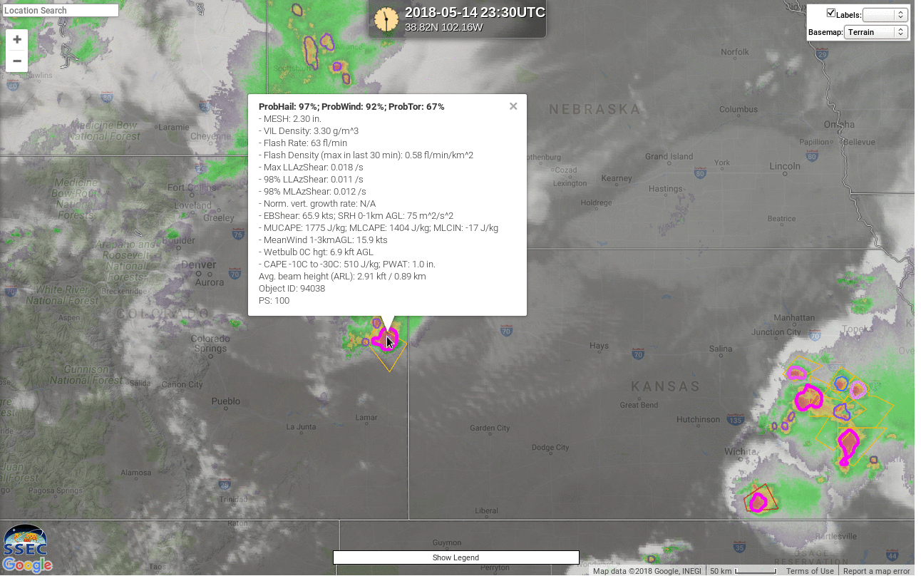
NOAA/CIMSS ProbSevere All Hazards showed very high probabilities for this cell at 2330 UTC, when it was over eastern Colorado, as shown below (Source).
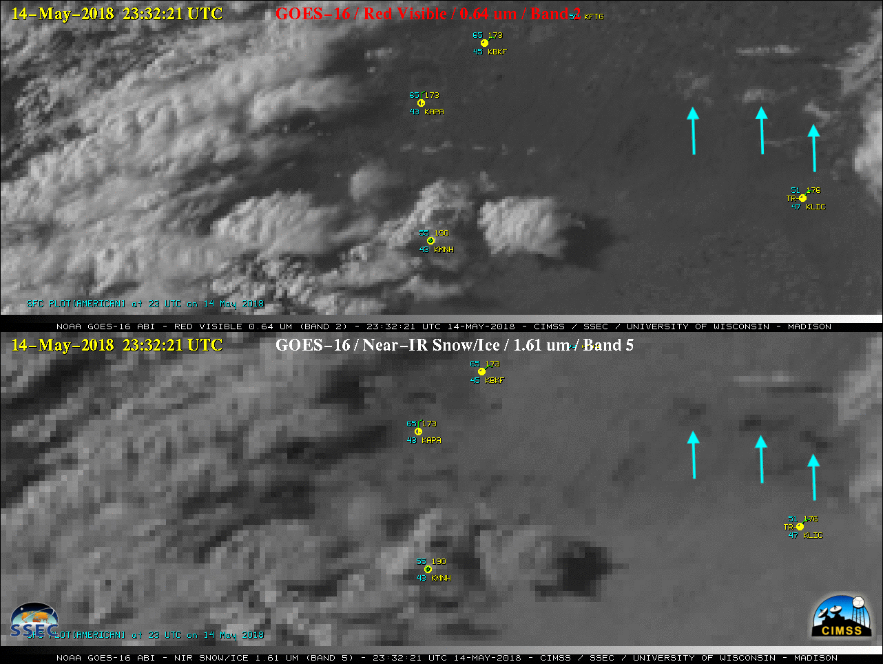
As noted elsewhere (link, link), hail deposited by this storm in central Colorado (in Douglas and Elbert counties) was widespread enough to be visible from satellite, below. The hail appears white in the visible (0.64 µm) imagery and dark in the 1.61 µm Snow/Ice imagery because ice strongly absorbs energy with wavelengths of 1.61 µm.
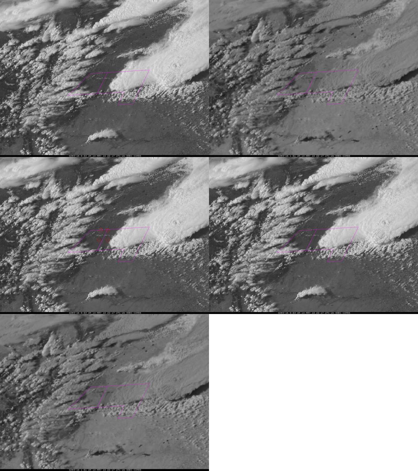
GOES-16 Band 2 (“Red Visible”, 0.64 µm) and Band 5 (“Snow/Ice”, 1.61 µm) imagery at 2217 UTC on 15 May 2018 showing hail on the ground in Douglas and Elbert counties, Colorado (Click to enlarge)
Once the severe convection moved closer to the Colorado/Kansas border, a second hail swath was later seen to the east-northeast (below).


