Early Spring Nor’easter over the eastern United States

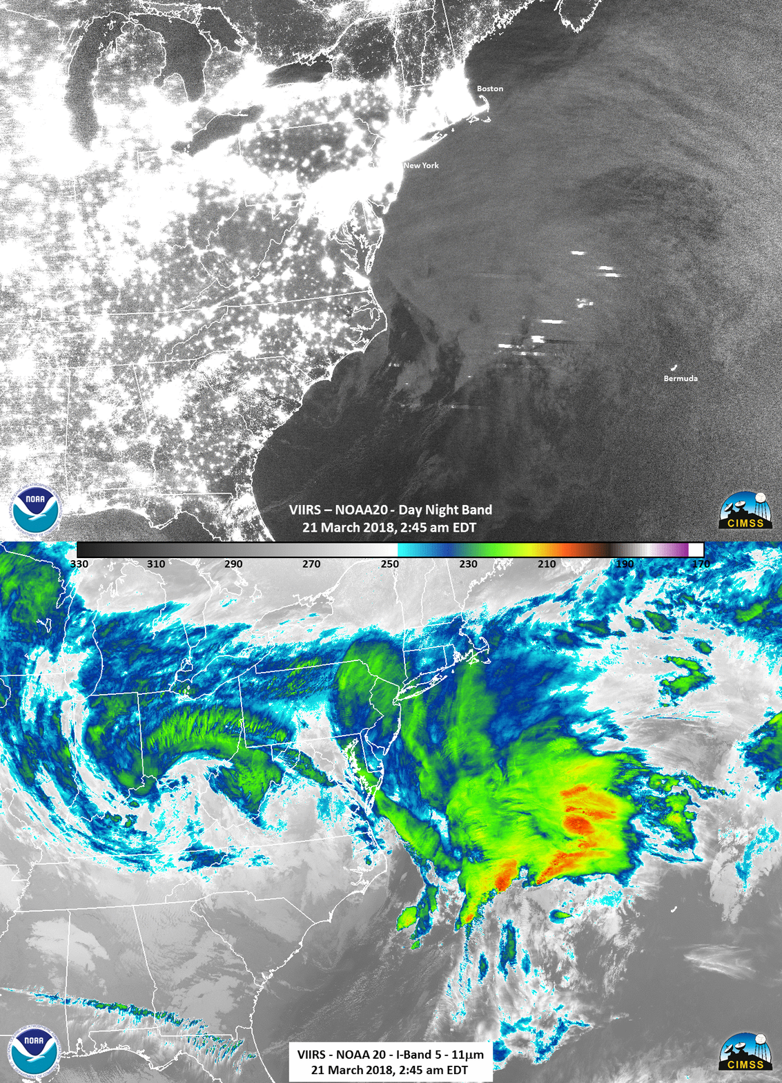
NOAA-20 VIIRS Day Night Band Visible (0.70 µm) and I05 Infrared (11.45 µm) Imagery, 0645 UTC 21 March 2018 (Click to enlarge)
NOAA-20 Imagery shown in this post is Non-Operational and preliminary and undergoing testing.
The imagery above shows a toggle between the Day Night Band Visible (0.70 µm) Imagery and the I05 Infrared (11.45 µm) Imagery on NOAA-20. The strong nor’easter affecting the East Coast of the United States is apparent in the imagery. Strong convection over the warm water south of the Gulf Stream to the east of the Carolinas is apparent in cold cloud tops in the infrared, and in lightning streaks in the Day Night Band imagery. The waxing crescent moon at the time was below the horizon; Earthglow is thus the primary illumination source for the clouds over the ocean. Over land, city lights are apparent, even through the thick precipitating clouds associated with the storm.
Additionally, the fine spatial resolution in the Infrared imagery allows for the identification of cloud-top gravity wave features in the warm conveyor belt over eastern Pennsylvania and New York, and also elsewhere.
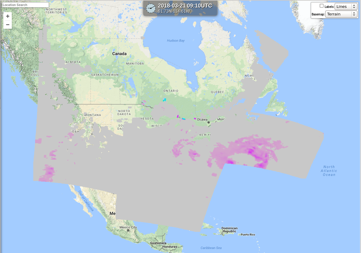
Microwave imagery from Suomi NPP can be used to estimate rain rate (Here’s the OSPO site that shows this product from NOAA-18 and -19, and also Metop A and B; the Operational Blended Rain Rate product is here). The Real Earth image below shows Rain Rate from Suomi NPP ATMS data as calculated from the Direct Broadcast signal in Madison, WI; the entire system is not quite captured from the antenna in Madison, WI. Data that are used to compute the Rain Rate include 90 Ghz, shown here (also from Real Earth). The heavy precipitation with the convection over the Atlantic is readily apparent. Precipitation with this system extends back into Indiana!
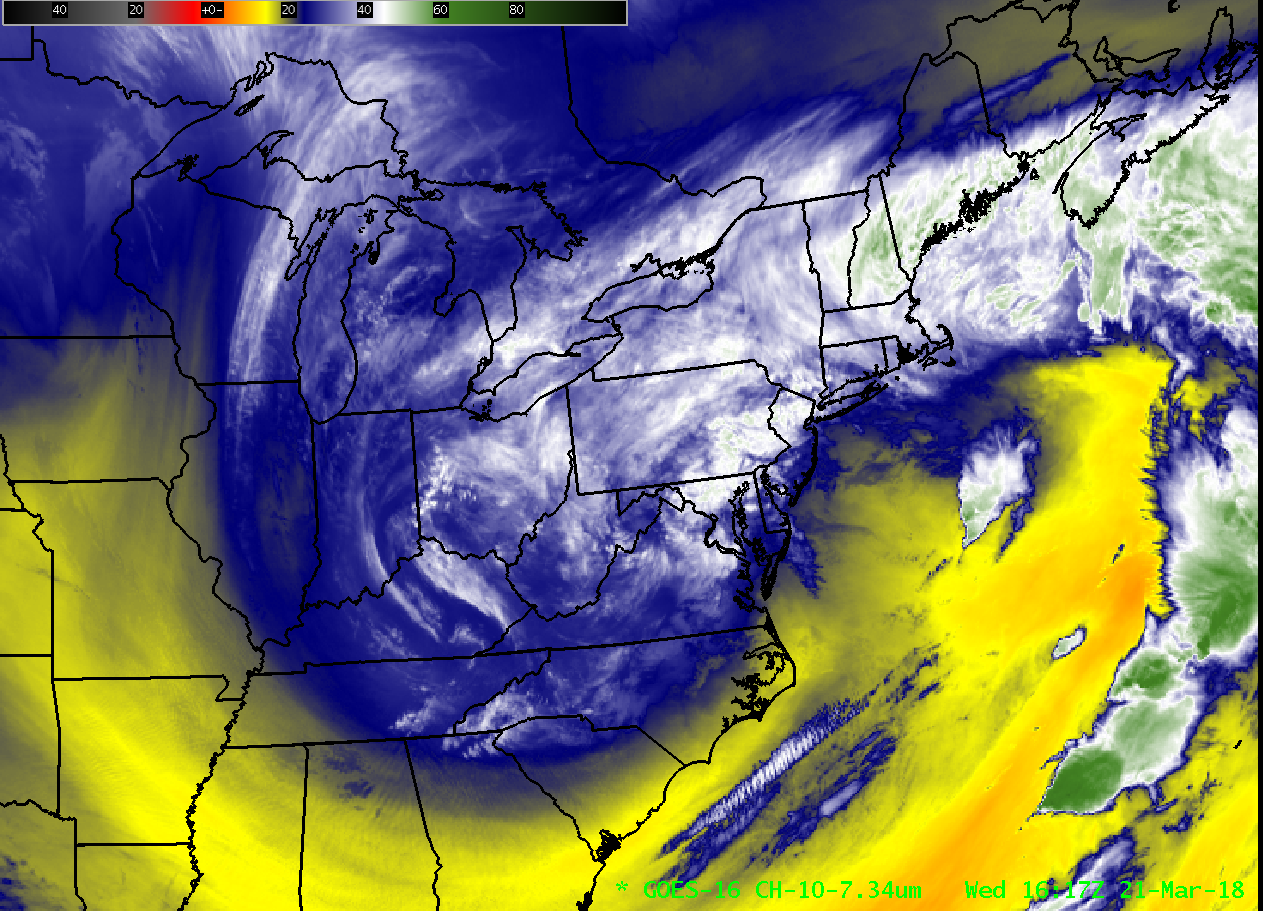
GOES-16 captured the temporal evolution of this storm. The animation of low-level water vapor (7.34) infrared imagery, below, shows a well-developed warm conveyor belt well to the east of an upper level feature that is wobbling westward over northern Kentucky. A second upper-level circulation develops northern Virginia and is obvious over West Virginia at the end of the animation. Strong subsidence can be inferred behind the storm as well, where the yellows/oranges appear in this water vapor enhancement, suggesting brightness temperatures around -10ºC. Very dry air is apparent north of the storm: The St Lawrence River is visible in the water vapor animation!


