Ice in the western Great Lakes
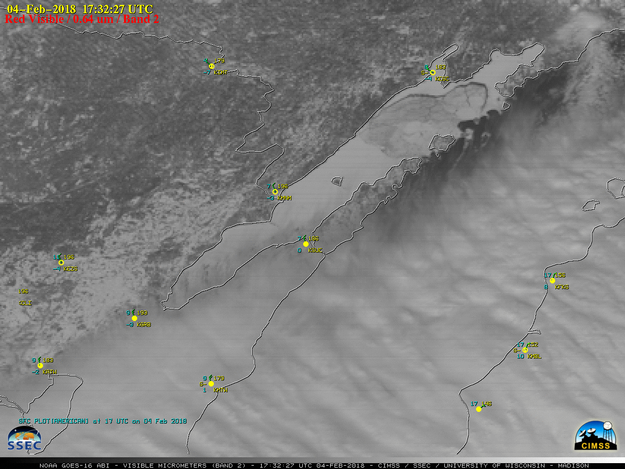
![GOES-16 "Red" Visible (0.64 µm) images, with plots of hourly surface reports [click to play animation]](https://cimss.ssec.wisc.edu/satellite-blog/wp-content/uploads/sites/5/2018/02/180204_goes16_visible_western_Lake_Superior_ice_anim.gif)
GOES-16 “Red” Visible (0.64 µm) images, with plots of hourly surface reports [click to play animation]
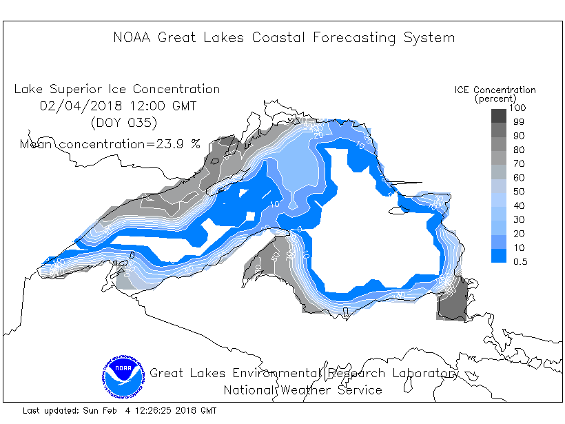
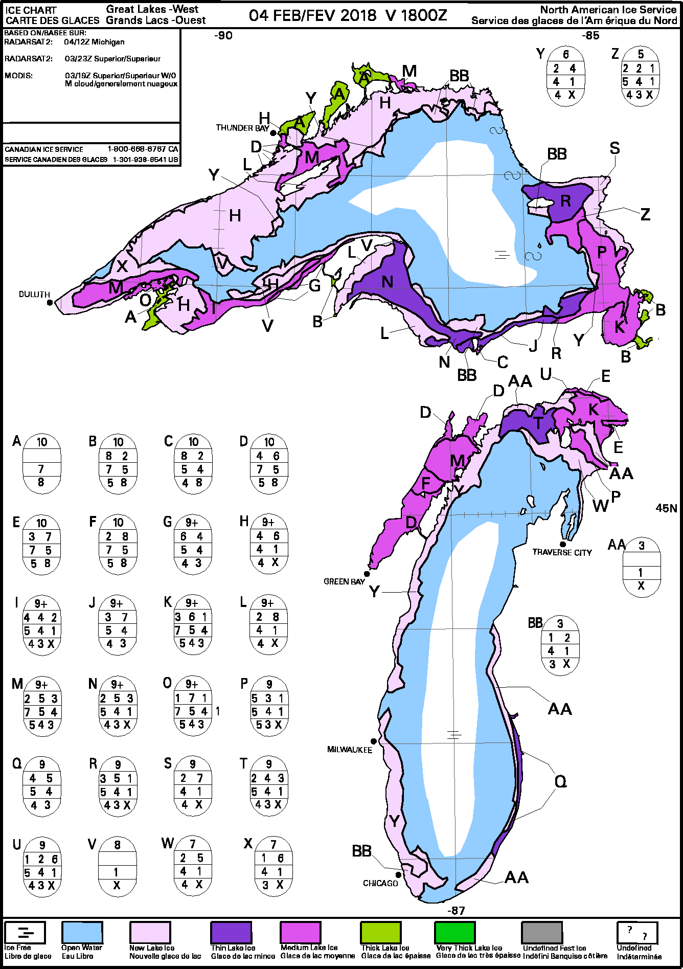
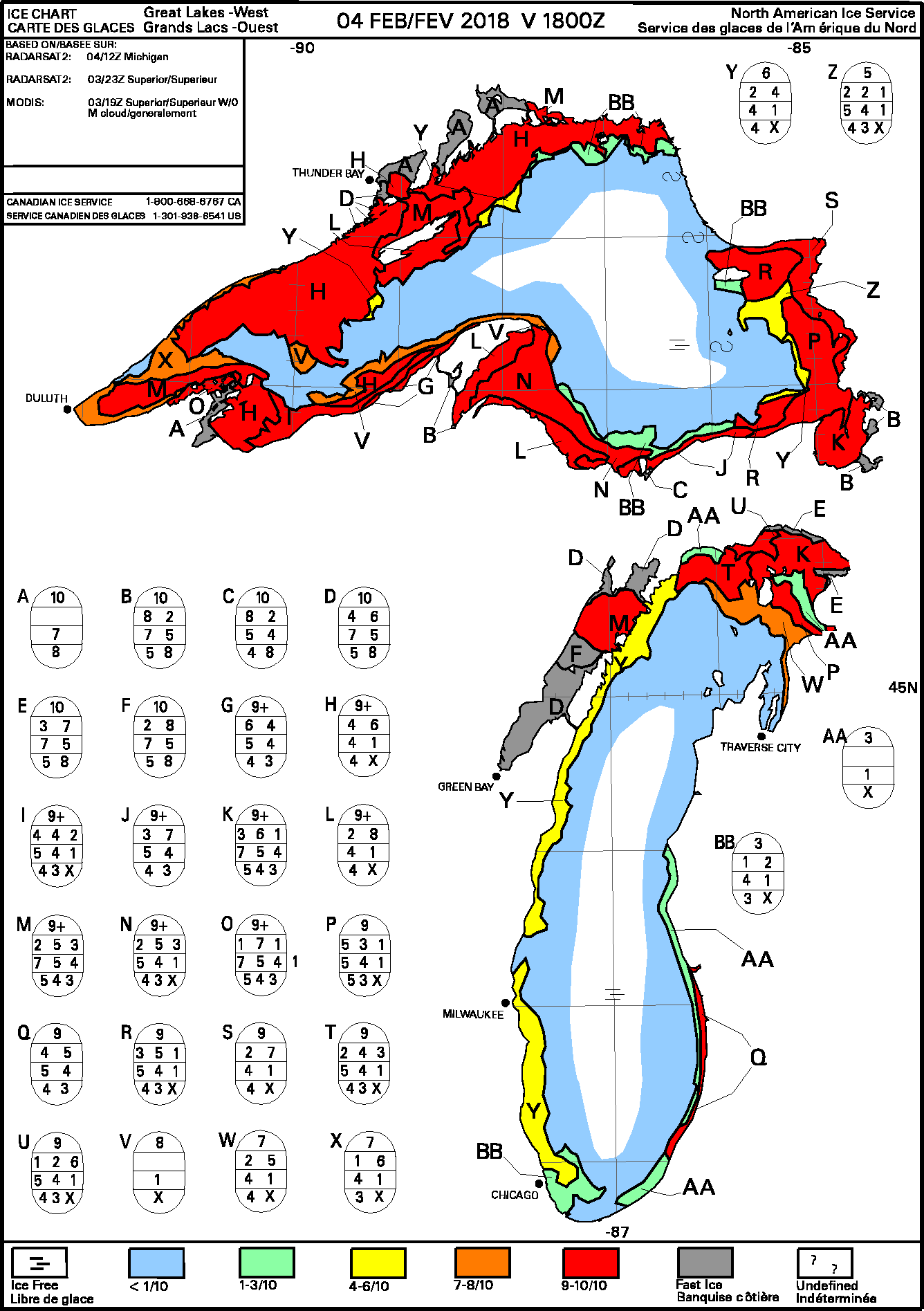
With an overpass of the Landsat-8 satellite at 1646 UTC, a 30-meter resolution False-color Red-Green-Blue (RGB) image (below) provided a very detailed view of a portion of the Lake Superior ice. NOAA-GLERL analyzed the mean ice concentration of Lake Superior to be at 23.9% ; the Canadian Ice Service analyzed much of the new lake ice to have a concentration of 9/10ths to 10/10ths.
![Landsat-8 False-color RGB image [click to enlarge]](https://cimss.ssec.wisc.edu/satellite-blog/wp-content/uploads/sites/5/2018/02/180204_1646utc_landsat8_falsecolor_Lake_Superior_ice.jpeg)
Landsat-8 False-color RGB image [click to enlarge]
![Landsat-8 False-color RGB image [click to enlarge]](https://cimss.ssec.wisc.edu/satellite-blog/wp-content/uploads/sites/5/2018/02/180204_landsat8_zoom_1.jpeg)
Landsat-8 False-color RGB image [click to enlarge]
![Landsat-8 False-color RGB image [click to enlarge]](https://cimss.ssec.wisc.edu/satellite-blog/wp-content/uploads/sites/5/2018/02/180204_landsat8_zoom_2.jpeg)
Landsat-8 False-color RGB image [click to enlarge]
![Landsat-8 False-color RGB image [click to enlarge]](https://cimss.ssec.wisc.edu/satellite-blog/wp-content/uploads/sites/5/2018/02/180204_landsat8_zoom_3.jpeg)
Landsat-8 False-color RGB image [click to enlarge]
![Landsat-8 False-color RGB image [click to enlarge]](https://cimss.ssec.wisc.edu/satellite-blog/wp-content/uploads/sites/5/2018/02/180204_landsat8_zoom_4.jpeg)
Landsat-8 False-color RGB image [click to enlarge]
GOES-16 “Red” Visible (0.64 µm) images, with plots of hourly surface reports [click to play animation]