Rope Cloud over the northwest Gulf of Mexico
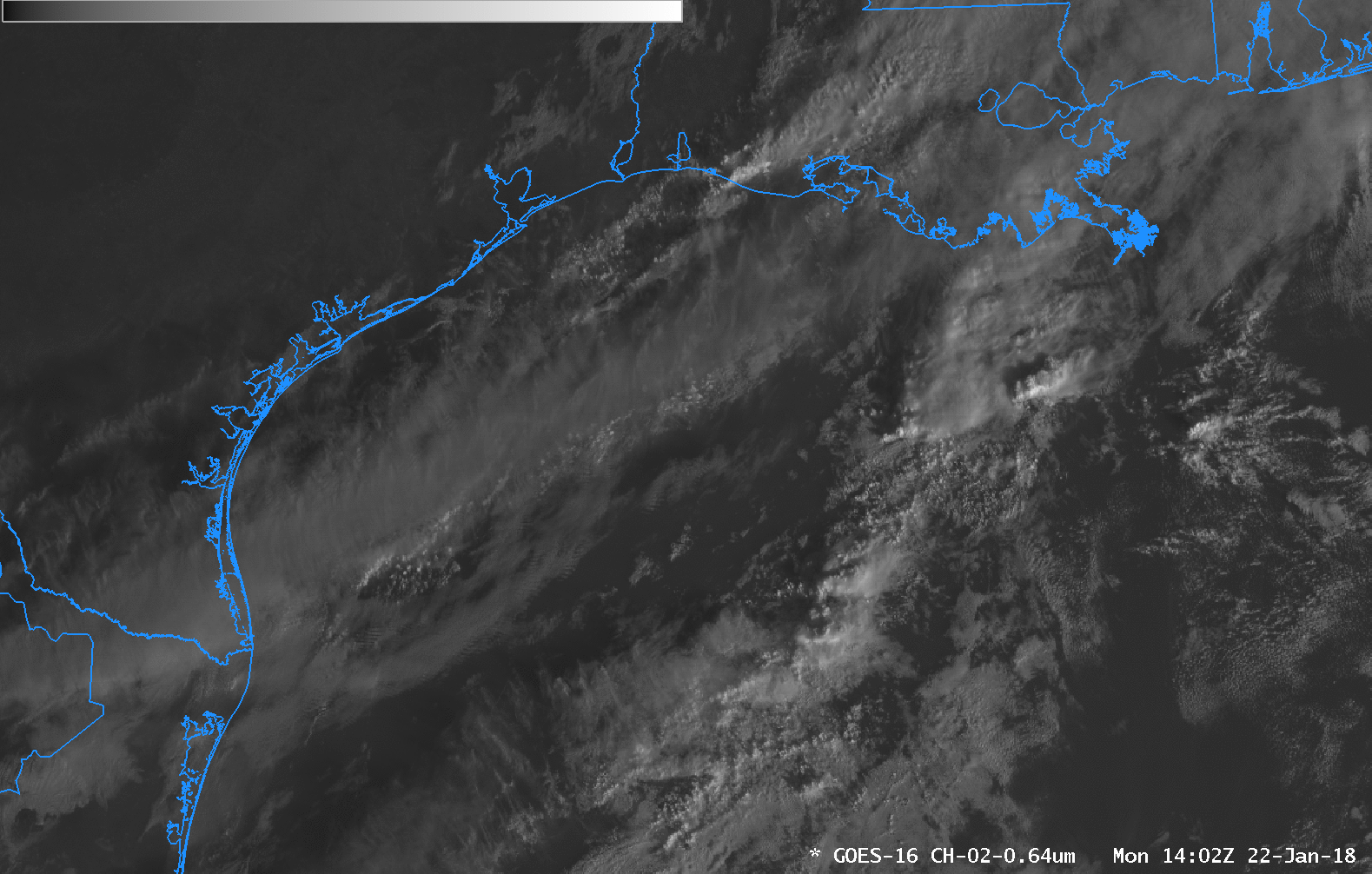
GOES-16 “Red Visible” 0.64 µm imagery from 1402-2142 UTC on 22 January 2018. (Click to animate)
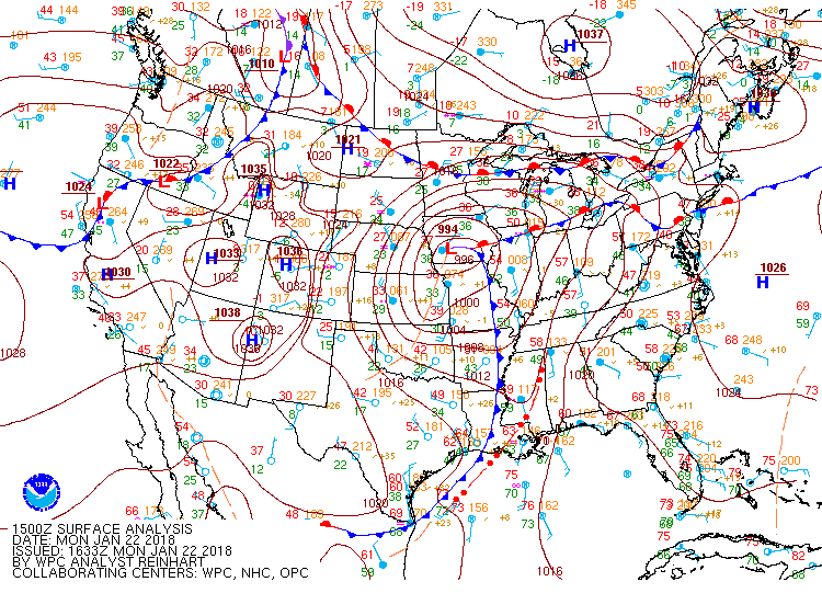
Visible GOES-16 Satellite Imagery over the northeastern Gulf of Mexico on 22 January 2018 showed the development of a Rope Cloud. Such features have been discussed before on the CIMSS Blog — here, here, here and here! Rope Clouds are handy features in satellite analysis over the ocean because they indicate distinctly where the surface cold front exists. Note that the WPC surface analysis, shown here for 1500 UTC, has the front in the same location as the rope cloud, with convection noted out in advance of the surface cold front. The hourly animation below, showing surface observations and the GOES-16 Red Visible (0.64 µm) Imagery, confirms the windshifts that were observed when the Rope Cloud/Cold Front passed any station.

Hourly Surface Observations and GOES-16 “Red Visible” 0.64 µm imagery from 1400-2200 UTC on 22 January 2018. (Click to enlarge)