Irma over Florida as seen by Suomi NPP and GOES-16
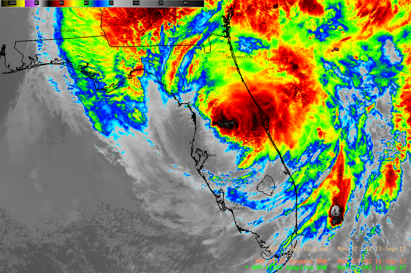
Suomi NPP overflew Florida and Hurricane Irma shortly after 0700 UTC on Monday 11 September. The 10.8 µm Infrared Image from the VIIRS Instrument, above, shows cold cloud tops and strong convection over much of central Florida (Orlando International Airport received 3″ of rain between 0300 and 0600 UTC on 11 September, as shown in a time series plot of surface data). The center of Irma at this time was about 55 miles northeast of Tampa.
Suomi NPP includes a Day/Night Band on the VIIRS Instrument, allowing night-time visible imagery that is illuminated by the Moon. The Day/Night Band Near Constant Contrast product from the same time as the infrared image above, but zoomed out, is shown below. In addition to the cloud structures, this band can help identify power outages. Tampa and Miami city lights are still visible. Key West is dark. A zoomed-in view of Key West (here) shows very little illumination.

Suomi NPP Day/Night Band Image over the southeast United States showing Hurricane Irma over Florida, 0710 UTC on 11 September 2017 (Click to enlarge)
GOES-16 data posted on this page are preliminary, non-operational and are undergoing testing
In addition, GOES-16 “Clean” Infrared Window (10.3 µm) images with surface wind gusts (in knots) are shown below during that night and the following daytime/evening hours on 11 September 2017 — Irma was eventually downgraded to a Tropical Storm and then a Tropical Depression (NHC Discussions) as it moved northward across the Florida peninsula and into southern Georgia and South Carolina.
GOES-16 “Clean” Infrared Window (10.3 µm) images, with surface wind gusts in knots (Click to animate)
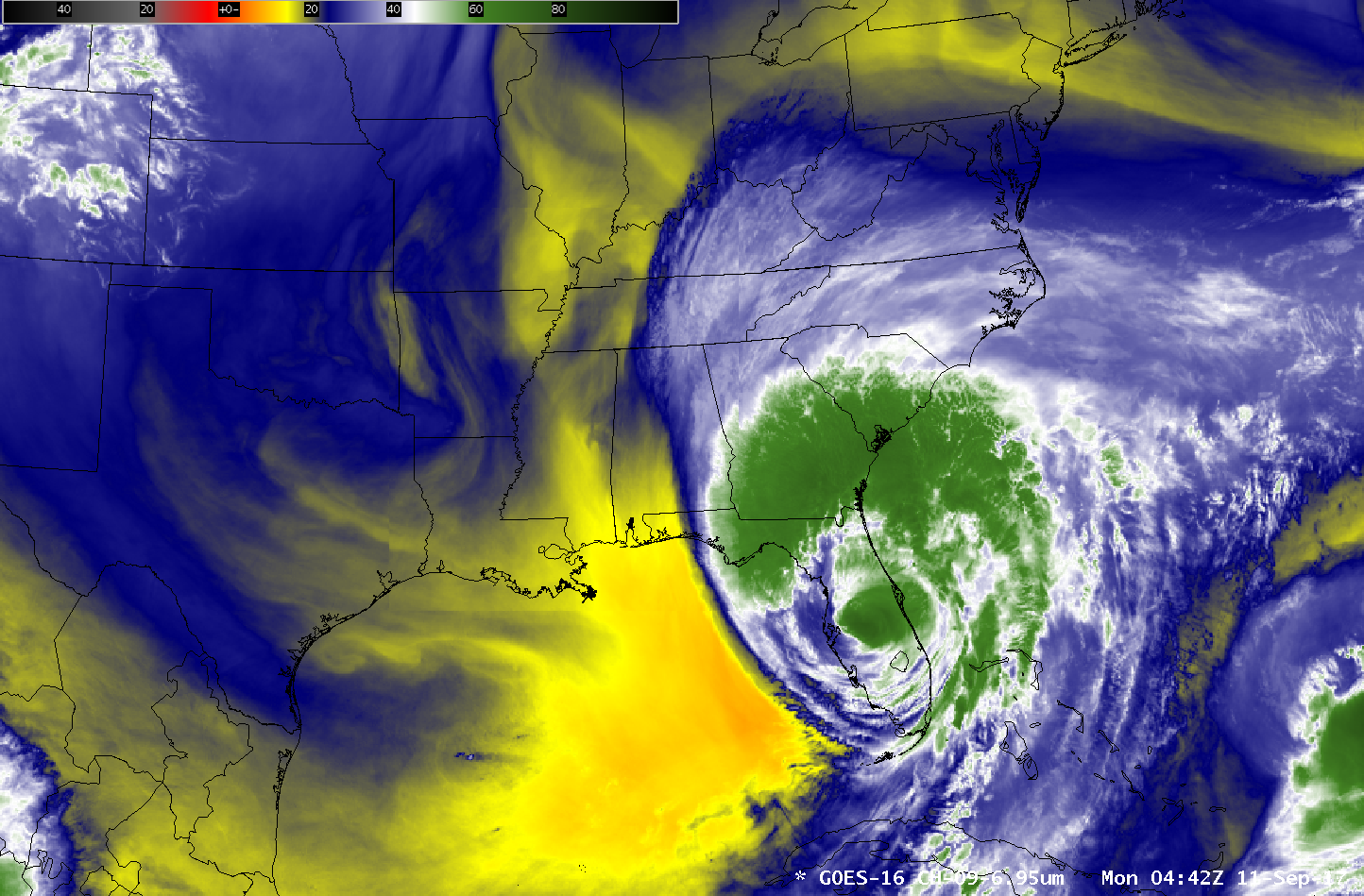
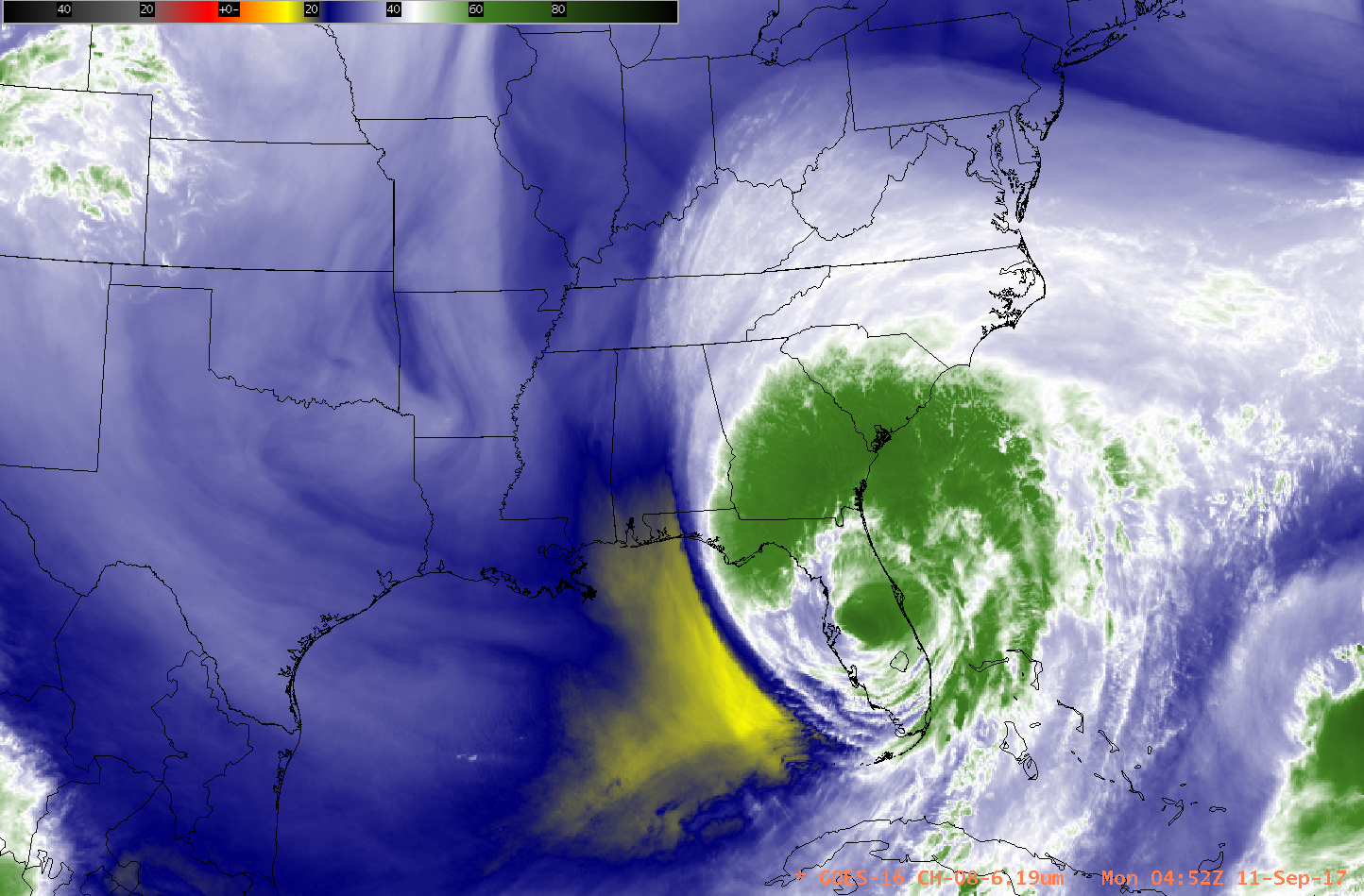
GOES-16 Water Vapor animations, below, show the evolution of the Hurricane as it transitions to an extratropical cyclone. At the start of the animations, near 0400 UTC on 11 September, the convection in the center of the hurricane is apparent between Tampa and Cape Canaveral. That central convection diminishes with time as it moves northeast and as the extratropical transition continues.


