GOES-16 Views a fire in Oakland, California
GOES-16 data (and products) posted on this page are preliminary, non-operational data and are undergoing testing
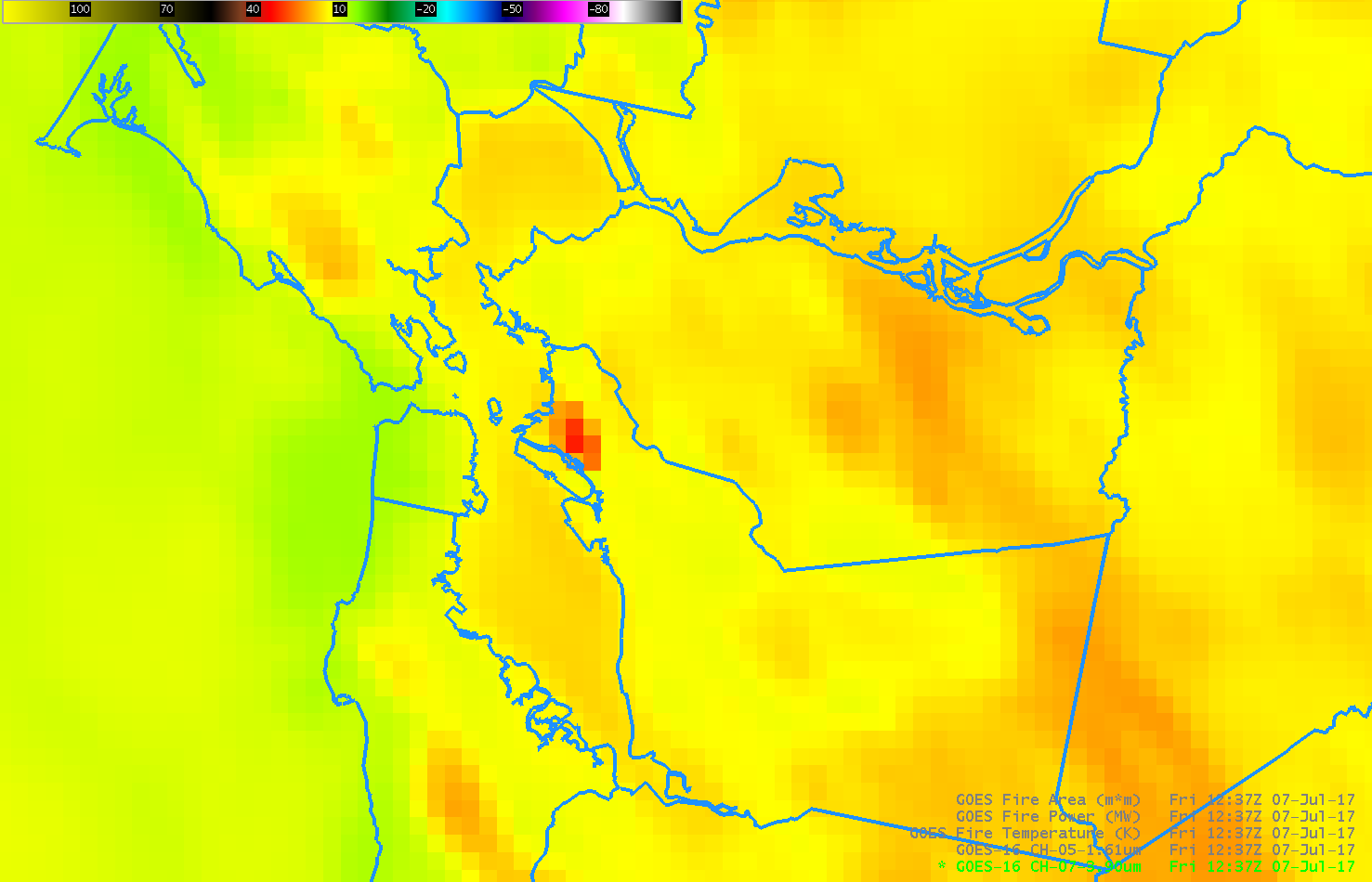
The San Francisco Bay Area National Weather Service office Tweeted out an image (as noted by the Media) during the early morning of 7 July of the GOES-16 Fire Temperature, a GOES-16 Baseline Product (link) above a massive fire in Oakland (News Report). The animation above shows the evolution of the fire as detected by the 3.9 µm Brightness Temperature shown in AWIPS. The first indication of a fire appeared around 1200 UTC; the fire was difficult to discern after 1330 UTC.
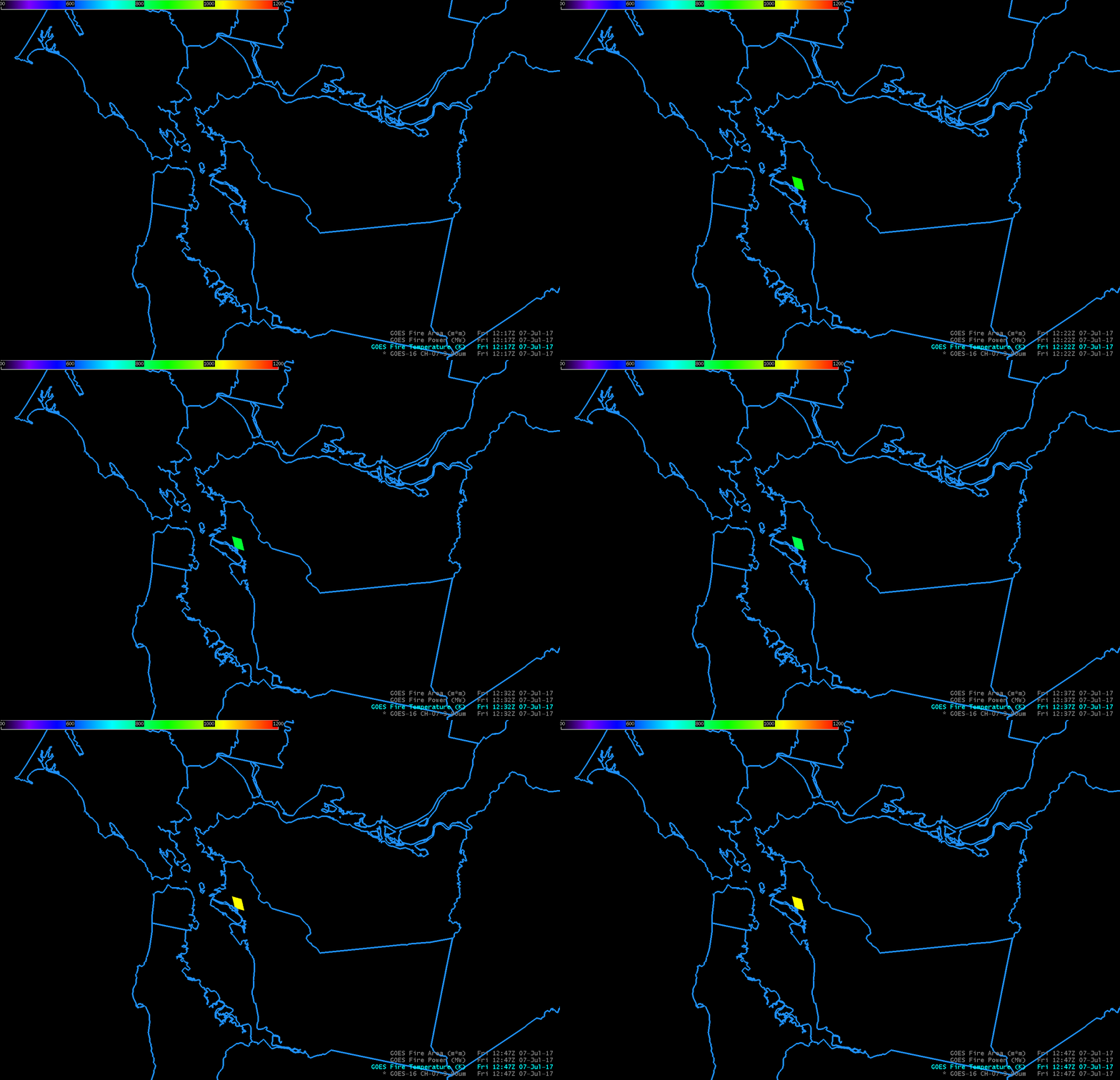
GOES-16 Baseline Products include Fire-Detection products: Fire Temperature, Fire Power, and Fire Area. These products returned values from 1222 to 1247 UTC, when the fire was at its most intense. The table below shows the values as noted in AWIPS. The fire peaked in terms of Power and Area at 1237 UTC. The animation below is for Fire Temperature, and only one area is indicated (Fire Power and Fire Area caused the same region to show a non-zero values, the same values noted in the table below). GOES-16 Engineers and Scientists are investigating why the pixel size below does not match the correct pixel sizes above in the 3.9 µm imagery.
| Time | Fire Temperature (K) | Fire Power | Fire Area (Square Meters) |
|---|---|---|---|
| 1222 UTC | 892 K | 86 | 4000 |
| 1227 UTC | 873 K | 92 | 4000 |
| 1232 UTC | 849 K | 153 | 4671 |
| 1237 UTC | 833 K | 167 | 5402 |
| 1242 UTC | 889 K | 137 | 4000 |
| 1247 UTC | 1041 K | 94 | 4000 |
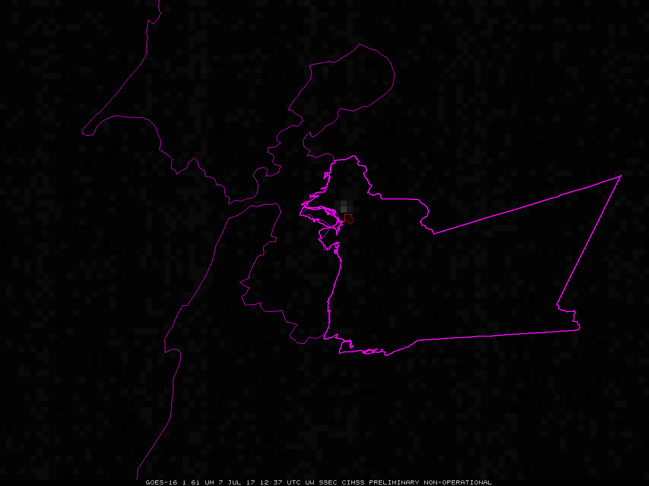
The fire was hot enough that it emitted detectable near-infrared 1.61 µm radiation, as shown below (animation). The brightest pixel, pointed to by the red arrow, over downtown Oakland in Alameda County (outlined in magenta) shows an albedo of 4.2% before sunrise!


