Lake Superior lake breeze and marine stratus
![GOES-16 Visible (0.64 µm) images, with hourly surface reports [click to play animation]](https://cimss.ssec.wisc.edu/satellite-blog/wp-content/uploads/sites/5/2017/06/170614_goes16_visible_Lake_Superior_lake_breeze_anim.gif)
GOES-16 Visible (0.64 µm) images, with hourly surface reports [click to play animation]
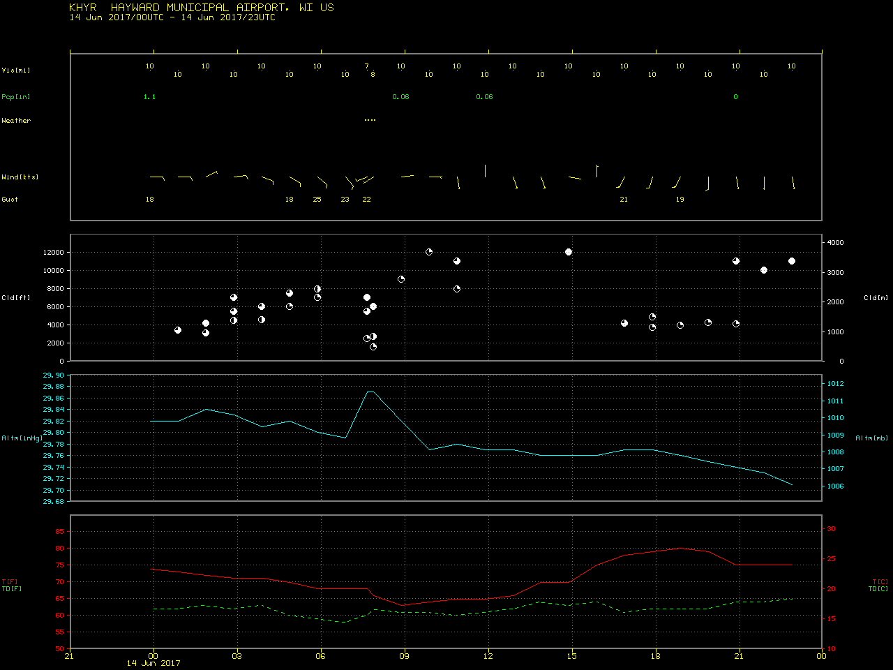
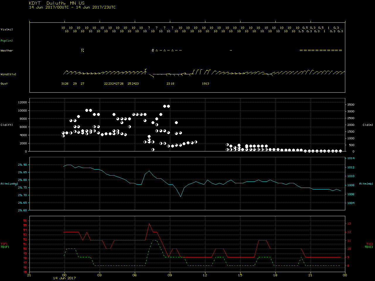
GOES-!6 Visible (0.64 µm) images (above) revealed the presence of a well-defined lake breeze boundary on 14 June 2017, which extended well inland from Lake Superior across northeastern Minnesota and northwestern Wisconsin. This shallow pool of lake-cooled air was acting to suppress the formation of inland cumulus clouds and maintain marine layer fog/stratus over the water and the adjacent coast — both of which slowed the warming of surface air temperatures. For example, in northwestern Wisconsin, Hayward Sawyer County Airport (KHYR) reached an afternoon high temperature of 81º F, while not far to the northwest Duluth Sky Harbor Airport (KDYT) only reached an afternoon high of 52º F as fog and stratus shrouded the site and held temperatures in the 40s F much of the day. Note that a few bore-like wave structures were seen in the lake stratus.
A comparison of Suomi NPP VIIRS Visible (0.64 µm) imagery at 1803 UTC with RTMA surface winds at 18 UTC (below) showed the flow and cloud features associated with the lake breeze.
![Suomi NPP VIIRS Visible (0.64 µm) image, with RTMA surface winds [click to enlarge]](https://cimss.ssec.wisc.edu/satellite-blog/wp-content/uploads/sites/5/2017/06/170614_1803utc_viirs_visible_rtma_surface_winds_Lake_Superior_anim.gif)
Suomi NPP VIIRS Visible (0.64 µm) image, with RTMA surface winds [click to enlarge]