Using GOES-16 visible and near-infrared imagery to diagnose areas of flooding
![Flood Warnings (green) in effect at 7:43 pm CDT on 06 April 2017 [click to enlarge]](https://cimss.ssec.wisc.edu/satellite-blog/wp-content/uploads/sites/5/2017/04/170406_flood_warnings.jpeg)
Flood Warnings (green) in effect at 7:43 pm CDT on 06 April 2017 [click to enlarge]
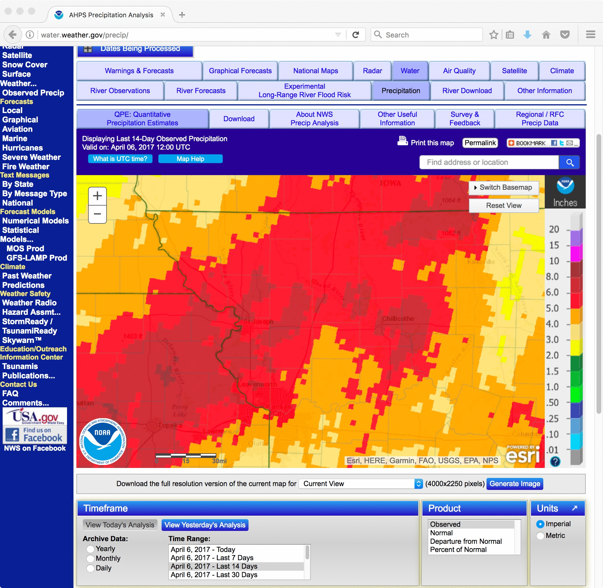
Following several days of heavy rainfall across northwestern Missouri, Flood Warnings remained in effect for many areas on 06 April 2017 (above).
A comparison of GOES-16 Visible (0.47 µm and 0.64 µm) and Near-Infrared (0.86 µm and 1.61 µm) images at 1507 UTC (below) shows that the Vegetation and Snow/Ice spectral bands are useful for identifying areas of swollen rivers and adjacent flooded lands (since water appears darker on those 2 images).
![GOES-16 Visible (0.47 µm and 0.64 µm) and Near-Infrared (0.86 µµ and 1.61 µm) images [click to enlarge]](https://cimss.ssec.wisc.edu/satellite-blog/wp-content/uploads/sites/5/2017/04/170406_1507utc_goes16_bands_1_2_3_5_KS_flooding_anim.gif)
GOES-16 Visible (0.47 µm and 0.64 µm) and Near-Infrared (0.86 µµ and 1.61 µm) images [click to enlarge]