GOES-16 Views of Tornadic Thunderstorms over Louisiana
Severe Weather hit Louisiana on Tuesday 7 February 2017, and the ABI on GOES-16 viewed the convective development. This website includes an animation (also available on YouTube) of the visible imagery (Band 2, 0.64 µm with 0.5-km resolution at the subsatellite point) from ABI during the time period of the strongest tornadoes in and near New Orleans. Click here for an animation that includes views of all 16 ABI Bands.
A comparison of GOES-13 (GOES-East) Visible (0.63 µm) and Infrared Window (10.7 µm) images is shown below, with hourly surface reports and locations of the tornado reports.
GOES-13 0.63 µm Visible (top) and 10.7 µm Infrared Window images (bottom), with hourly surface reports in yellow and locations of the tornado reports in cyan.
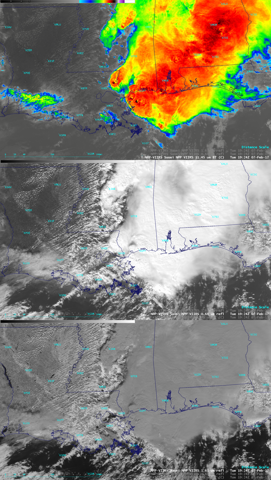
Suomi NPP overflew the convection shortly after the tornadoes were on the ground in Louisiana, and images from the three spectral bands shown below, 11.45 µm, 0.64 µm and 1.61 µm show a mature convective system with overshooting tops over the Gulf Coast states and the Gulf of Mexico. The 1.61 µm Snow Ice band helps in the discrimination between cloud tops comprised of water droplets (bright white) vs. cloud tops comprised of ice crystals (grey); the ABI on GOES-16 has a similar band.


