The Loma fire in California
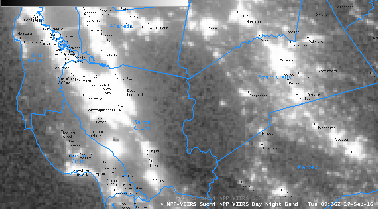
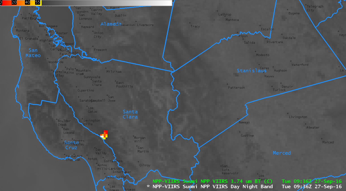
![Suomi NPP VIIRS imagery from the Day/Night Band visible (0.70 µm) and Infrared (3.74 µm) at 0936 UTC on 27 September, and terrain [Click to enlarge]](https://cimss.ssec.wisc.edu/satellite-blog/wp-content/uploads/sites/5/2016/09/NPP_DNB_3.74_0936_27Sep2016toggle.gif)
Suomi NPP VIIRS imagery from the Day/Night Band visible (0.70 µm) and Infrared (3.74 µm) at 0936 UTC on 27 September, and terrain [Click to enlarge]
GOES-15 can provide 3.9 µm imagery roughly 4 times per hour (when GOES-R is launched, shortwave infrared imagery will be produced every 5 minutes over the continental United States) allowing a better indication of how the fire is evolving with time. The animation below, from 0500 through 1530 UTC, shows a cooling trend in the warmest pixels (hottest pixels are colored red in the animation, then yellow, then black), which is expected as winds that drive the fire relax at night. There is notable motion in the navigation of this image. GOES-15 is operating with only 1 Star Tracker (vs. the usual 3), resulting in less-precise image navigation.
![GOES-15 shortwave infrared (3.9 µm) imagery from 0500 UTC through 1500 UTC on 27 September [Click to animate]](https://cimss.ssec.wisc.edu/satellite-blog/wp-content/uploads/sites/5/2016/09/GOES15_IR2_27SEP2016_anim_0500_1530UTC.gif)
GOES-15 shortwave infrared (3.9 µm) imagery from 0500 UTC through 1500 UTC on 27 September [Click to animate]
![GOES-15 visible (0.62 µm) imagery from 1430 to 1530 UTC on 27 September [Click to enlarge]](https://cimss.ssec.wisc.edu/satellite-blog/wp-content/uploads/sites/5/2016/09/GOES15_VIS_27SEP2016_anim.gif)
GOES-15 visible (0.62 µm) imagery from 1430 to 1530 UTC on 27 September [Click to enlarge]