Flooding Rains in southern California
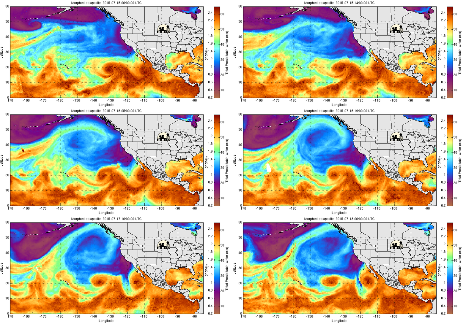
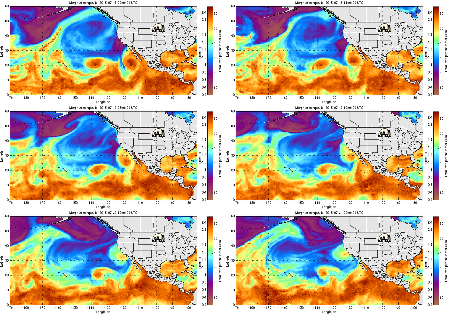
Unusual rains causing flooding and mudslides hit southern California (San Diego in particular) on 18-19 July 2015. The two-day rain total (1.69″) at Lindbergh Field broke the monthly record for July (previous record, 1.29″) and exceeded the January-April 2015 rainfall (the typical wet season) at the station. The San Diego Padres had their first July rainout ever, and the Anaheim Angels had their first rainout since 1995! What caused the rains? The water vapor imagery, above, shows the three systems that contributed. Pacific Hurricane Dolores (Track) was declared post-tropical off the coast of Baja California at 0300 UTC on 19 July. Farther to the west, Pacific Tropical Storm Enrique was declared post-tropical at 0300 on 18 July. High pressure aloft was helping support a Gulf Surge, a surge of moisture up the Gulf of California towards the desert southwest. Two animations of MIMIC Total Precipitable Water, below, show the surge and also show that moisture associated with main circulation of Dolores remains mostly offshore until late on the 19th, after the heavy rains had ended.

MIMIC Total Precipitable Water, 0000 UTC on 15 July through 0000 UTC on 18 July 2015 (click to enlarge)

MIMIC Total Precipitable Water, 0000 UTC on 18 July through 0000 UTC on 21 July 2015 (click to enlarge)
The Blended Precipitable Water Product (data collected from this site), below, also shows evidence of a Gulf Surge of moisture moving northward through the Gulf of California in the few days preceding the rains.

NESDIS Blended Total Precipitable Water (left) and Percent of Normal (right), 1200 UTC on 15 July through 1200 UTC on 20 July 2015 (click to animate)
The animation of 10.7 µm imagery, below, suggests that the precipitation on Saturday the 18th was associated more with the Gulf Surge of moisture (which surge was likely influenced both by the large scale synoptic flow and by the circulation of Dolores); precipitation on Sunday the 19th seems more directly influenced by Dolores.
What part did the upper-level outflow jets from the two tropical cyclones play in this event? Consider the water vapor animation below, zoomed in from the larger-scale view at the top of this post. Outflow from Enrique moves from the southwest part of the domain towards the southern California coast (the low-level circulation of Enrique are at the southwest edge of the domain), moving inland as convection develops on Saturday 18 July 2015. The Total Precipitable Water imagery suggests that convection starts as the leading edge of the Gulf Surge arrives; water vapor imagery suggests a tie to Enrique.
GOES-15 Visible Imagery, below, from Saturday the 18th and from Saturday the 19th suggest rain on 19 July was more directly tied to the circulation of Dolores. On both days, the convective nature of the precipitation is apparent, with numerous overshooting tops present. Convection on Sunday the 19th started over higher terrain first, and then was joined by tropical convection moving in from the ocean.
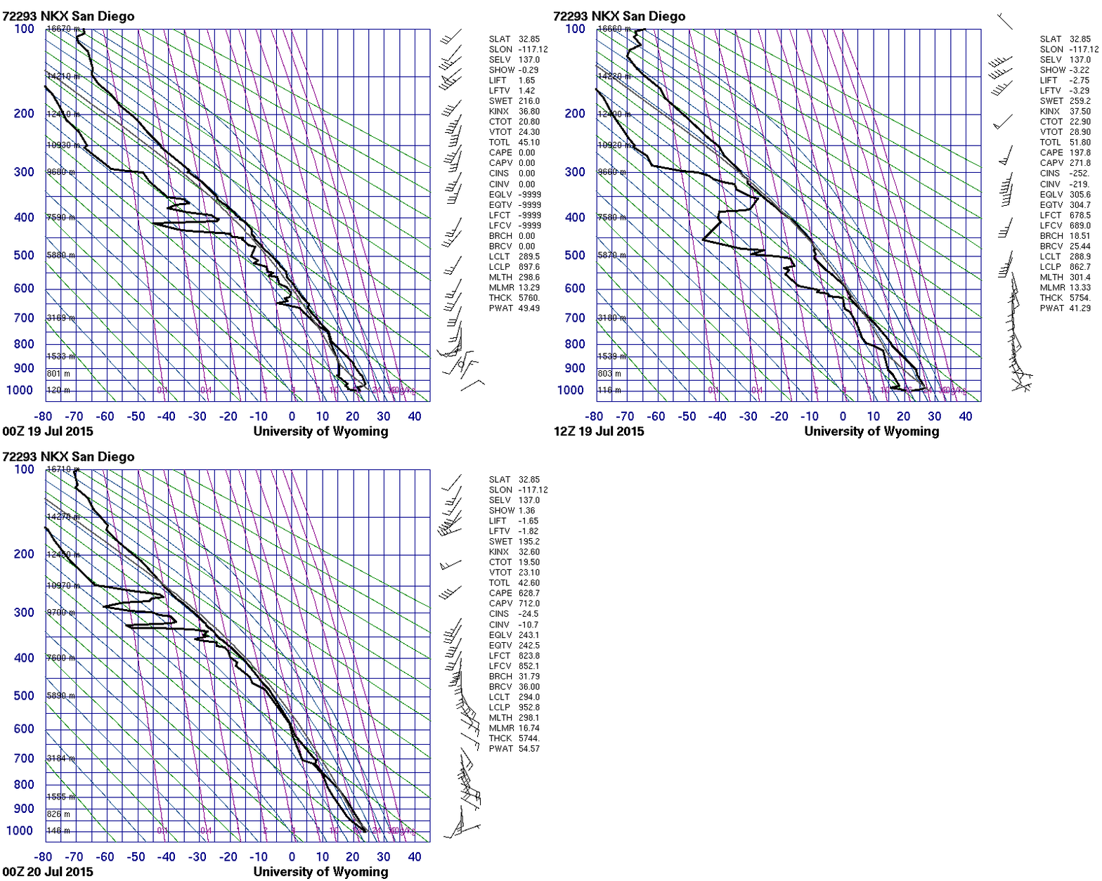
As might be expected, the San Diego sounding (source) shows deep tropical moisture late on the 18th and late on the 19th as the heavy rains occurred. The precipitable water value of 2.10″ at 0000 UTC on 20 July was a top 5 value for July (Source). The rains caused two spikes in the flow of the San Diego River (Link, courtesy Alex Tardy, NWS San Diego).

Stuve plots of radiosonde data at 72293, 0000 and 1200 UTC 19 July and 0000 UTC 20 July 2015 (click to enlarge)
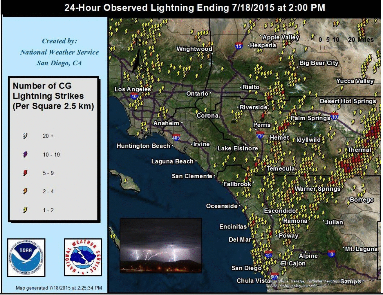
The convection over San Diego produced many lightning strikes on Saturday, as shown on the map below, courtesy of Alex Tardy, NWS San Diego.


