Smoke and Fog in the VIIRS Day/Night Band

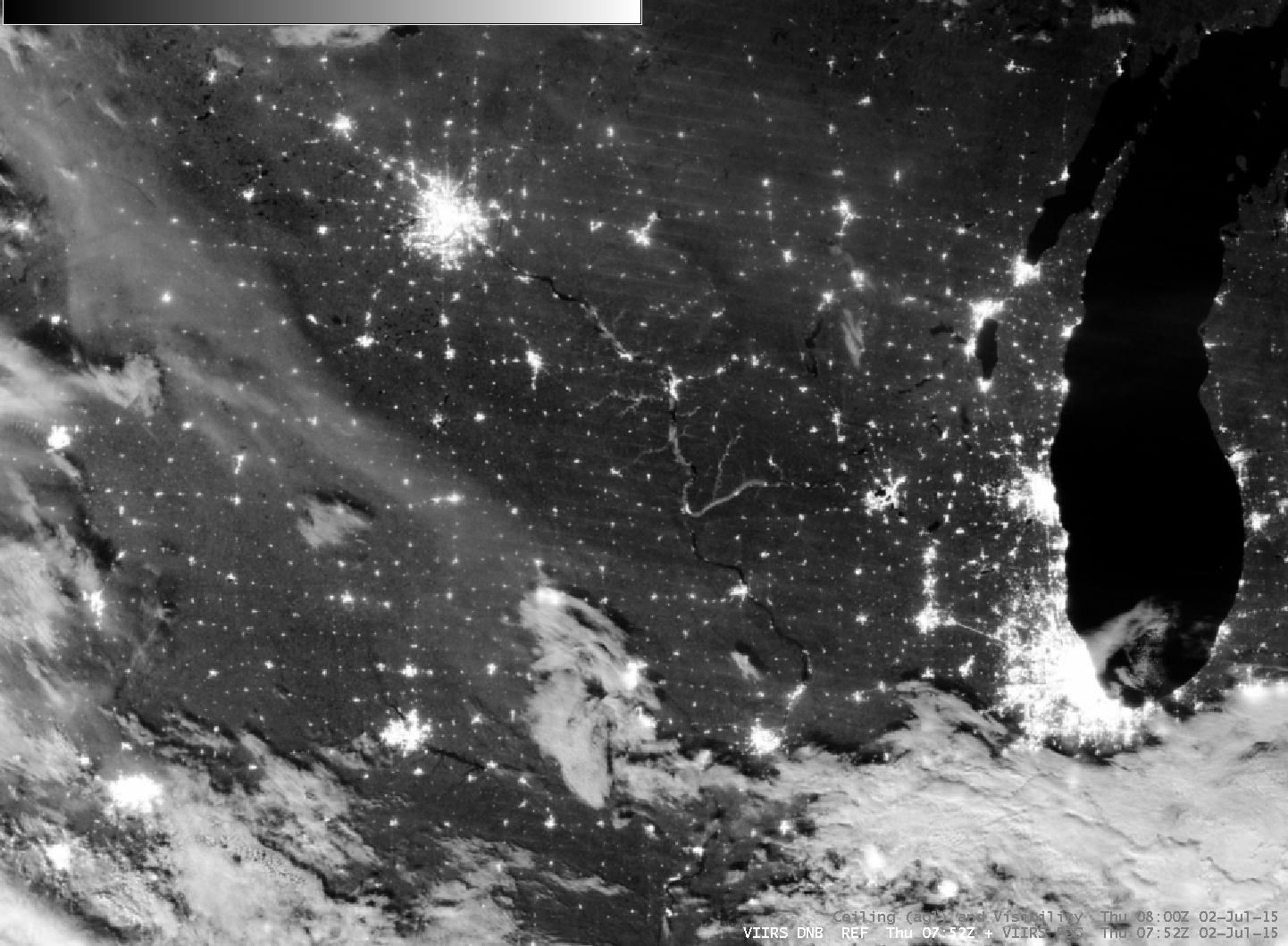
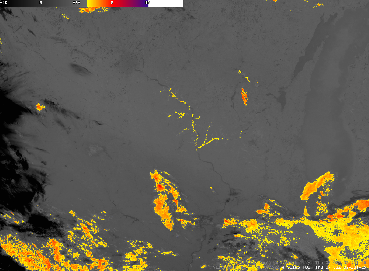
Suomi NPP VIIRS 0.70 µm visible Day/Night Band and 11.45 µm – 3.74 µm IR Brightness Temperature Difference images, and Ceilings and Visibilities, ~0800 UTC (click to enlarge)
July’s first Full Moon occurred at 0219 UTC on 2 July (a second full moon occurs later this month on 31 July). Strong illumination from the moon showed river valley fog in several tributaries of the Mississippi River (for example, the Wisconsin River in southwest Wisconsin; the Upper Iowa River in Iowa) across the Upper Midwest. The Suomi NPP VIIRS Day/Night Band also shows a plume of Canadian wildfire smoke aloft, stretching from central Iowa northwestward to western Minnesota. This smoke (visible on 1 July in Aqua true-color imagery from the MODIS Today site) is not apparent in the IR Brightness Temperature Difference field, although the river valley fog certainly is. Smoke is transparent to most infrared channels and detection at night is very difficult if visible information such as that provided by the Day/Night Band is not present.
The VIIRS Day/Night Band also enabled detection of the dense plume of Canadian wildfire smoke as it moved off the US East Coast and over the adjacent offshore waters of the western Atlantic Ocean at 0614 UTC (below). Again, note that the smoke aloft does not exhibit a signature on the corresponding VIIRS Infrared imagery.
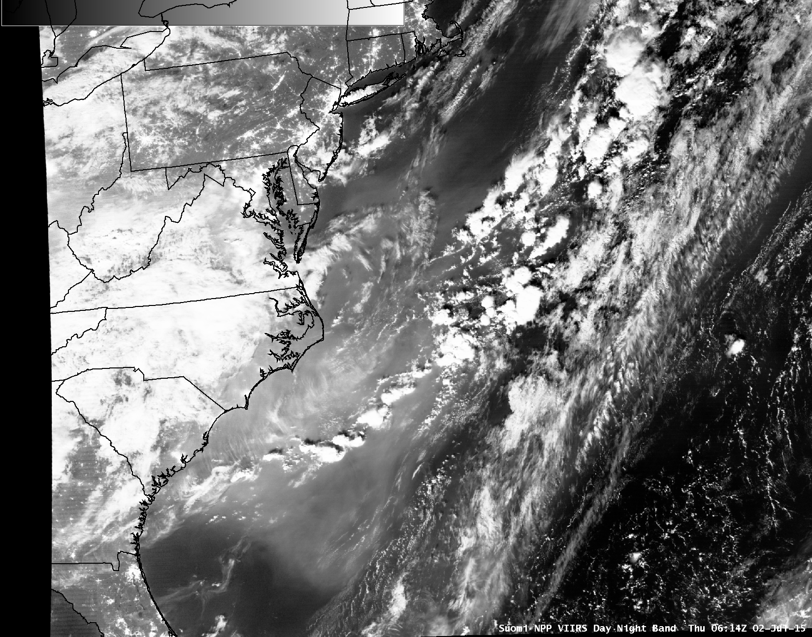
Suomi NPP VIIRS 0.7 µm Day/Night Band and 11.45 µm Infrared images (click to enlarge)