Historic Rainfall in Islip, NY
GOES-13 10.7 µm infrared imagery on 13 August 2014; The Islip airport (KISP) is at the violet square (click to animate)
The system that caused flooding in Detroit, MI on 11 August and in Baltimore/Washington on 12 August has moved eastward: Islip, NY, on central Long Island, had historically heavy rainfall early in the morning on 13 August as more than 13″ of rain fell (9.71″ in two hours, and 5.34″ in one hour!!), smashing the New York state record for 24-hour rainfall (Record Event Report).
The GOES-13 animation above shows the satellite presentation of the storms that produced the heavy rainfall (the heaviest rain fell between 0900 and 1100 UTC). It is immediately apparent that the deepest convective clouds were not responsible for the heavy rains: cloud-top IR brightness temperatures over Islip were only near -30º C (per the 1200 UTC OKX sounding, that was around 300 hPa; the tropopause was closer to 150 hPa) and cloud-to-ground lightning was not detected. Winds at the Islip airport shifted from easterly/northeasterly to southeasterly as the heavy rains ended (time series plot of surface weather): an approaching frontal boundary may have helped force the heavy rains.
The animation shows continual cold cloud redevelopment at/near Islip, suggesting that training shower development was an important factor in the flooding.
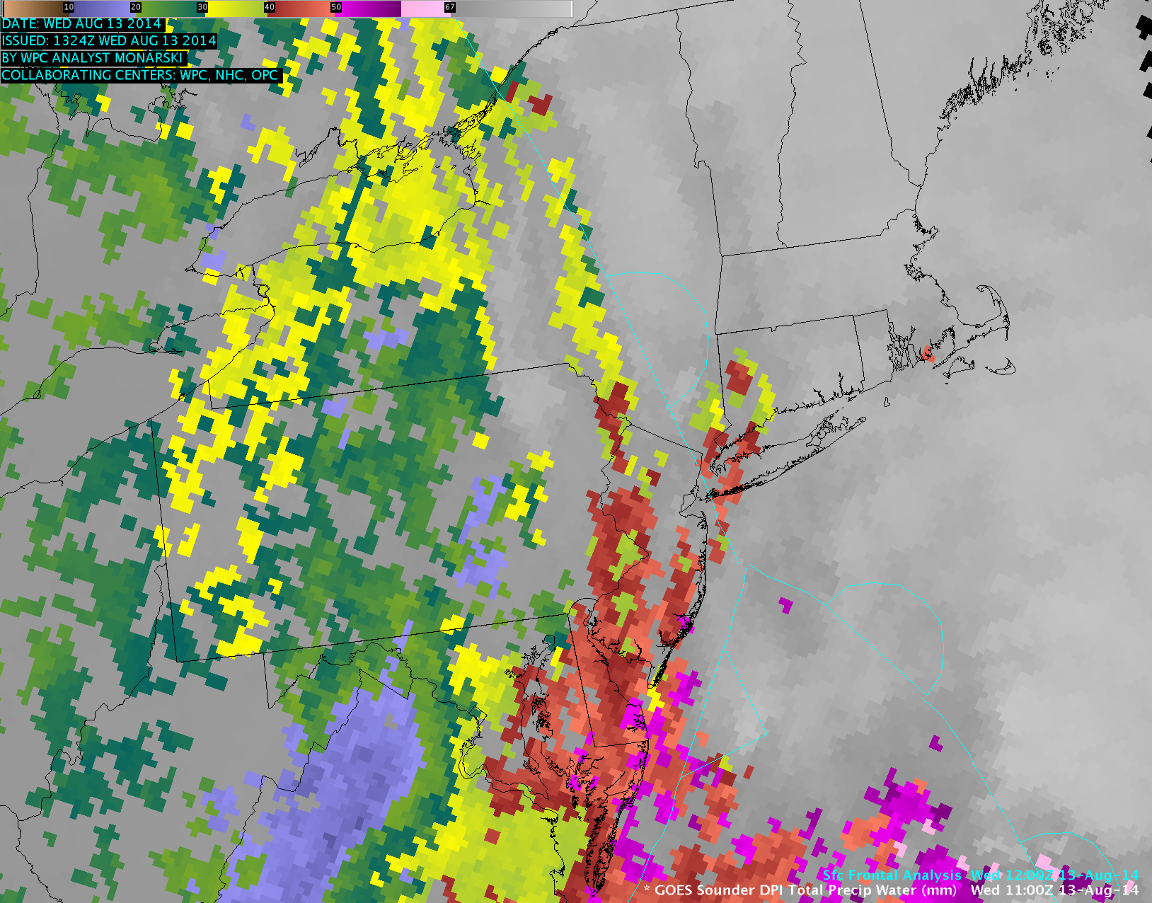
Although the region was generally cloudy, holes in the cloud cover revealed GOES-13 sounder Total Precipitable Water values (below; click image to play animation) of 45-50 mm or 1.8-2.0 inches over Long Island just ahead of the advancing frontal boundary. The Blended Total Precipitable Water product showed a sudden jump to over 50 mm or 2.0 inches around 10 UTC over Long Island, and these TPW values were around 150% of normal for that location and time of the year.
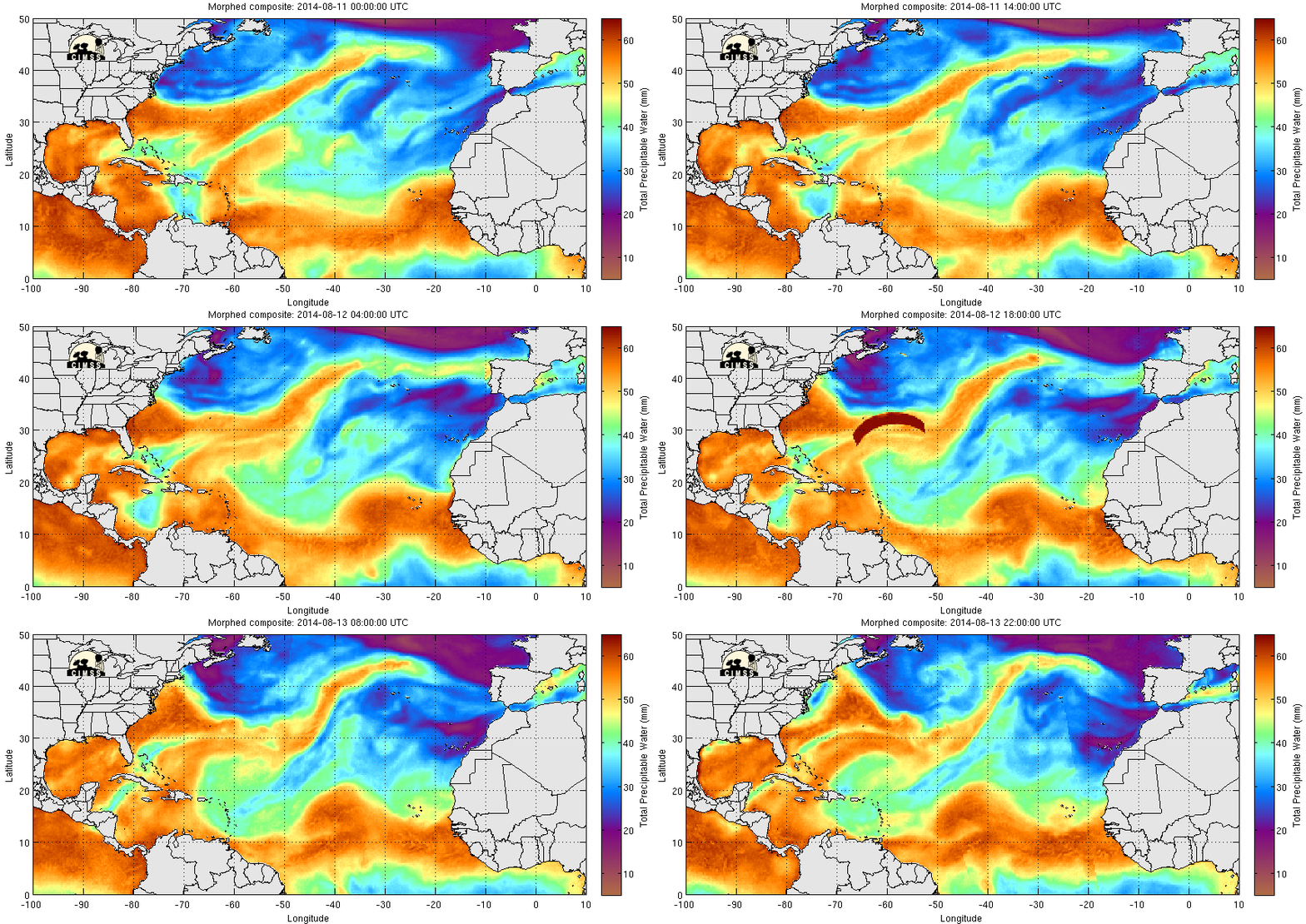
The MIMIC Total Precipitable Water product (below) showed a northward surge of tropical moisture into the region on 13 August.


