Rammasun makes landfall in southern China
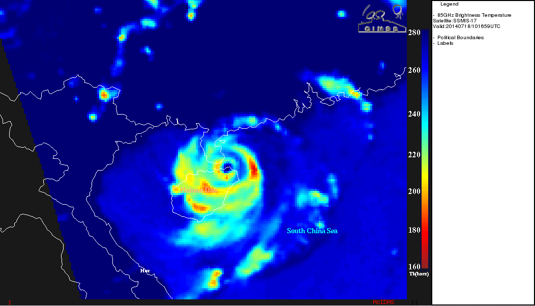
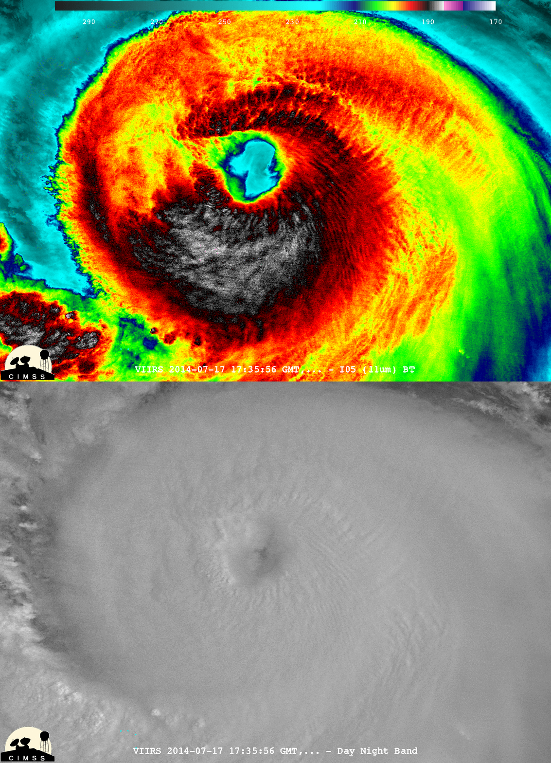
Super Typhoon Rammasun has made landfall in southern China – apparently this was the strongest typhoon to hit the South China region in 41 years (news story). The COMS-1 IR animation, above, shows the storm skirting along the north shore of the island of Hainan before hitting the south shore of the Leizhou Peninsula. A plot of the CIMSS Advanced Dvorak Technique indicated that Rammasun went though a period of rapid intensification on 17 July before reaching Super Typhoon intensity around 00 UTC on 18 July. The projected path (from this site) of the storm has it moving across the Gulf of Tonkin (where very warm Sea Surface Temperatures are present) and making landfall near the Vietnam/China border. Visible imagery (below) captured the eye as it approached Hainan and then moved into the Qiongzhou strait between the island and the mainland. Note the initially mostly clear eye (with embedded small-scale vortices) rapidly fills after landfall. A DMSP SSMIS 85 GHz microwave image (below) showed a well-defined eyewall at 1016 UTC.A comparison of Suomi NPP VIIRS 11.45 µm IR and 0.7 µm “visible image at night” Day/Night Band data at 1735 UTC on 17 July (below; courtesy of William Straka, SSEC) revealed an interesting packet of waves in the southeastern quadrant of the eyewall region of the tropical cyclone.


![COMS-1 10.8 µm infrared channel images [click to play animation]](https://cimss.ssec.wisc.edu/satellite-blog/wp-content/uploads/sites/5/2014/07/COMS1_IR_18July2014_0630.gif)
![Past and Projected path of Rammasun, with Sea Surface Temperatures [click to enlarge]](https://cimss.ssec.wisc.edu/satellite-blog/wp-content/uploads/sites/5/2014/07/Path_RAMMASUN.gif)
![COMS-1 0.675 µm infrared channel images [click to play animation]](https://cimss.ssec.wisc.edu/satellite-blog/wp-content/uploads/sites/5/2014/07/COMS1_VIS_18July2014_0630.gif)

