Strong offshore winds across the Alaska Panhandle region
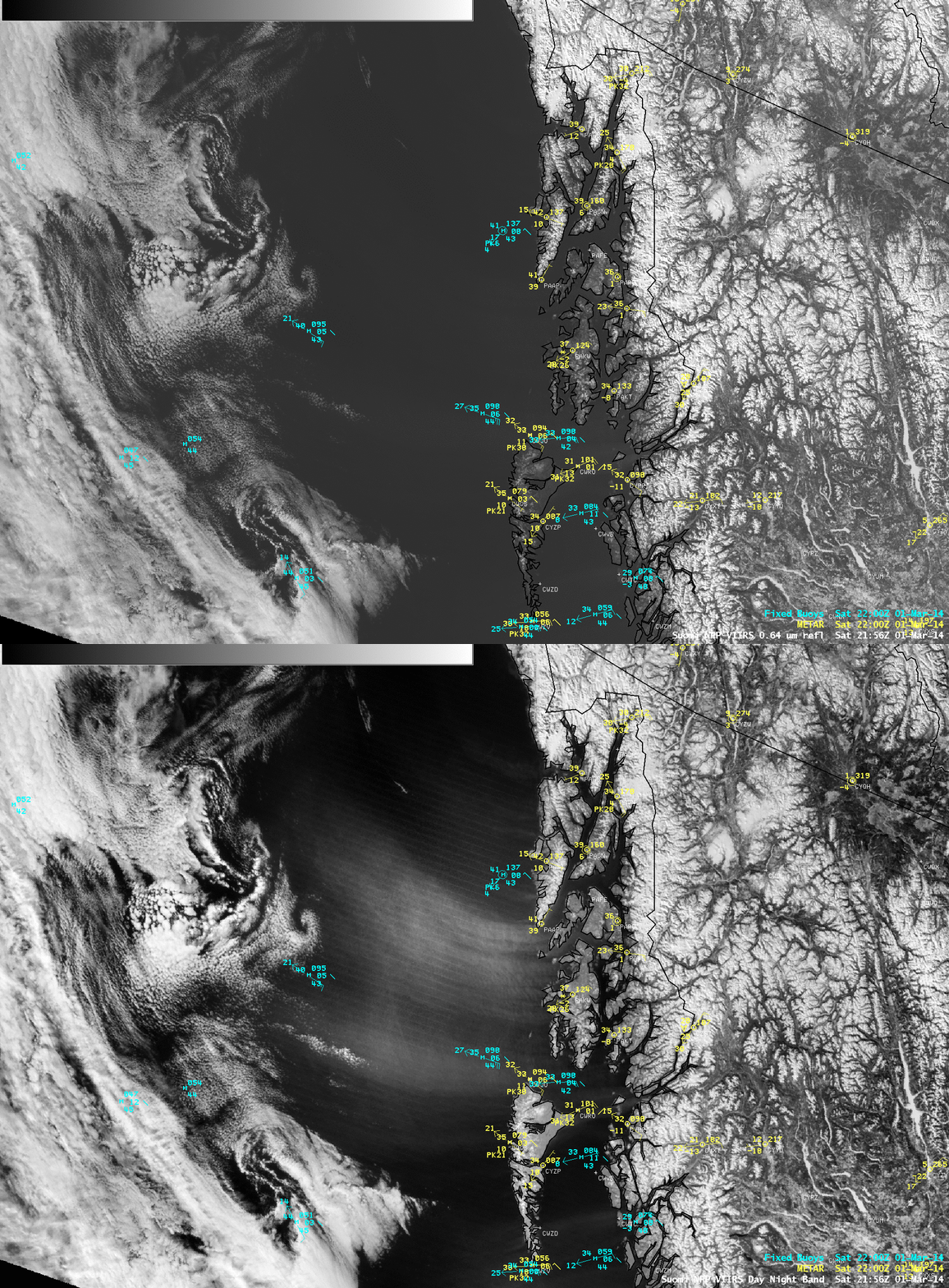
A comparison of AWIPS images of Suomi NPP VIIRS 0.64 µm visible channel and 0.7 µm Day/Night Band (DNB) data (above) demonstrated the superior ability of the broadband spectral response of the DNB to detect the plumes of airborne aerosols which were being lofted by strong offshore winds in the southern Alaska Panhandle region on 01 March 2014.
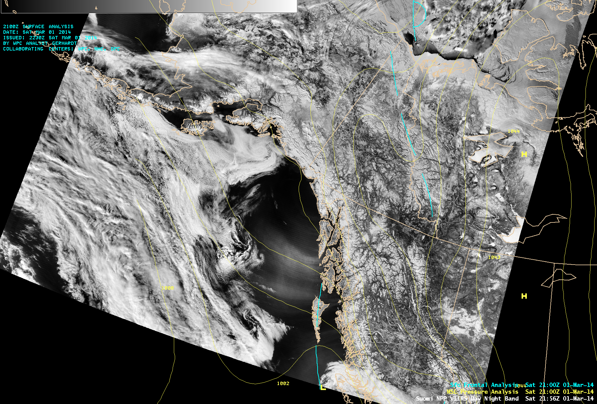
These strong offshore winds were the result of the strong pressure gradient between a ridge of high pressure inland over Canada and a trough of low pressure located off the coast (below). The air was quite cold and dry across inland Canada (plot of minimum temperatures), and this air experienced further drying as it was forced through the various mountain passes and then descended toward the coast.
McIDAS images of GOES-15 6.5 µm water vapor channel data (below; click image to play animation) showed a trend of strong middle-tropospheric drying during the day, as seen by the growth in areal coverage of the warmer (yellow-enhanced) region moving southwestward over the Alaska Panhandle region.
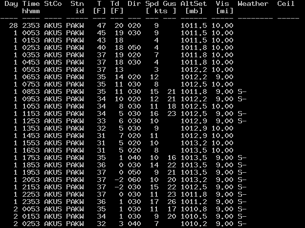
It is interesting to note that the surface observations at Klawock, Alaska (below) included “Snow” as the wind speeds increased and the aerosol plume became evident on satellite imagery. However, given the relatively warm surface air temperatures and the very low dew points (along with the fact that the sky conditions were reported as “Clear” during the entire day), it is likely that automated sensors mistook the airborne aerosol particles as snow.


