Detecting snow cover at night with VIIRS Day/Night Band imagery
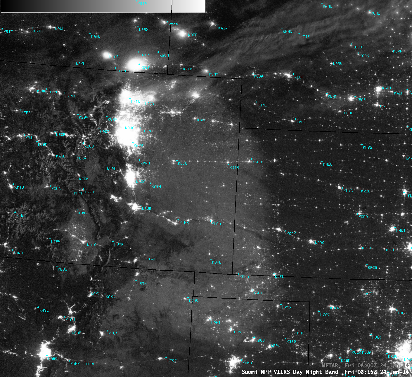
Due to illumination by moonlight — the Moon was in the waning crescent phase, at 40% of full — a broad area of snow cover could be seen over parts of the High Plains and Foothills regions of the US on an AWIPS image of Suomi NPP VIIRS 0.7 µm Day/Night Band (DNB) data at 08:15 UTC or 1:15 AM local time on 24 January 2014 (above). This was what remained of the general 1-4 inches of new snow that fell over that area, aided by upslope flow in the wake of a southward-moving cold frontal passage on 23 January.
A comparison of this Day/Night Band image with the corresponding VIIRS 11.45-3.74 µm IR brightness temperature difference (BTD) “Fog/stratus product” and 11.45 µm IR channel images (below) confirmed that this feature seen on the DNB image was not an area of fog or low-level clouds (although some patches of cold high-altitude clouds were seen from far northern Colorado into Wyoming and Nebraska). On the 11.45 µm IR image, some areas in eastern Colorado exhibited IR brightness temperature values of -30º C or colder (yellow color enhancement) — these were likely locations where the snow cover was the deepest, allowing faster radiational cooling of the surface air layer.

Suomi NPP VIIRS 0.7 µm Day/Night Band, IR BTD “fog/stratus product”, and 11.45 µm IR channel images
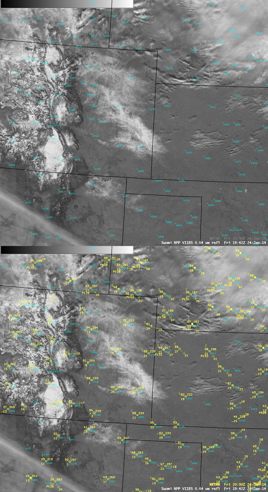
A Suomi NPP VIIRS 0.64 µm visible channel image at 19:42 UTC or 12:42 PM on the following afternoon (below) showed that while the areal coverage of the snow cover had decreased with daytime heating, what snow cover did remain was acting to hold surface air temperatures down at least 10-15º F compared to adjacent bare-ground locations.


