Strong cold front moves through the Hawaiian Islands
McIDAS images of 4-km resolution GOES-15 6.5 µm water vapor channel data (above; click images to play animation) showed the dramatic signature of rapid intensification of a very large mid-latitude cyclone over the eastern Pacific Ocean during the 20 January – 23 January 2014 time period.
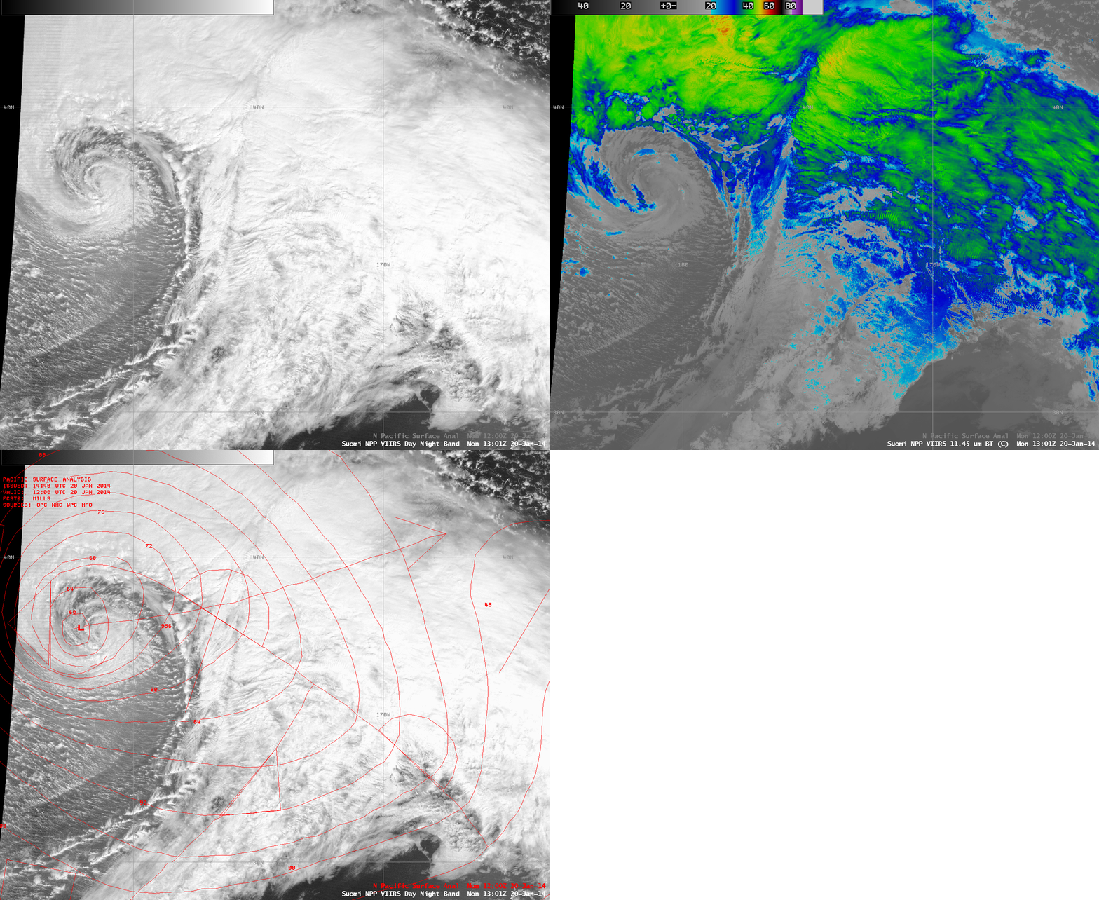
A comparison of AWIPS images of 1-km resolution Suomi NPP VIIRS 0.7 µm Day/Night Band and 11.45 µm IR channel data (below) revealed the tightly-wrapped center of circulation at 13:01 UTC on 20 January. Intricate mesoscale banding structures could also be seen within portions of the warm conveyor belt southeast and east of the storm center (which was analyzed to have a central pressure of 956 hPa).
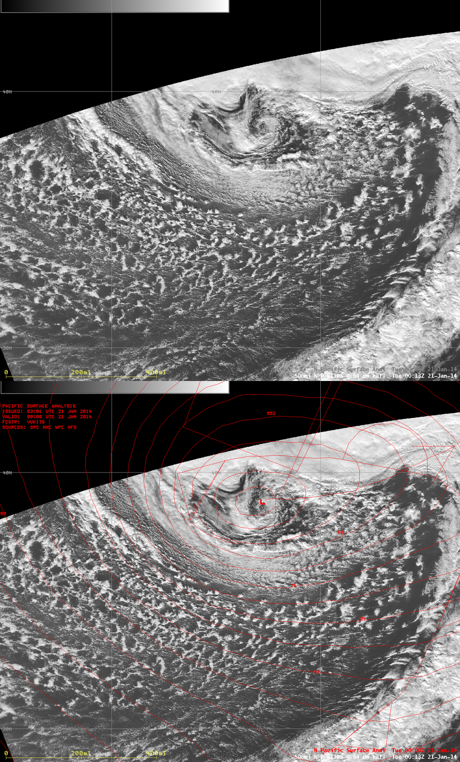
A Suomi NPP VIIRS 0.64 µm visible channel image (below) showed a small but well-defined comma-shaped cloud feature marking the center of the storm at 00:13 UTC on 21 January (which was analyzed to have a central pressure of 952 hPa).
A Suomi NPP VIIRS 0.64 µm visible channel image at 23:54 UTC on 21 January (below) depicted the band of clouds associated with the 950 hPa cyclone’s cold front as it approached the northwestern portion of the Hawaiian Island chain. A narrow “rope cloud” marked the leading edge of the cold frontal boundary.
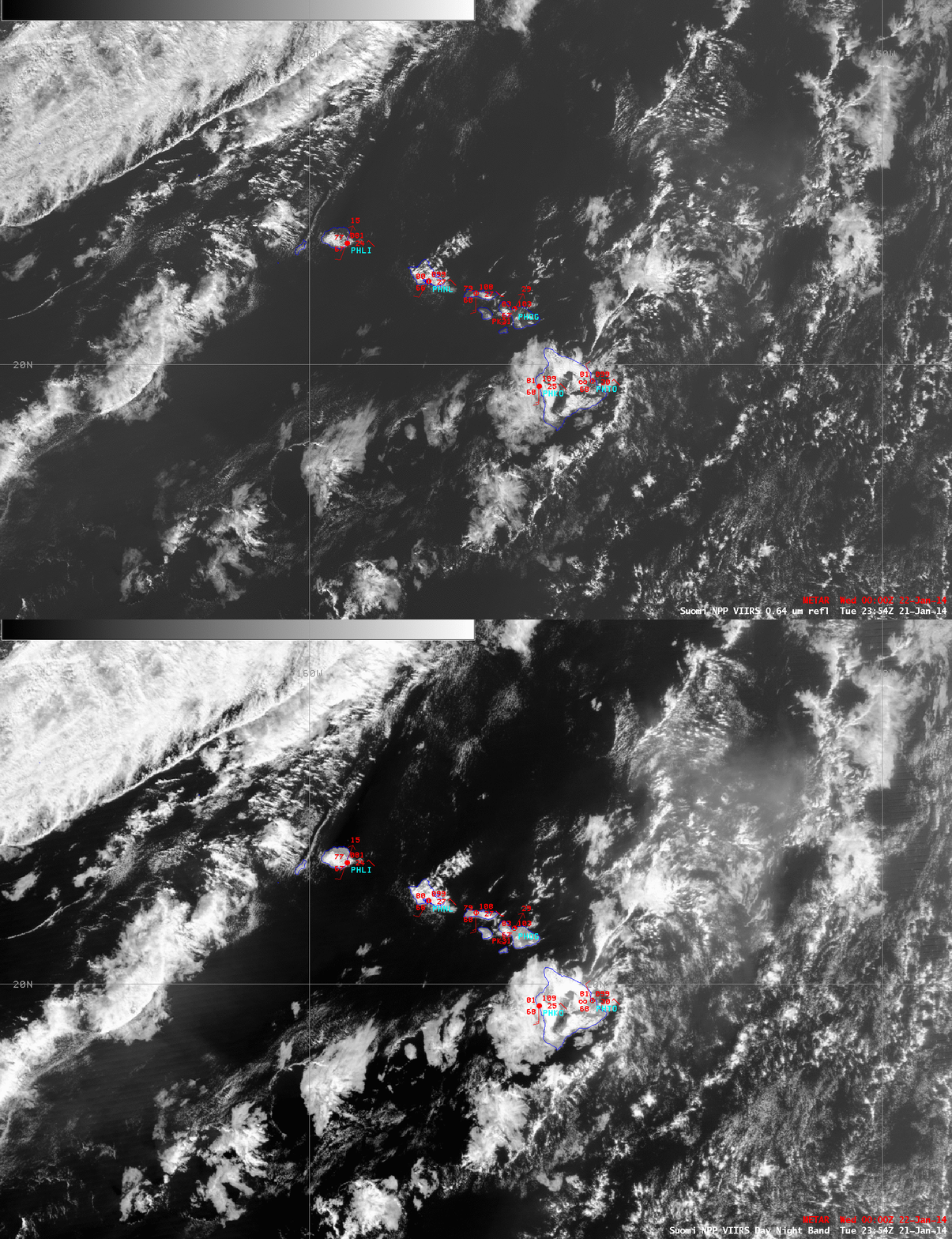
In a closer view centered over the Hawaiian Islands at 23:54 UTC on 21 January (below), a hazy “vog” plume (from the active Kilauea volcano on the Big Island) could be seen blowing northeastward ahead of the approaching cold front. Note how the areal coverage of the vog plume shows up better in the broadband 0.7 µm Day/Night Band image compared to the 0.64 µm visible channel image with its more narrow spectral width.
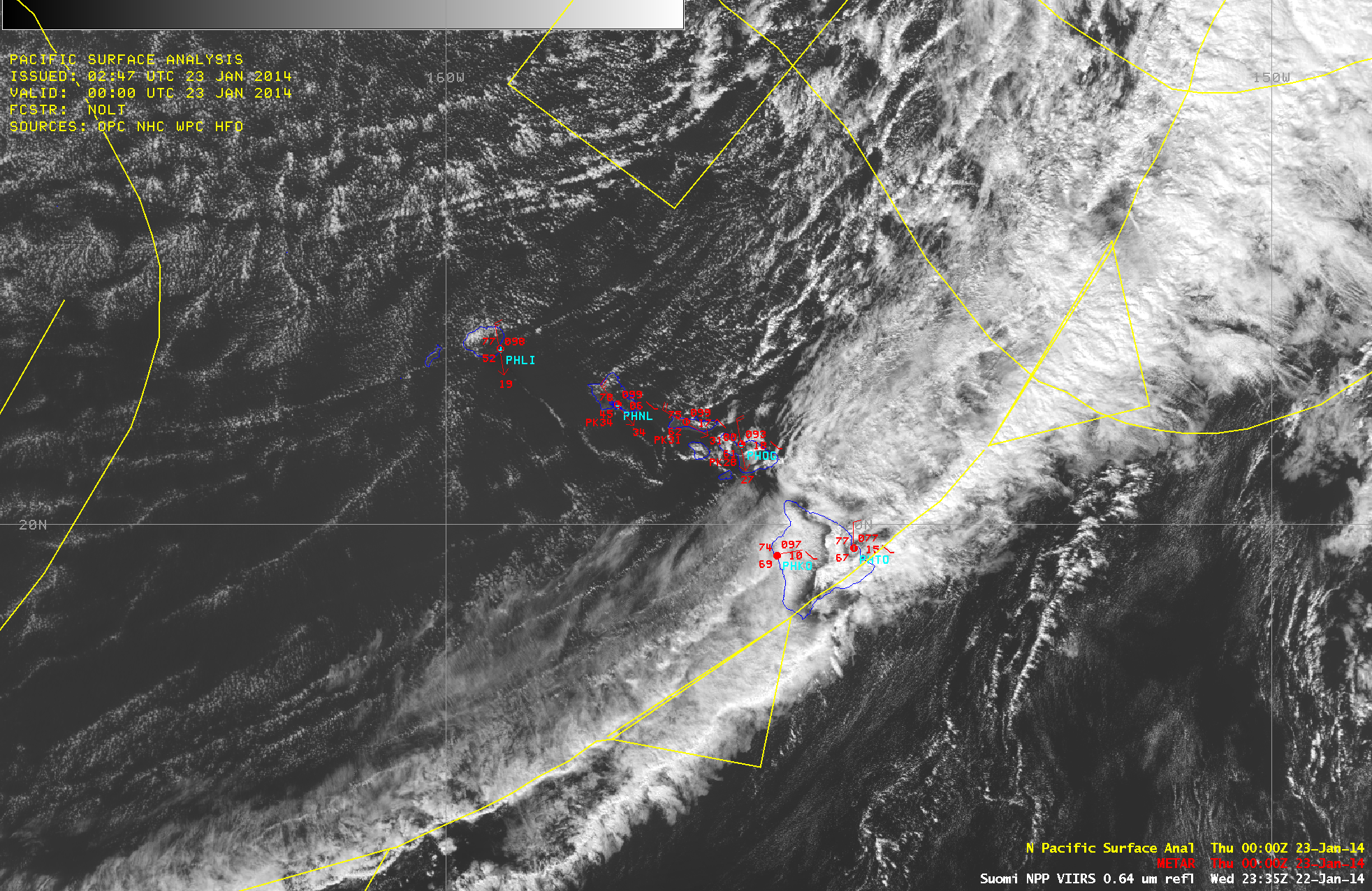
Finally, a Suomi NPP VIIRS 0.64 µm visible channel image at 23:35 UTC on 22 January (below) showed the cold frontal band as the leading edge was about to move southeast of the Big Island of Hawaii. Note that Honolulu (PHNL) had a temperature/dewpoint of 78ºF/45ºF, with northwesterly winds gusting to 34 knots at 00 UTC. Wind speeds on the summits of the Big Island of Hawaii were sustained hurricane force, with gusts to near 100 mph. The strong winds also caused a giant northwesterly ocean swell, with significant wave heights as high as 31 feet at Buoy 51101 (located 91 miles northwest of Kauai). There was also a notable air temperature drop at Buoy 51101 as the cold front passed, with a peak wind gust of 39 knots.
GOES-15 0.63 µm visible channel images (below; click image to play animation) showed the cold front as it was passing through the Hawaiian Island chain on 22 January. A few areas of orographic wave clouds could be seen as the strong northwesterly winds in the wake of the cold front interacted with the topography of the islands.


