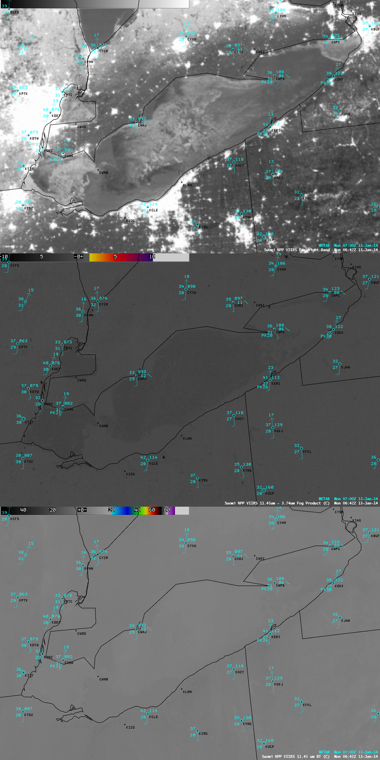
VIIRS Day/Night Band images: ice in Lake Erie, and thunderstorms over the Gulf of Mexico

Suomi NPP VIIRS 0.7 µm Day/ight Band, 11.45-3.74 µm “fog/stratus product”, and 11.45 µm IR channel images
With ample illumination by moonlight (the Moon was in the Waxing Gibbous phase, at 98% of full), an AWIPS image of Suomi NPP VIIRS 0.7 µm Day/Night Band data was able to provide a “visible image at night” that showed the extensive ice coverage in Lake Erie at 06:42 UTC or 1:42 AM local time on 13 January 2014 (above). The mean ice concentration of Lake Erie was 76.8% at that time (up from less than 20% at the begining of January). Note that there was no signal of any potential fog/stratus over the lake on the corresponding 11.45-3.74 µm IR brightness temperature difference “fog/stratus product”, and very little thermal contrast seen in the 11.45 µm IR image.
Farther to the south over the Gulf of Mexico, the 08:21 UTC or 2:21 AM local time VIIRS 0.7 µm Day/Night Band image (below) showed large thunderstorms, with cloud-top shadowing from overshooting tops as well as a few bright “lightning streaks” due to cloud illumination by intense lightning activity at the time the instrument was scanning the region. Overlays of cumulative 1-hour cloud-to-ground lightning strikes indicated over 2400 strikes ending at 08 UTC, and over 1800 strikes ending at 09 UTC over the area of the satellite scene. A comparison with the corresponding 11.45 µm IR image showed that the coldest cloud-top IR brightness temperatures were -65º C over the northern convective complex, and -73º C over the southern convective complex.

Suomi NPP VIIRS 11.45 µm IR channel, 0.7 µm Day/Night Band, and 1-hour cloud-to-ground lightning strikes

