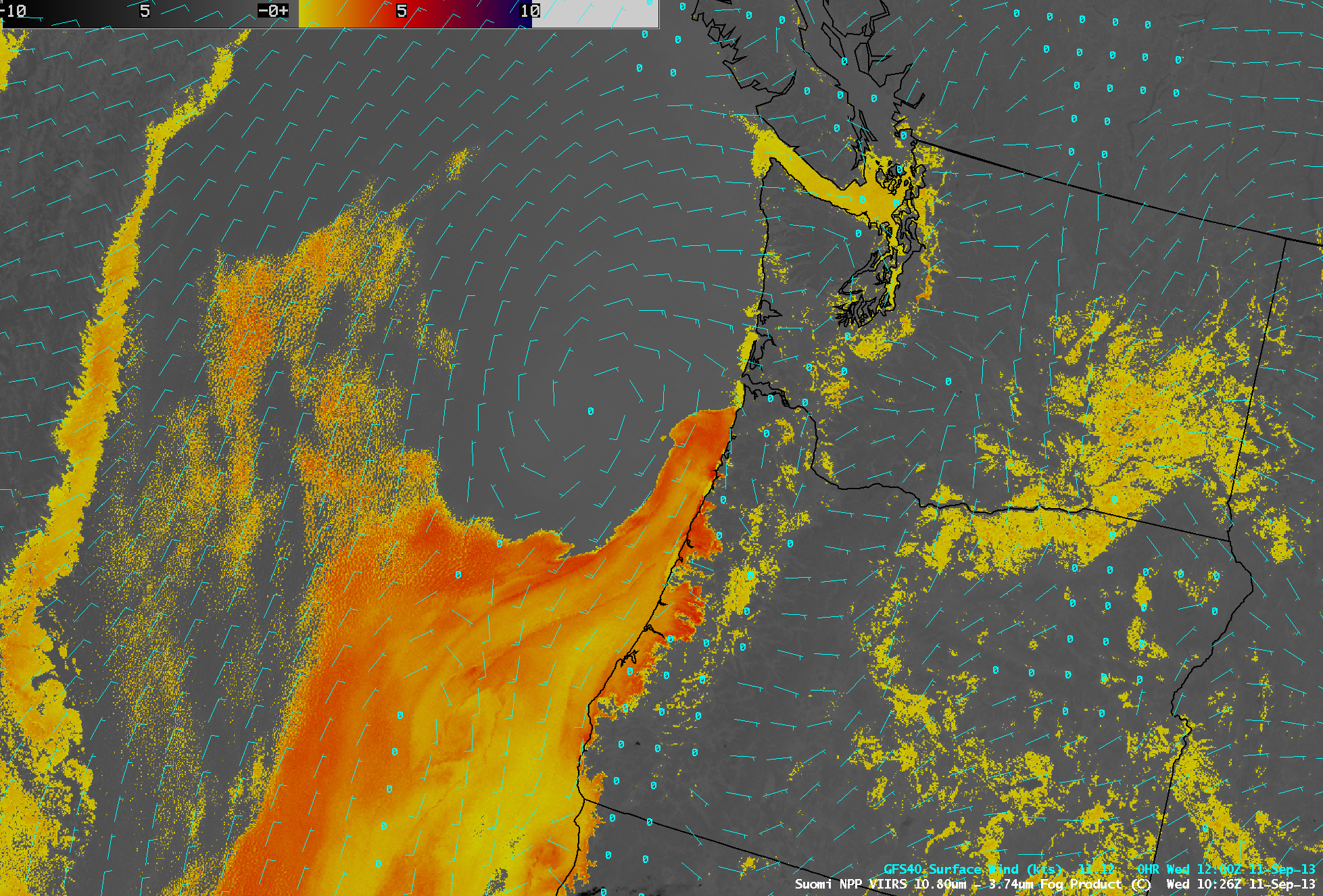
Northward advection of stratus along the Oregon and Washington coasts
An AWIPS image of the Suomi NPP VIIRS 11.45 – 3.74 µm IR brightness temperature difference “fog/stratus product” at 10:26 UTC or 2:26 AM local time on 11 September 2013 (above) revealed a relatively narrow tongue of stratus cloud (darker orange to red color enhancement) which was beginning to move northward along the nearshore coastal waters of Oregon. The northward stratus advection was being driven by the presence of an elongated trough of low pressure off the West Coast of the US, with some embedded closed low circulations along the trough axis.
During the subsequent daylight hours, McIDAS images of GOES-15 0.63 µm visible channel data (below; click image to play animation) showed the continued northward and northwestward spread of the plume of stratus cloud along and just off the coast of Washington, with some inland intrusions of marine stratus noted later in the day. One of the aforementioned closed cyclonic circulations (which was not well-analyzed by the GFS40 model surface winds on the VIIRS image above) could be seen within the marine boundary layer stratus off the coast of Oregon. Other features of interest included the dispersion of smoke plumes from 2 small wildfires that were burning in southwestern Oregon. Meteorological fun fact: on this day, for the Lower 48 states both the daily lowest temperature (22º F at Silver Lake) and the daily highest temperature (102º F at Medford) occurred in the state of Oregon!


