Snow cover across parts of northern Minnesota and southern Ontario
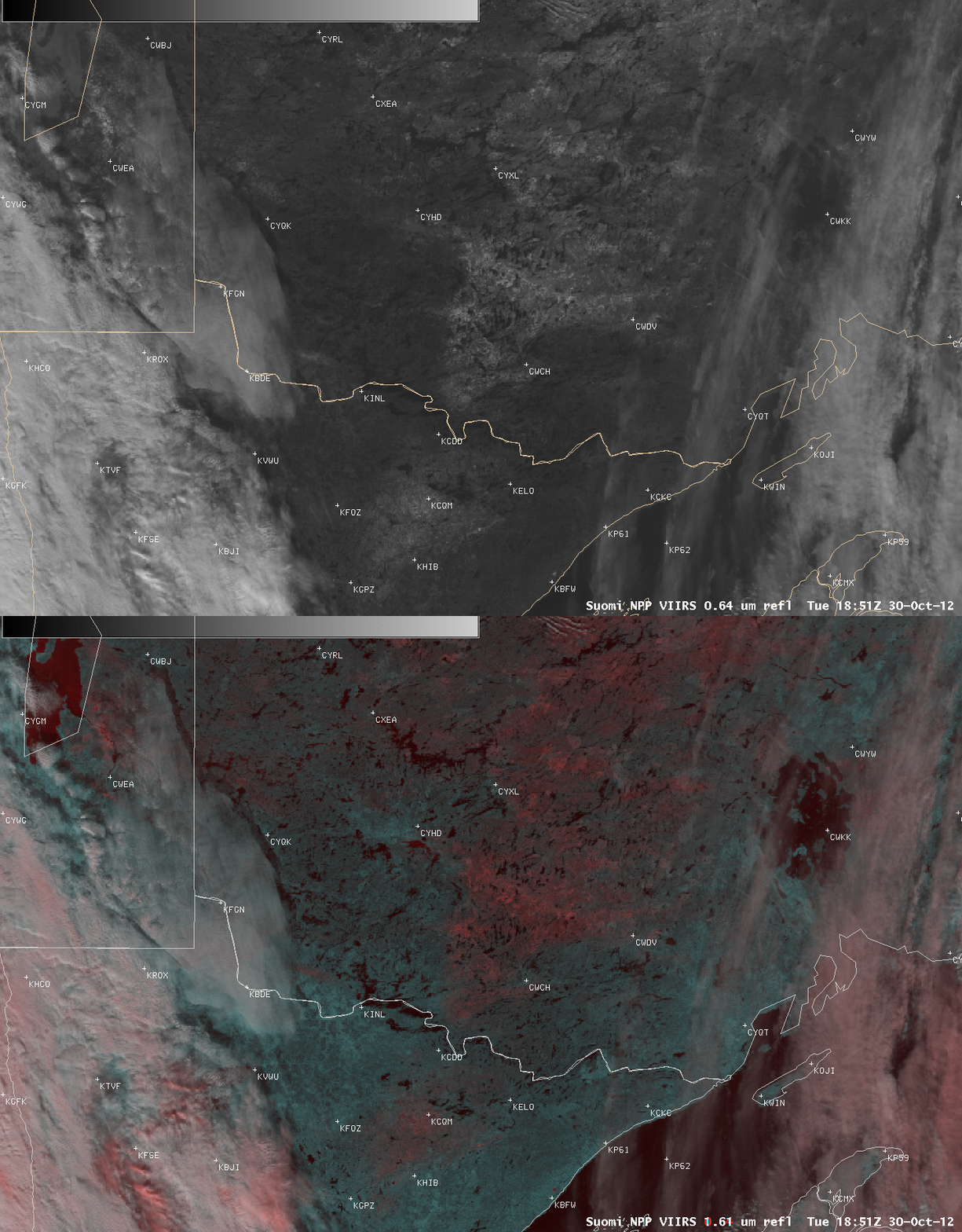
A comparison of AWIPS images of 1-km resolution Suomi NPP VIIRS 0.64 µm visible channel and false-color Red/Green/Blue (RGB) images (above) showed areas of light snow cover across parts of northern Minnesota and southern Ontario on 30 October 2012. The RGB image was created by using the 0.64 µm visible image as the Red component, and the 1.61 µm “snow/ice channel” image as the Green and Blue components of the image. Snow on the ground appears brighter white on the visible image, and lighter shades of red on the corresponding RGB image. This snow cover resulted from a series of weak disturbances that had moved across the region several days earlier, which produced as much as 4 inches of snow at some locations.
It is also possible to determine which lakes in the area have frozen over — for example, the shallow Lake Wabigoon just south of Dryden, Ontario (station identifier CYHD) and the larger Lake Winnipeg (east of Gimli, station identifier CYGM) appear darker red on the RGB image and light gray on the visible image.
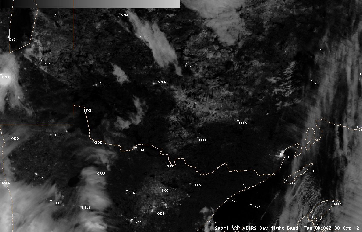
During the previous night, a Suomi NPP VIIRS 0.7 µm Day/Night Band image at 09:08 UTC or 4:08 AM local time (below) provided a “visible image at night” that allowed the areas of snow cover to be seen due to illumination by a full Moon.


