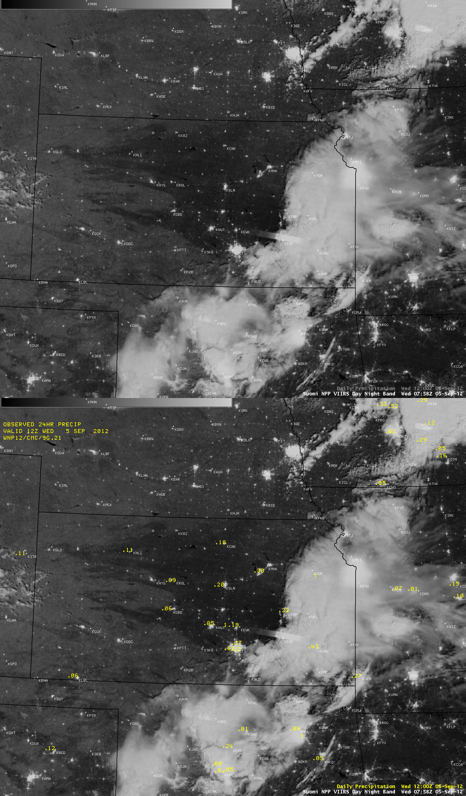
Wet ground as seen using the VIIRS Day/Night Band
An AWIPS image of the Suomi NPP VIIRS 0.7 µm Day/Night Band (above) showed a night-time view of large swaths of wet ground across much of Kansas at 07:58 UTC (2:58 AM local time) on 05 September 2012. Many parts of central Kansas received significant rainfall as thunderstorms moved eastward across the state; five sites reported over 1 inch of precipitation, with as much as 1.90 inches falling near Potwin. In southeastern Kansas, also note the bright southeast-to-northwest oriented “streak” — a signature of lightning illuminating the cloud top as the VIIRS instrument was scanning that area.
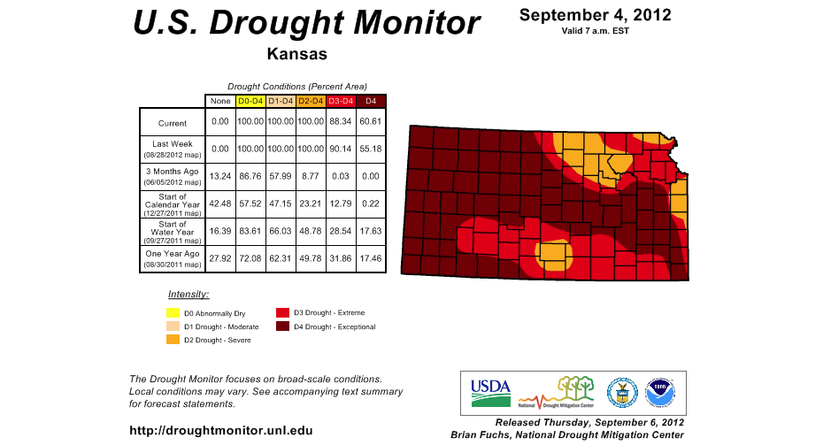
Many areas of Kansas had been experiencing extreme to exceptional drought (below). Since the moon was in the Waning Gibbous phase, moonlight from 75% of the disk was able to provide sufficient illumination to reveal the darker rain-soaked ground surfaces, which stood out in contrast to the surrounding dry ground across the state.


