Using NUCAPS profiles in lieu of missing upper air soundings
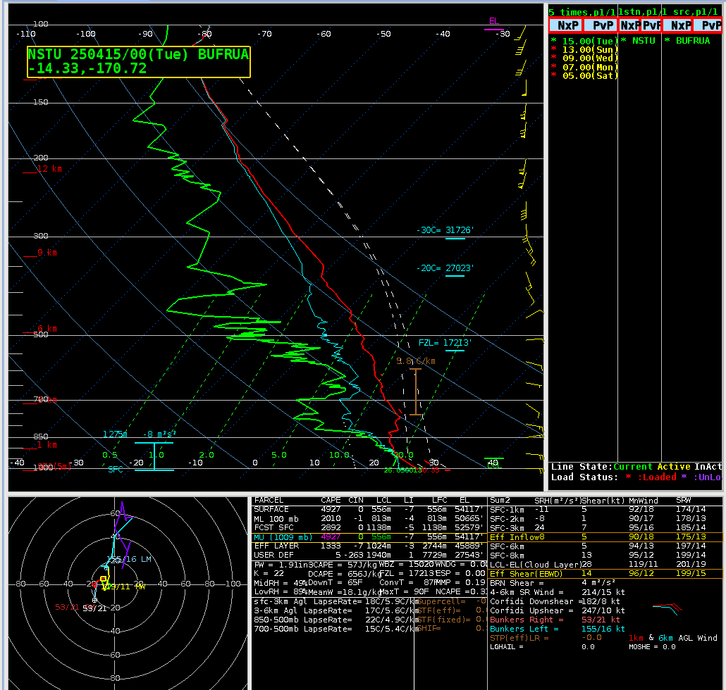
Instrument issues at the weather station in Pago Pago (related to Hydrogen generation) means that balloon launches occur only once every other day, at 0000 UTC on odd days. The sounding for 15 April/0000 UTC (1 PM Samoa Standard time on 14 April) is shown below.
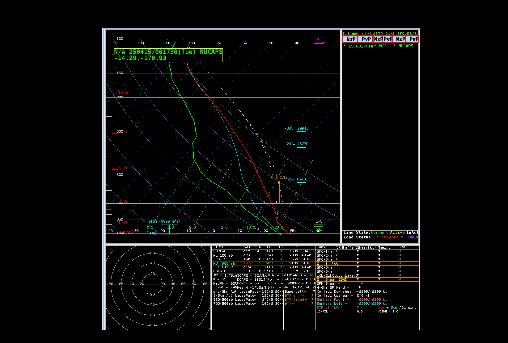
Two different JPSS satellites overflew the Samoan Islands just after 0000 UTC on 15 April 2025, and two profiles were created just west of Tutuila, as shown below.
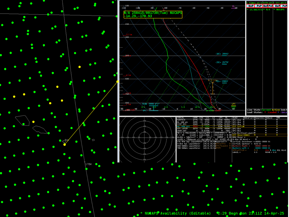
The toggle below compares the two NUCAPS soundings shown in the image above to the 0000 UTC rawinsonde from Pago Pago. There is, overall, agreement, although (of course), the NUCAPS soundings are very much smoother.
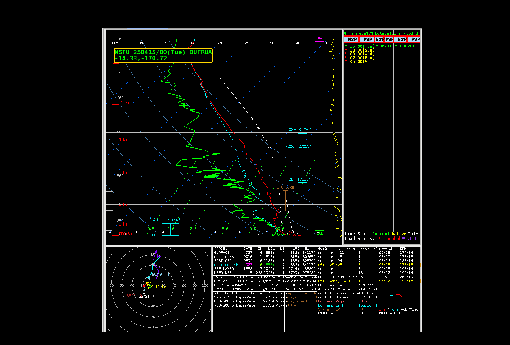
At 1200 UTC, no rawinsonde was launched. But NUCAPS profiles were available at around 1200 and 1300 UTC as shown in the animations below.
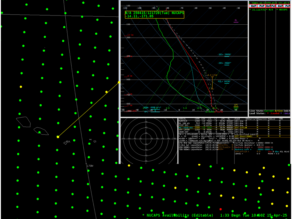
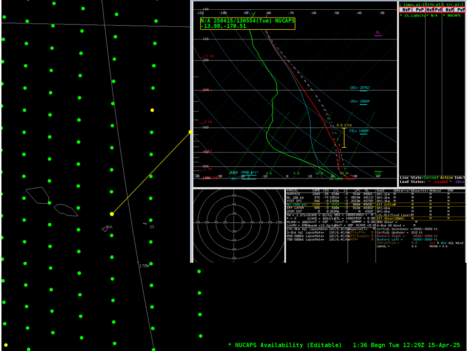
If you compare the 0000 UTC NUCAPS profiles to those sensed around 1200-1300 UTC, what changes do you see, and how might those changes have been sensed by a rawinsonde if it had been launched. The later profiles all show dryer conditions at mid-latitudes (precipitable water values have dropped by about 0.4″). Temperatures above 700 mb are very similar in the two profiles, but the later profile is a bit cooler between the surface and 850 mb
The information change in the 12h between NUCAPS profiles (note also that there was a NUCAPS profile at around 0900 UTC!) can help you decide what a full-resolution sounding (made by a radiosonde) might have looked like.