Cold/dry arctic air mass over central South Dakota (with some lake effect snow)
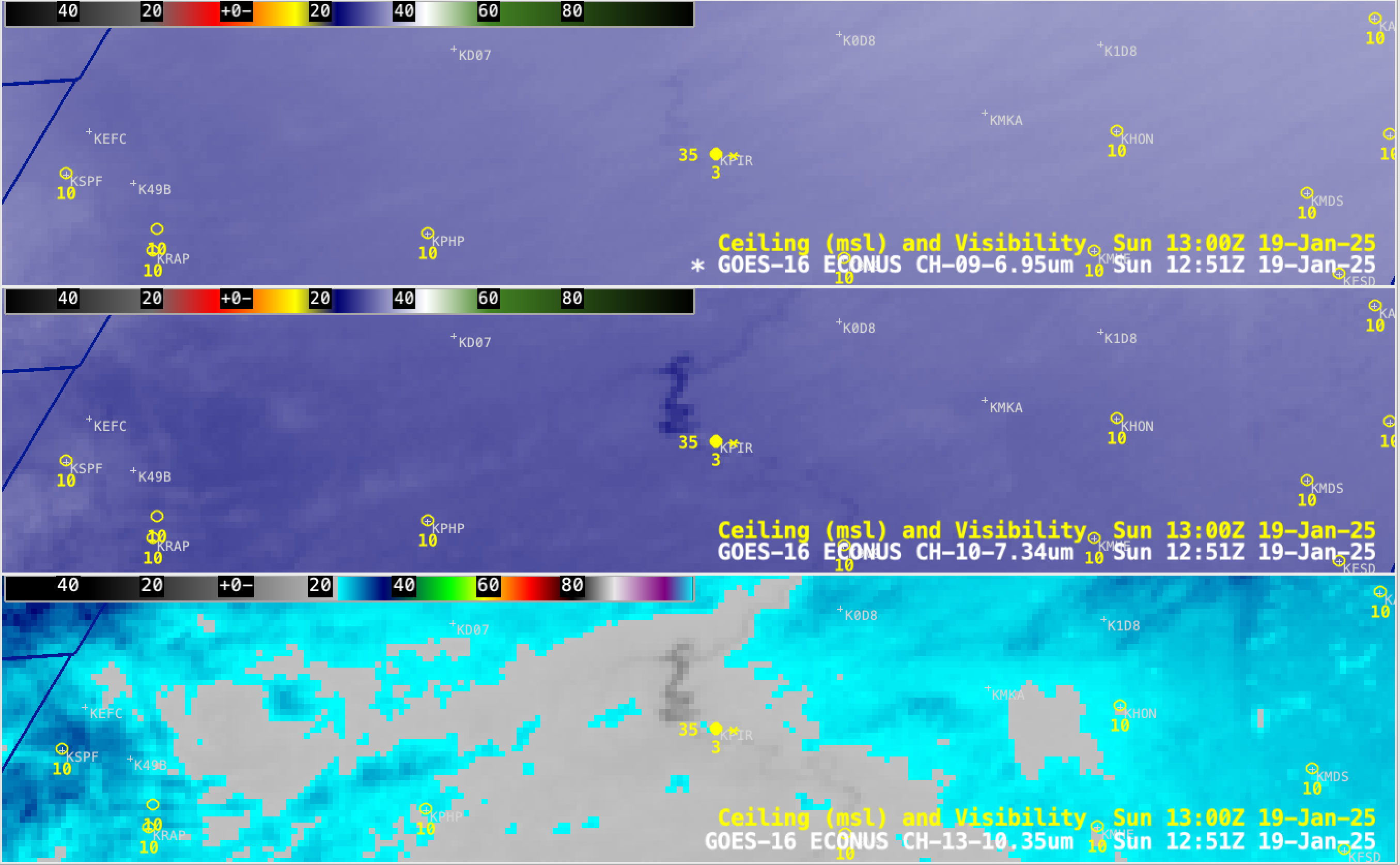
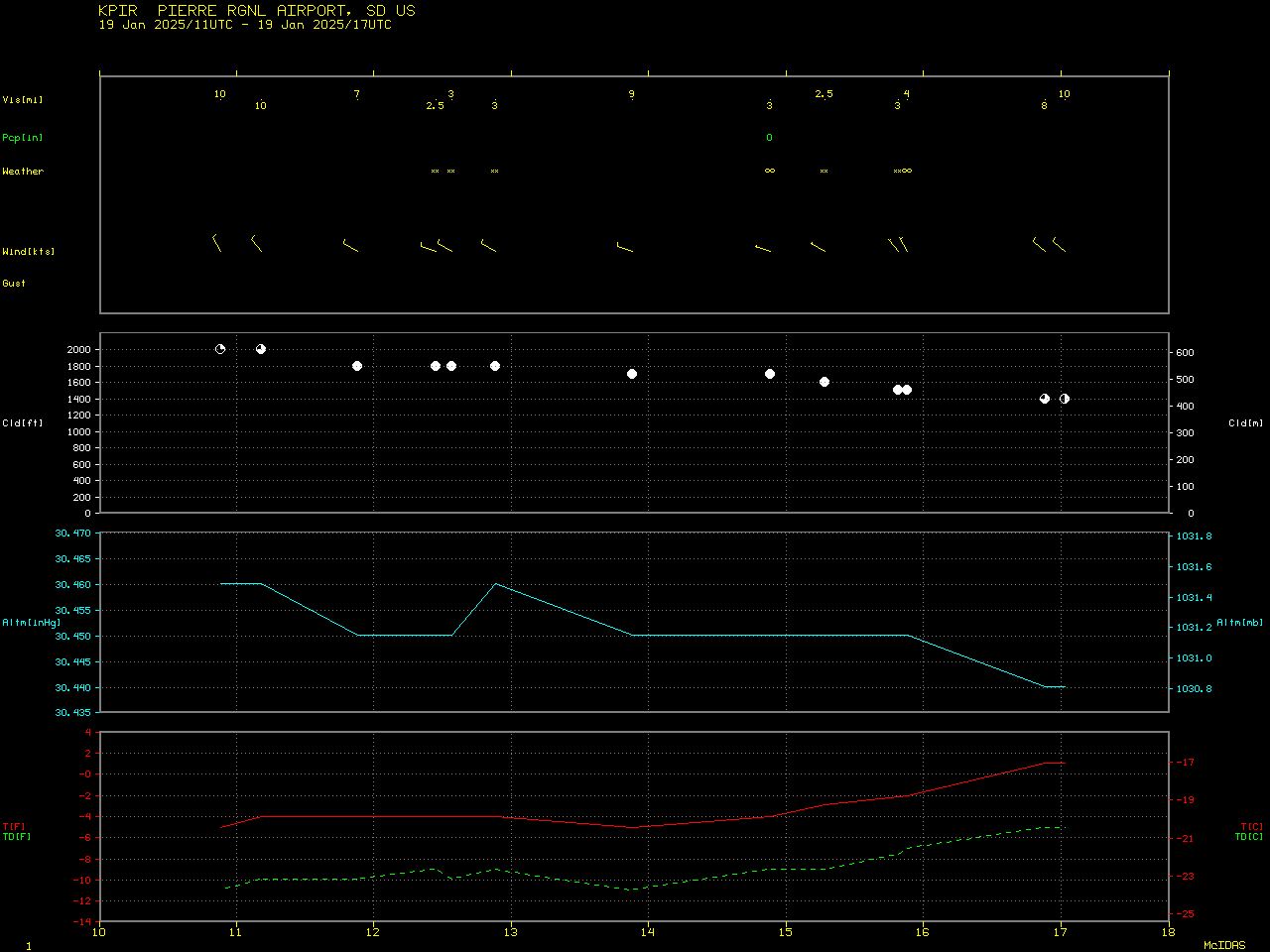
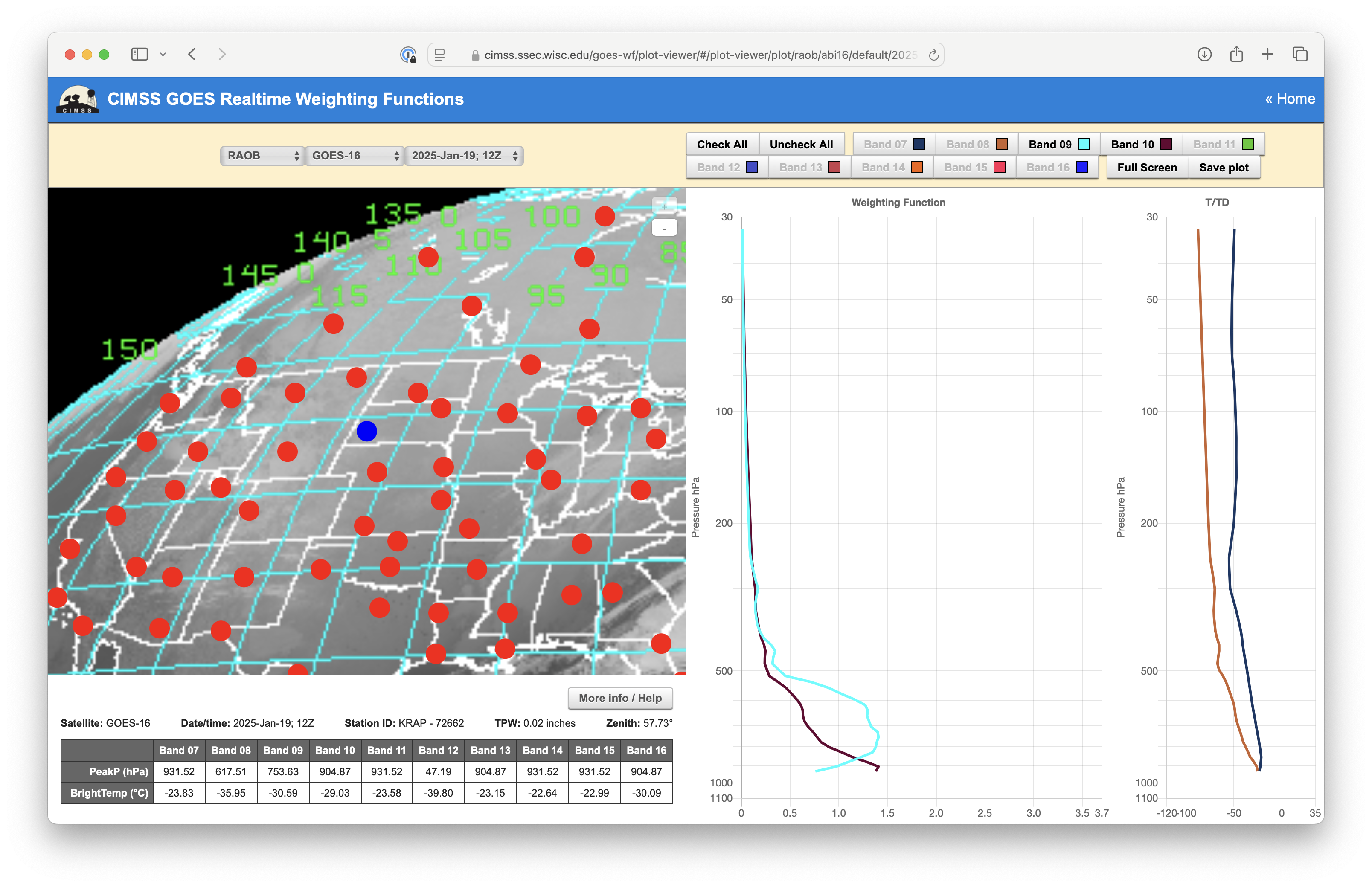
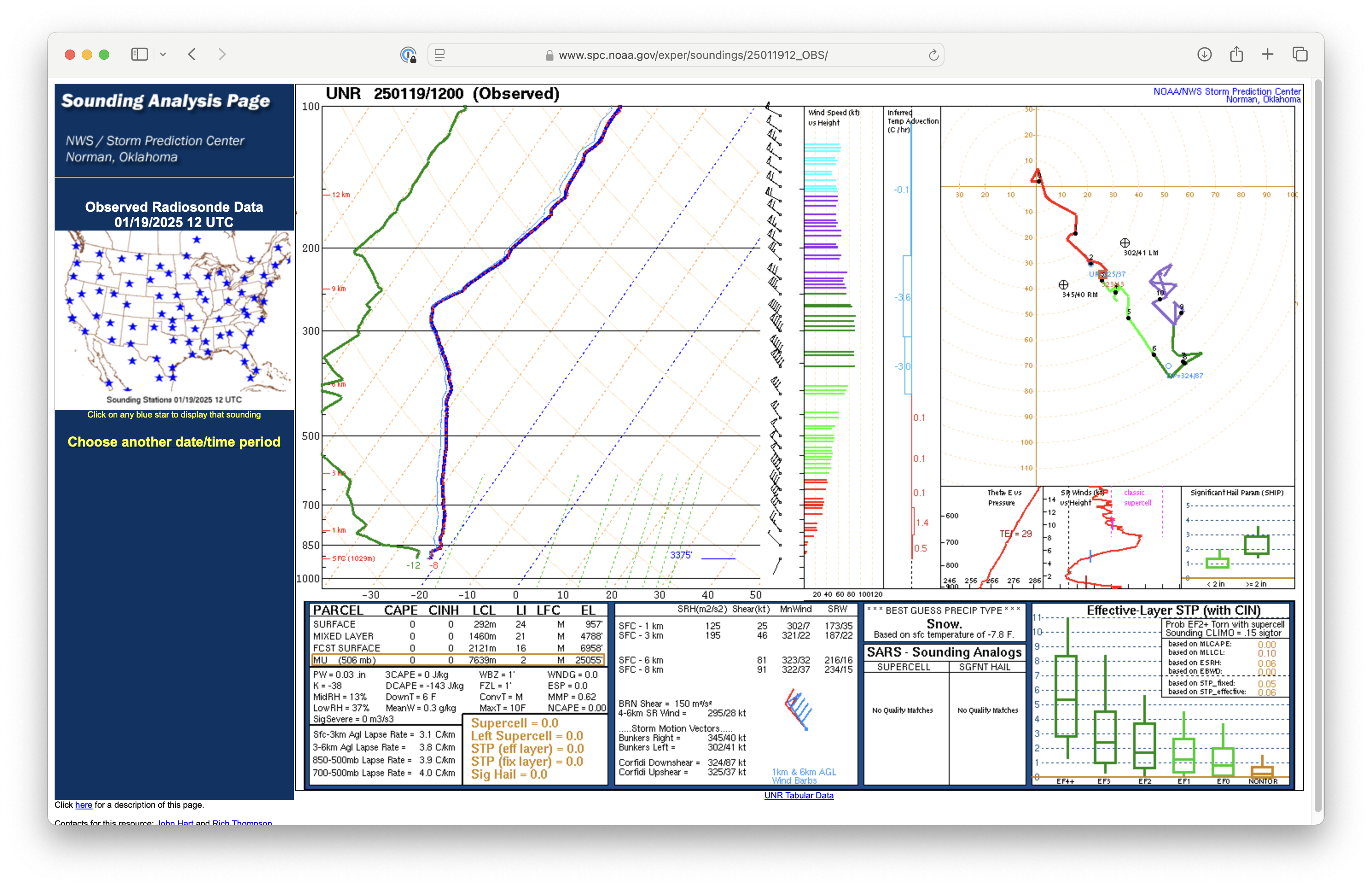
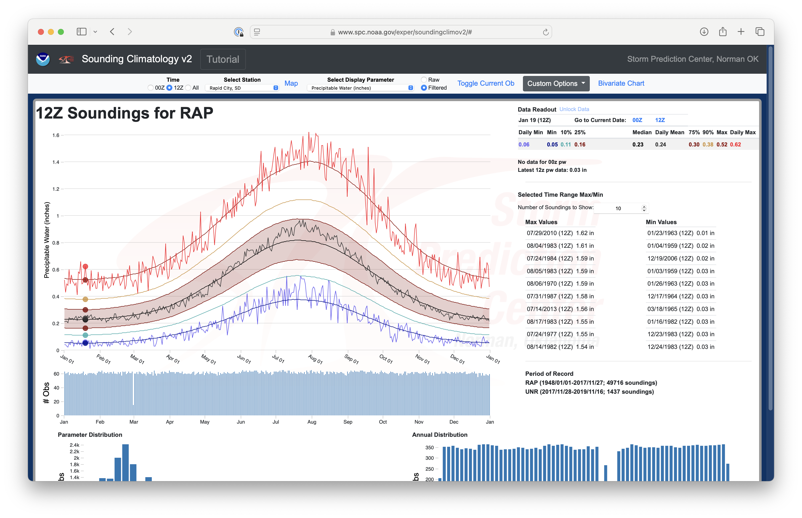
Thermal signatures of the still-unfrozen water of Lake Oahe reservoir (along the Missouri River, in central South Dakota) were evident in GOES-16 (GOES-East) Infrared, Low-level Water Vapor and Mid-level Water Vapor images on 19th January 2025 (above). As a result of cold arctic air flowing across the open water of Lake Oahe, there were also 2 brief periods of light lake effect snow at Pierre (KPIR), each which reduced the surface visibility to 2.5 miles (below). With a cold/dry arctic air mass over the region, the GOES-16 Mid-level Water Vapor (Band 09) and Low-level Water Vapor (Band 10) weighting functions peaked at lower than normal altitudes (below) — with significant amounts of radiation from the surface reaching the satellite detectors (thereby enabling a signature of Lake Oahe in the Water Vapor imagery).In fact, the Total Precipitable Water value derived from 1200 UTC Rapid City rawinsonde data (0.03 in) (above) was a record low value for 1200 UTC soundings on 19 January (below).