Milton approaches Florida

GOES-16 Infrared Imagery overnight on the 9th of October shows the evolution of Milton as it moves towards landfall over southwestern Florida. Of note is the disappearance of a pronounced eye. Lightning continues within the eye, however, as shown by the GLM overlay below, and deep convection (black/grey in the enhancement applied) continues to develop and wrap around the eye. Satellite estimates of strength (ADT, for example, from here) continue to show a very strong system.

Derived Motion Wind vectors from GOES-16, shown below on top of an Upper Level Water Vapor image at 1201 UTC, show the excellent outflow that is helping to ventilate Milton. There is very strong outflow above 350 mb to the northeast over Florida and the southeastern United States, and a second outflow channel above 250 mb to the west-southwest over the Yucatan and into the Pacific Ocean. The Water Vapor imagery also shows mid-level drying over the western Gulf of Mexico; perhaps some of that dry air is being entrained into the western edges of Milton, but at sunrise, any weakening due to dry air is subtle at best.

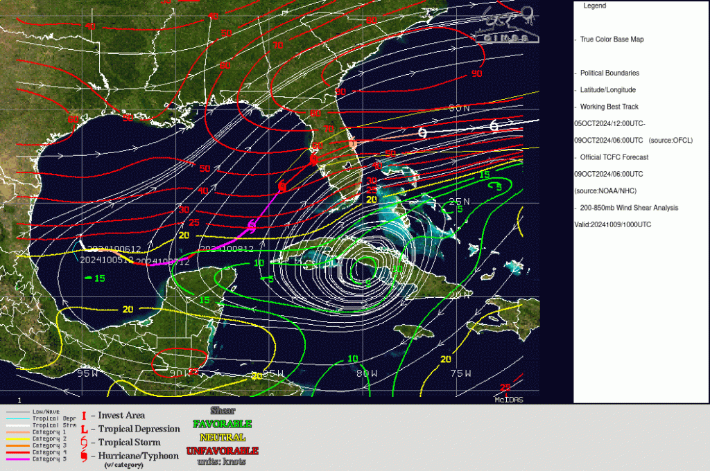
The very strong outflow — a positive for the strength of the storm — also means that Milton is now in an environment of significant vertical wind shear. That is shown in the shear analysis below from the CIMSS Tropical Website.

Both mesoscale sectors for GOES-16 are over Milton as of 1200 UTC on 9 October, meaning 30-second imagery is being produced. The 15-minute animation below was retrieved from the CSPP Geosphere site.
The National Hurricane Center has the latest information on this storm (link). Heavy Rain is overspreading southwest Florida on 9 October in advance of Milton. Conditions will continue to deteriorate during the day.

