MetopC and NOAA-20 NUCAPS Profiles in a Moderate Risk

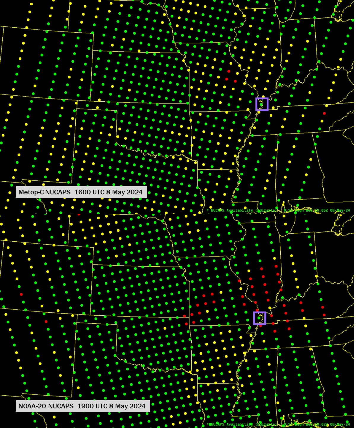
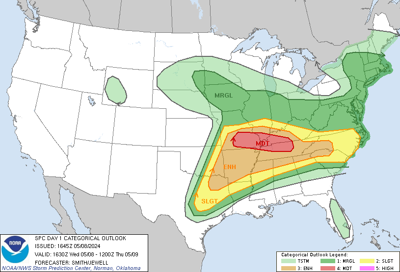
The Storm Prediction Center in Norman OK issued a Moderate Risk of severe weather over the lower Ohio River Valley/mid-Mississippi River Valley on 8 May 2024, as shown below. (Here are the storm reports for that day). The orbits for MetopC and NOAA-20 on the 8th sampled the region well, as shown in the toggle above of NUCAPS Sounding Availability with timestamps of 1605 UTC (Metop-C) and 1902 UTC (NOAA-20). Note the purple box in the toggle. Both MetopC NUCAPS and NOAA-20 NUCAPS retrievals at that location converged to a solution. How might the thermodynamic information within just those two profiles help?

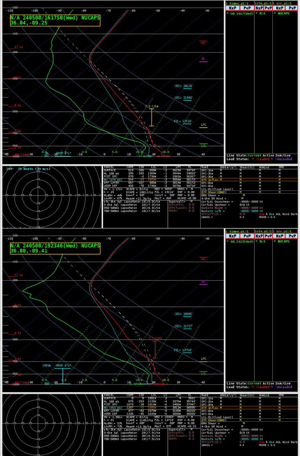
The toggle below compares the MetopC NUCAPS and NOAA-20 NUCAPS profiles within the purple box in the toggle at the top of this blog post. The atmosphere at this location destabilizes in these three hours: diagnosed MUCAPE has more than doubled, mid-level lapse rates have steepened, the LFC has dropped, total precipitable water has increased. These indicators (derived from satellite-sensed radiances) all suggest that development of strong convection might proceed.

This blog post just shows you two profiles showing how a small volume of the atmosphere over southeastern Missouri is changing. Gridded thermodynanic fields derived from all the NUCAPS profiles are also available and are especially useful in diagnosing gradients and changes in stability over a large area.

