River valley fog in Wisconsin, Minnesota and Iowa
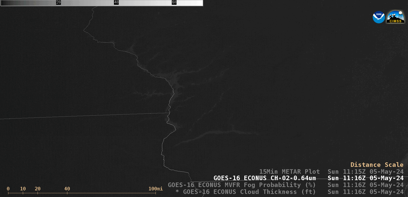
GOES-16 “Red” Visible (0.64 µm) images, with/without plots of 15-minute METAR surface reports [click to play animated GIF | MP4]
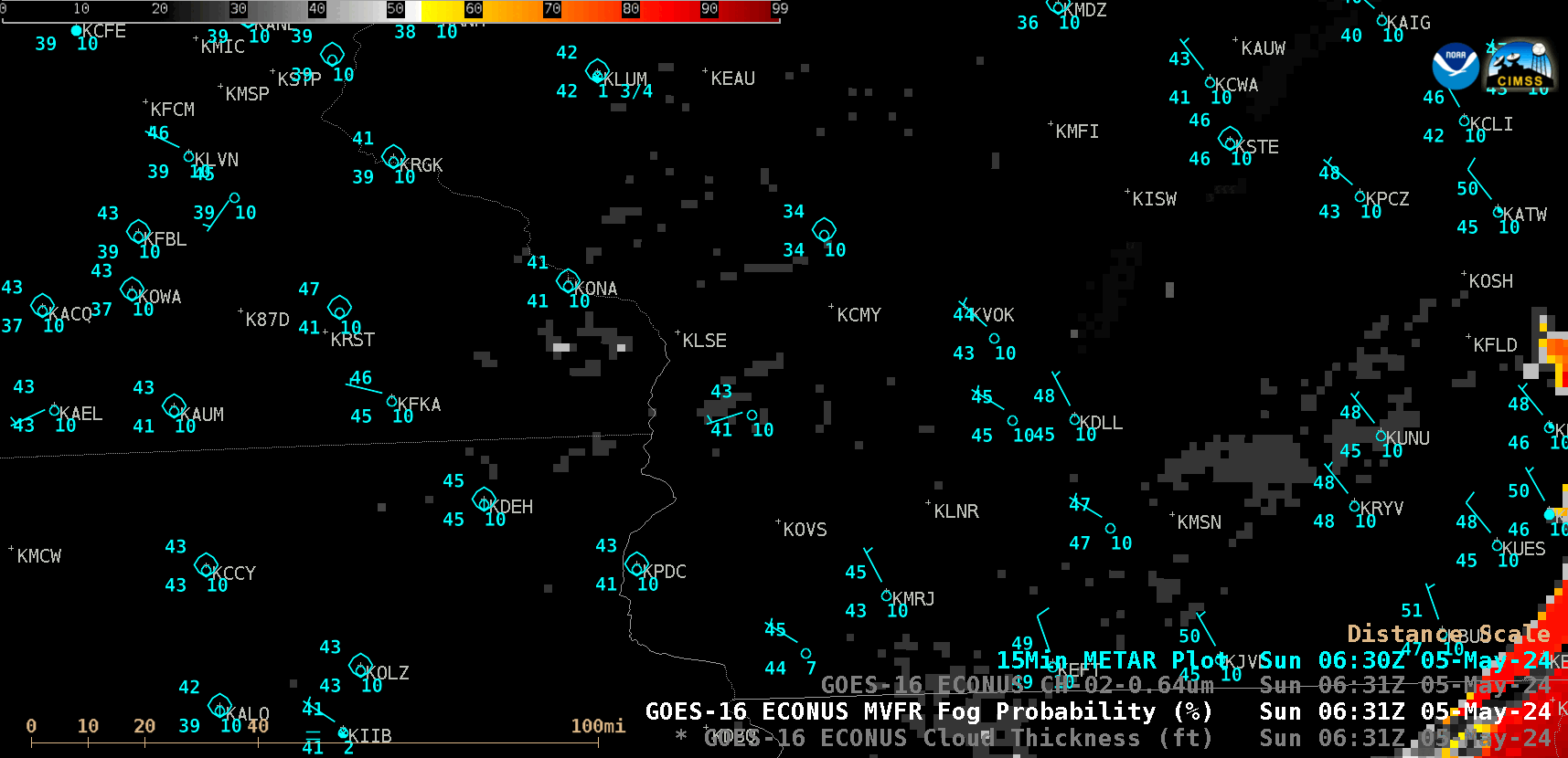
GOES-16 MVFR Fog Probability derived product, with plots of 15-minute METAR surface reports [click to play animated GIF | MP4]
The GOES-16 Low Cloud Thickness derived product (below) indicated that most of the fog and low stratus across the region was only 500-800 ft thick — with some of the more pronounced areas of river valley fog exhibiting values of 1000-1200 ft.
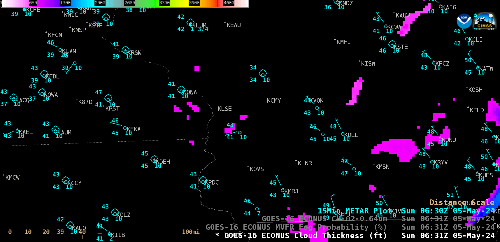
GOES-16 Low Cloud Thickness derived product, with plots of 15-minute METAR surface reports [click to play animated GIF | MP4]