VIIRS SSTs and Day Night Band imagery, late March 2024
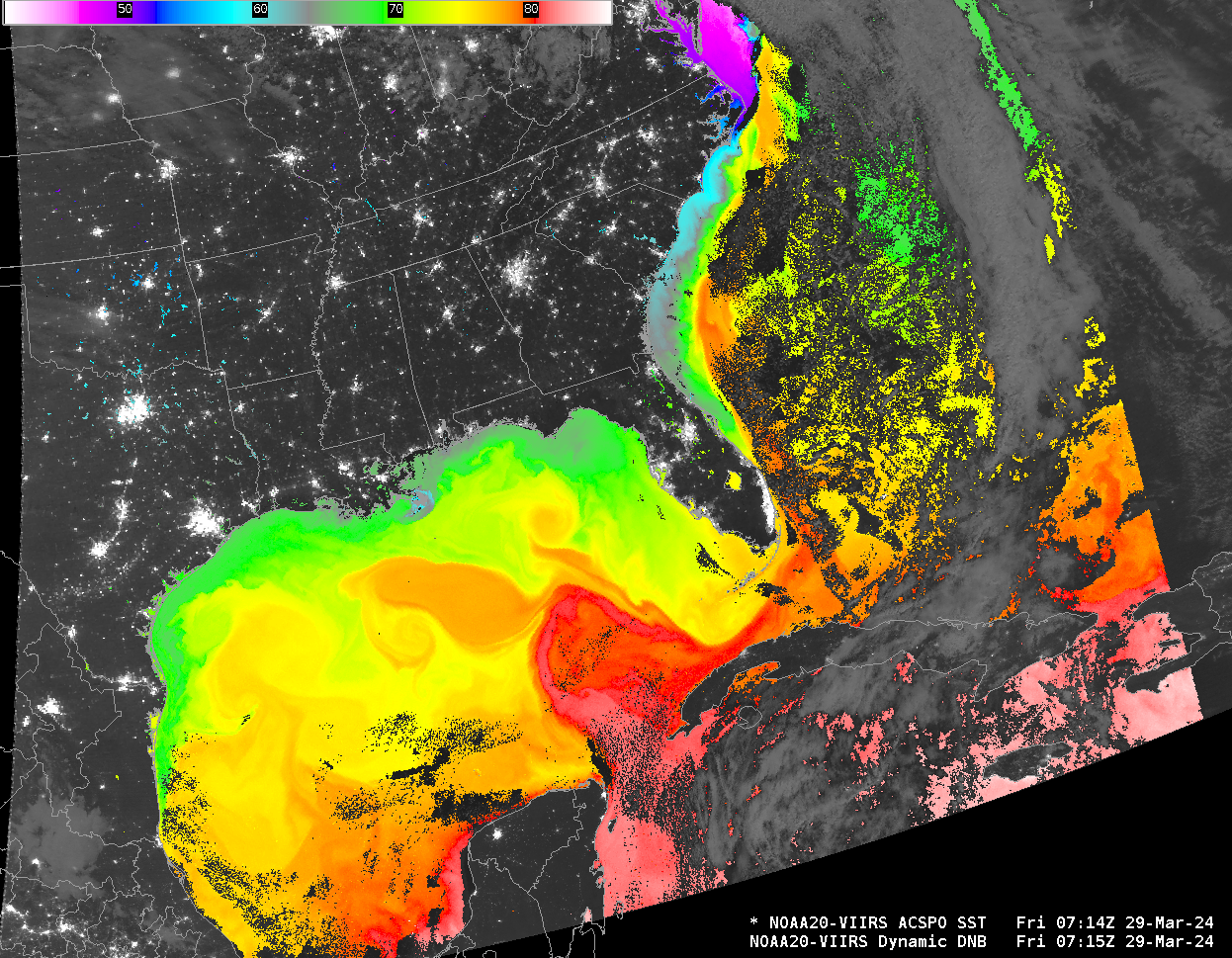
NOAA-20’s early morning orbit and clear skies allowed a distinct view of Sea Surface Temperatures over the Gulf of Mexico and the East Coast on 29 March 2024, as shown above (The data, derived from the CIMSS Direct Broadcast Antenna) are available via an LDM feed from CIMSS). The Loop Current in the Gulf of Mexico (with surface temperatures from 80-81oF) is obvious, as is the Gulf Stream along the East Coast.
How did the VIIRS Sea Surface Temperature values compare with co-located Fixed Buoy values? In the 3 examples below, the agreement was quite good — within 1ºF. Buoy SST values appear in the lower right corner of their station model plots.

Cursor sample of NOAA-20 VIIRS ACSPO Sea Surface Temperature at Buoy 42002 (courtesy Scott Bachmeier, CIMSS) [click to enlarge]
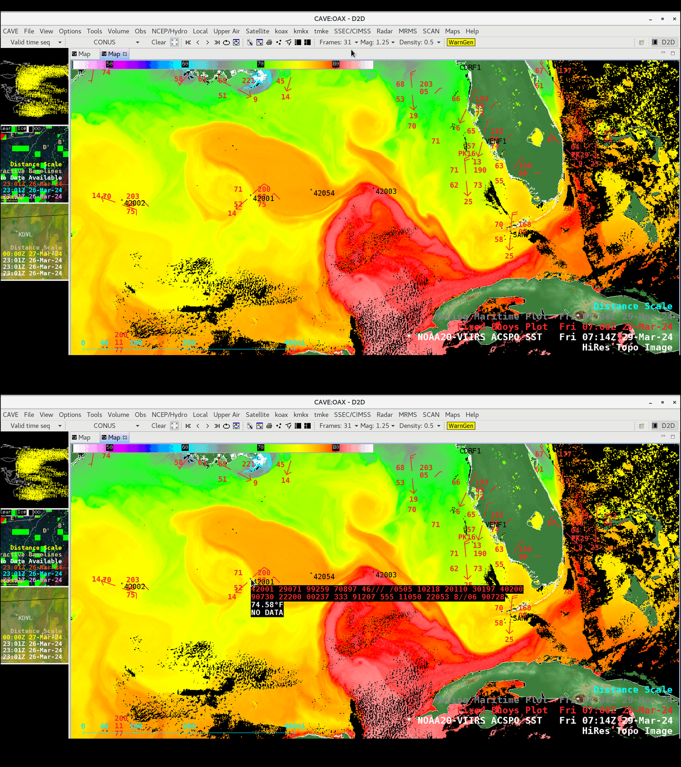
Cursor sample of NOAA-20 VIIRS ACSPO Sea Surface Temperature at Buoy 42001 (courtesy Scott Bachmeier, CIMSS) [click to enlarge]

Cursor sample of NOAA-20 VIIRS ACSPO Sea Surface Temperature at Buoy 42023 (courtesy Scott Bachmeier, CIMSS) [click to enlarge]
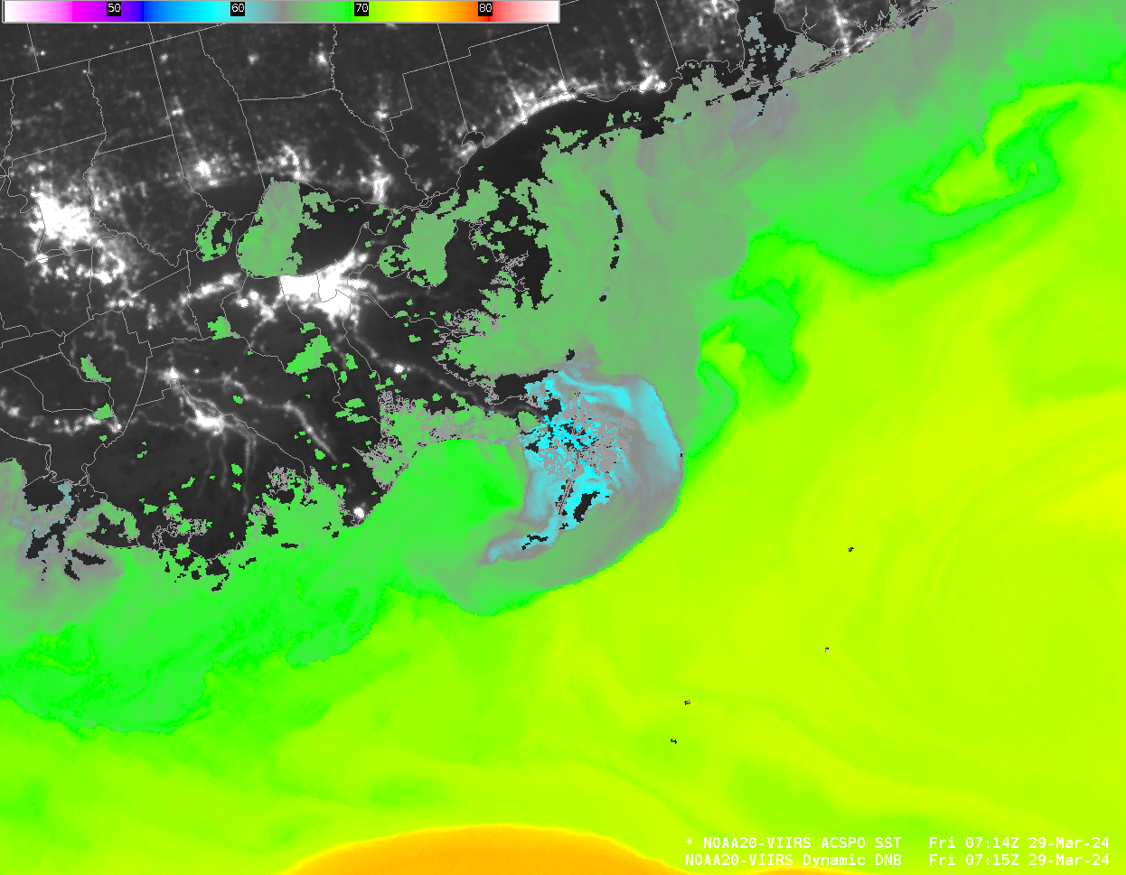
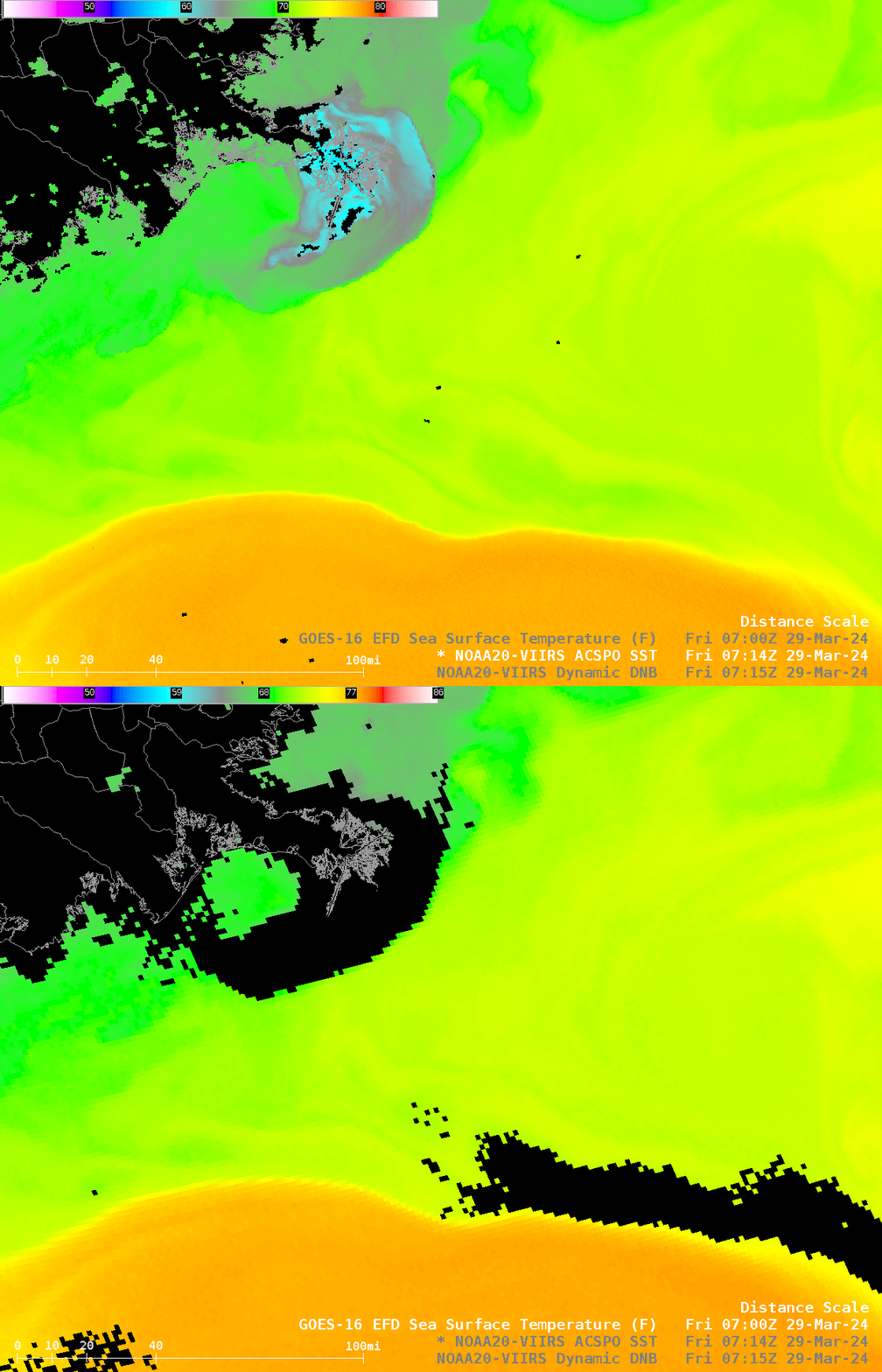
Two aspects (at least!) of this imagery bear mention. The Mississippi River delta (enlarged, below) is a source of cool water flowing into the Gulf. The cyan values are temperatures from 58-61oF vs low 70s oF (in yellow) just offshore.
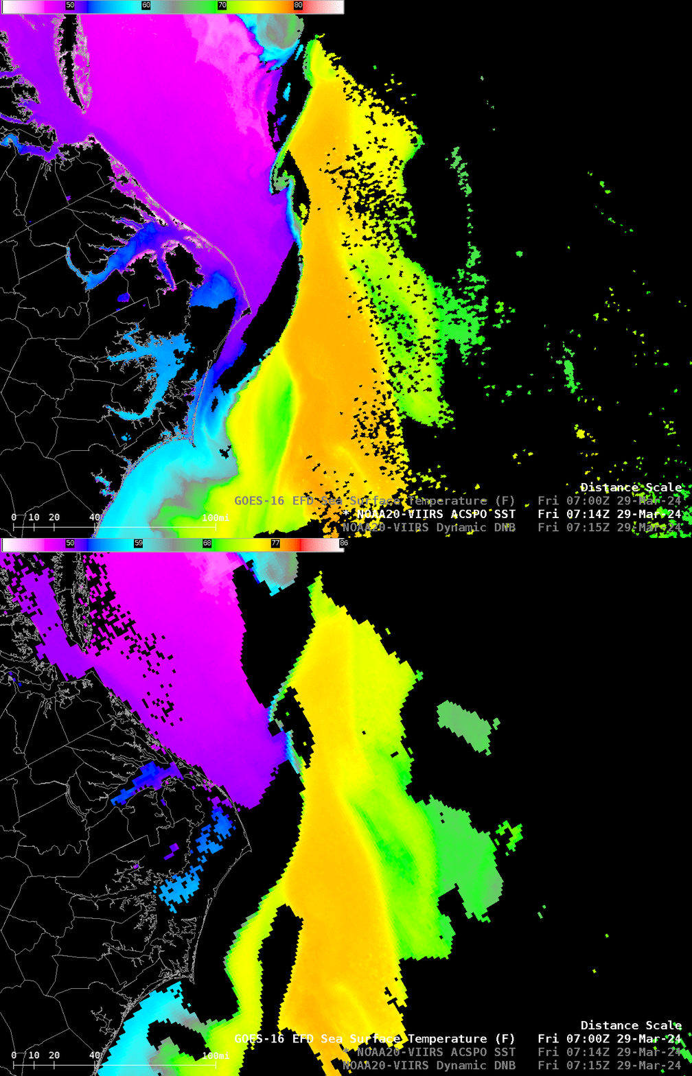
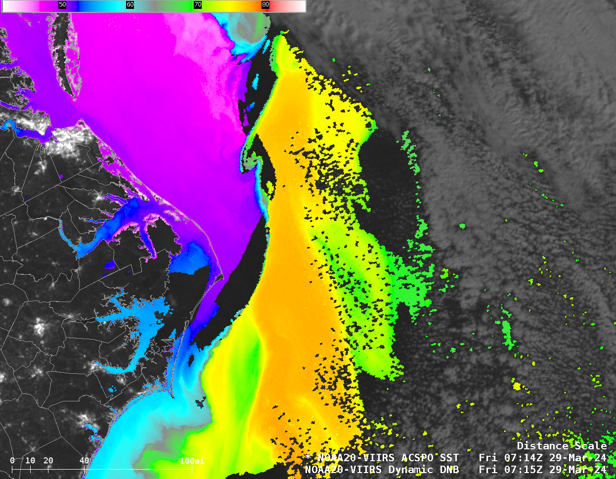
There is a very tight thermal gradient northeast of the Outer Banks of North Carolina! The magenta color shows temperatures in the upper 40s oF vs upper 70s (in orange) less than 20 miles away!
How do the VIIRS SSTs compare to GOES-16’s? The toggle below over the northern Gulf shows differences related to cloud detection over the cooler waters of the Mississippi River delta, and along the edge of the warmer waters offshore: NOAA-20 has a more complete picture.
The NOAA-20 imagery is also more complete near the Outer Banks as shown in the toggle below.
