Shallow fog/stratus over snow cover in Saskatchewan, Manitoba and North Dakota

GOES-16 Nighttime Microphysics RGB and Day Snow-Fog RGB images, from 0001 UTC to 2100 UTC on 22 December [click to play animated GIF | MP4]
A toggle between the GOES-16 Nighttime Microphysics RGB image at 1301 UTC and Topography (below) helped to highlight the 3 aforementioned plateau features (darker shades of tan to brown).
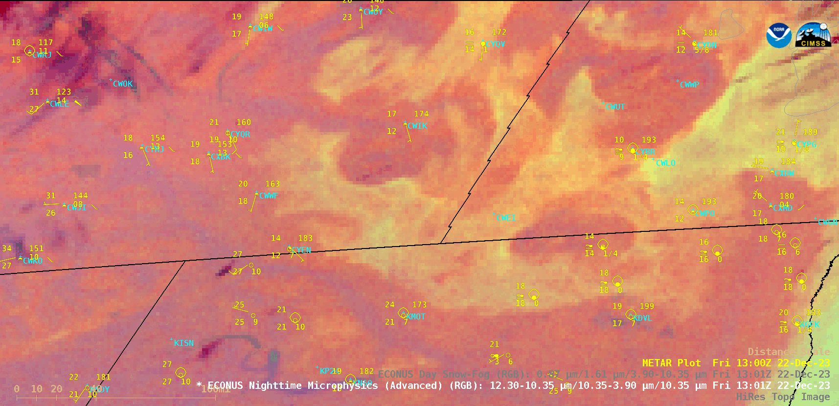
GOES-16 Nighttime Microphysics RGB image at 1301 UTC + Topography [click to enlarge]
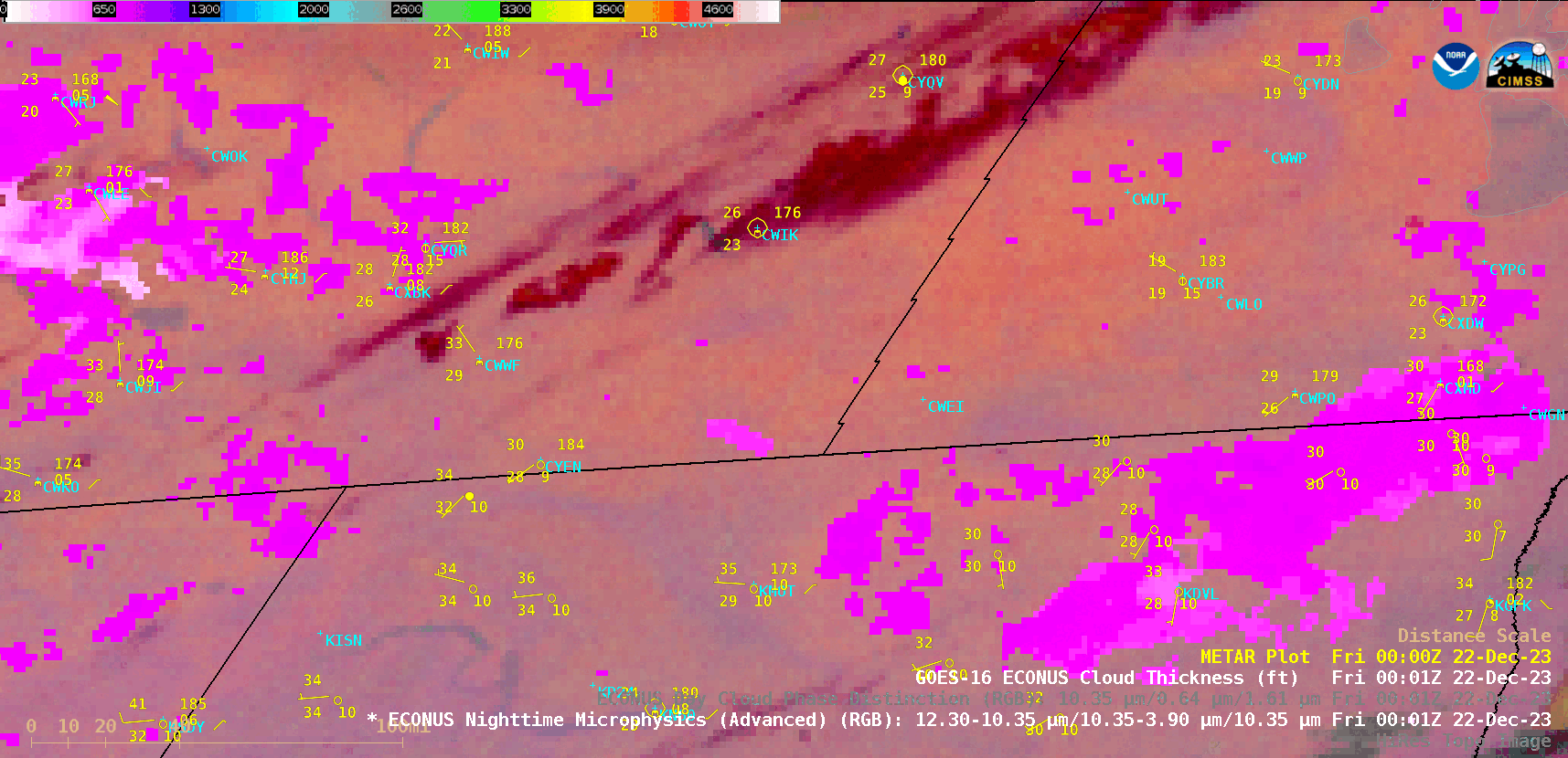
GOES-16 Nighttime Microphysics RGB + Cloud Thickness derived product, from 0001 UTC to 1401 UTC on 22 December [click to play animated GIF | MP4]