CSPP Geosphere updates to include Level 2 Products
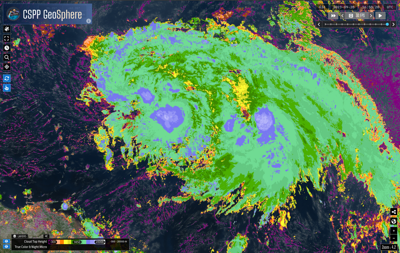
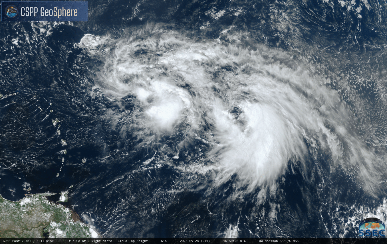
Scientists at CIMSS are putting a test version of the CSPP Geosphere site through its paces. The new version includes Level 2 products (Cloud Top Height, Cloud Top Pressure; both can be displayed using geo2grid software) — at full ABI resolution. The True-Color animation above shows Tropical Storms Phillipe and Rina in close proximity over the tropical Atlantic Ocean. (Rina’s exposed low-level circulation is very apparent!) The animation below include a Cloud Top Height overlay, with a scale shown. Cloud Top Heights over Rina peak at around 16000 m; those over Phillipe include values exceeding 17000 m
A toggle between the two images at 1650 UTC is shown below. Screen controls are not saved when imagery are exported, but those controls can be seen in this screenshot.
Stay tuned for an announcement for the update to CSPP Geosphere!