Satellite-derived soundings during a blowing dust event
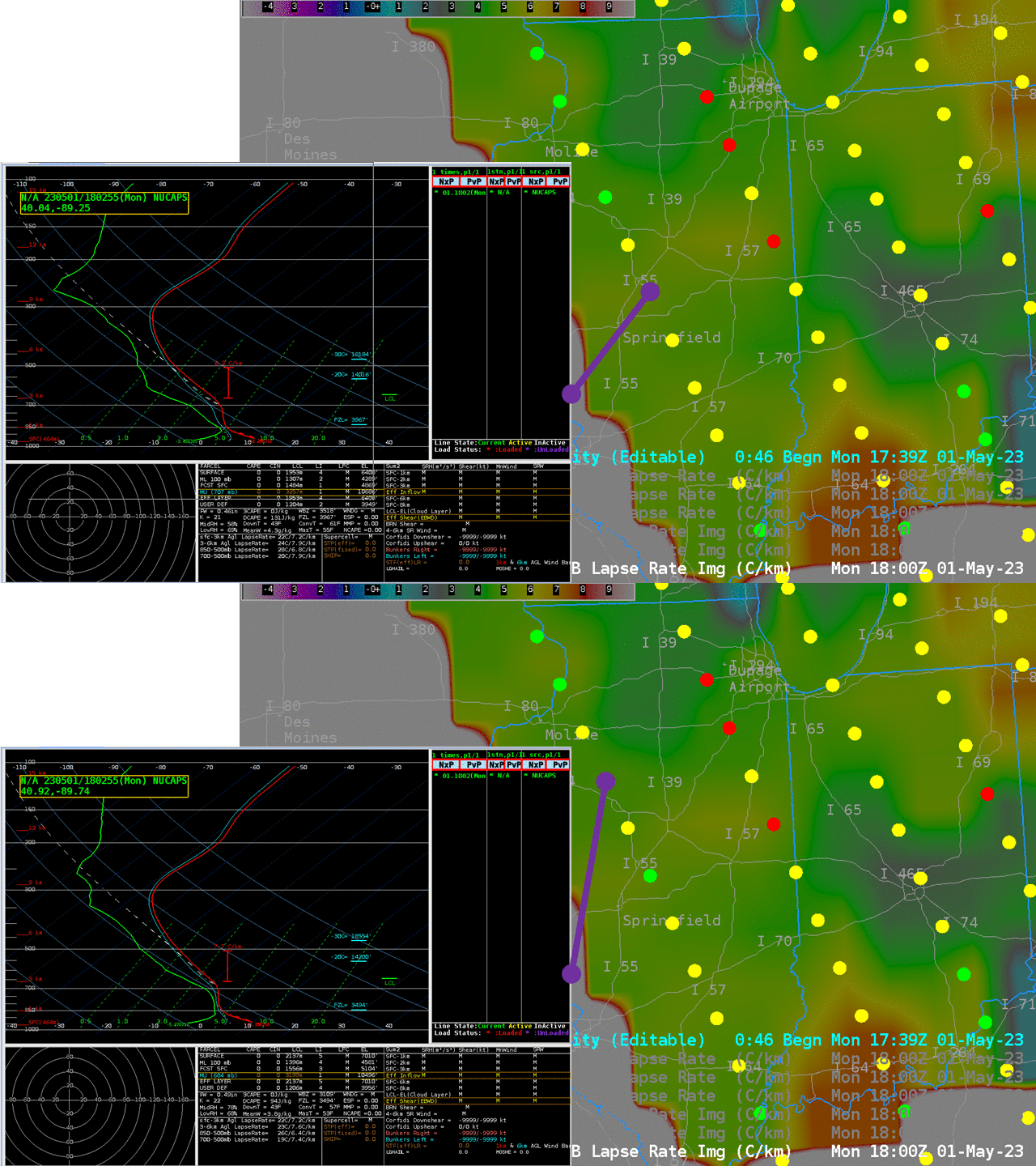
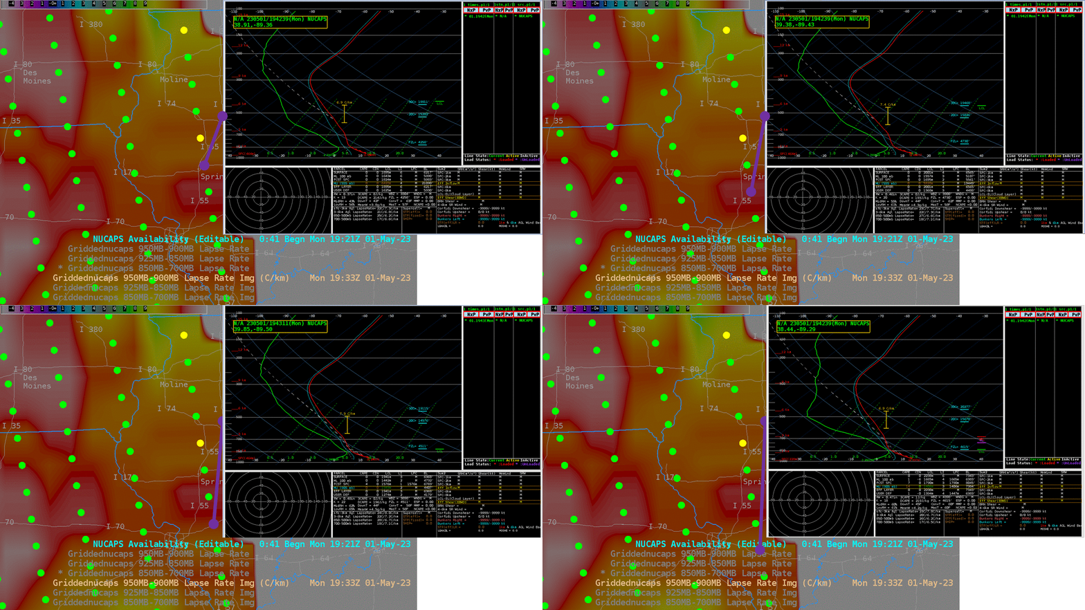
Did satellite soundings provide information during the surface wind event on 1 May 2023 that lead to the closure of Interstate 55 (click here for a Google Traffic map from 6 PM on 1 May 2023!) south of Springfield IL (see this CIMSS Satellite blog post)? On 1 May, the location in question was observed twice by NOAA-20, shortly before 1800 UTC (above) and ca. 1930 UTC (below). The low-level lapse rates from the NUCAPS soundings show the very strong lapse rates that accompany blowing dust.
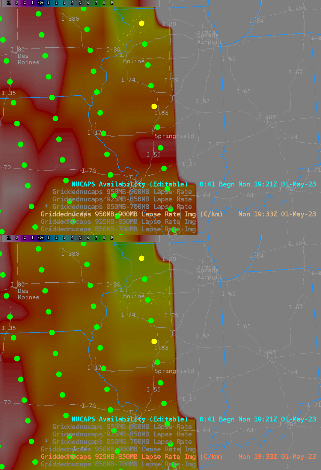
Gridded NUCAPS fields of low-level lapse rates are very revealing at 1933 UTC. Lapse rates from 925-850 and from 950-900 mb, shown below, suggest the steepest low-level lapse rates in the region just south of Springfield where the blowing dust occurred.
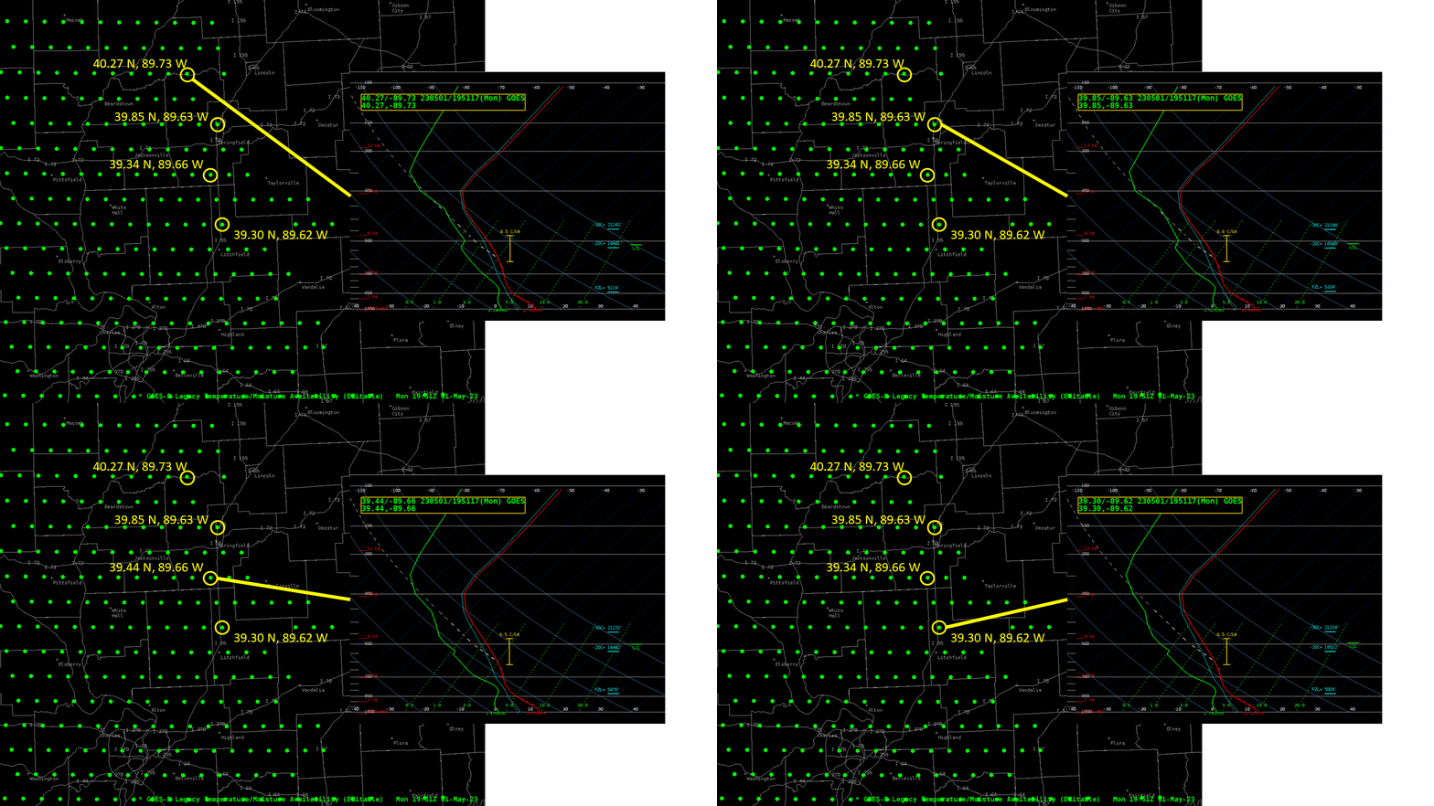
GOES-16 data can also be used to derive lapse rates in the vertical (although ABI data gives scant information in the vertical). The animation below shows derived profiles at 4 locations in central Illinois at 1951 UTC. (GOES-16 profiles are created only in regions that are confidently clear — clouds were present over much of eastern IL on 1 May 2023 as shown in this Day Cloud Phase Distinction RGB animation from 1746 – 1921 UTC). The blowing dust was most apparent in satellite imagery between the two southern profiles. As with the NUCAPS profiles, dry-adiabatic conditions are present near the surface.
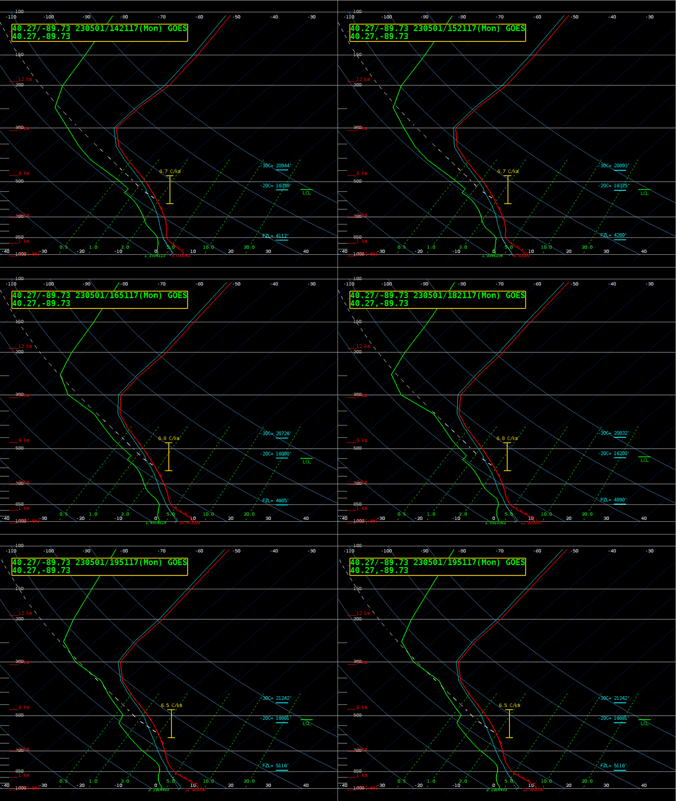
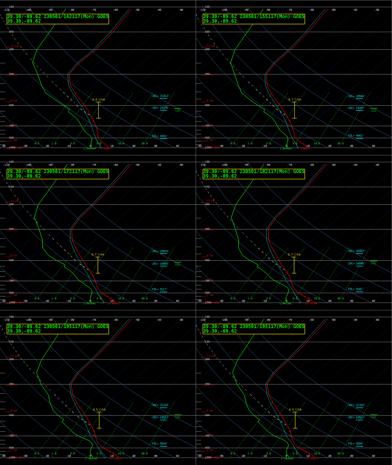
A benefit of GOES-R profiles is that they are produced every 30 minutes. Thus, one can view how things evolve with time in a way that is far more difficult with NUCAPS profiles. The animations below shows the profiles and the northern and southern points in the above figure. Both profiles show surface warming over the 5 hours plotted — with the southern station warming a bit more — and well-mixed boundary layers.
GeoXO — the follow-on to the GOES-R satellite series — will carry a hyperspectral sounding (the GXS) that will provide much more accurate profiles than are available from GOES-R.

