Record daily snowfall in Portland Oregon
Portland OR had a snowfall of 5.3″ on 22 February 2023, a record for the date. (Update! The snow on 22 February ended up being 10.8″, the second snowiest day of record!) The GOES-18 Clean Window Infrared (10.3) imagery animation, above, taken from the CSPP Geosphere site (direct link to animation) shows the system responsible for the precipitation. Colder higher clouds (lighter grey in the enhancement) over western Oregon are moving northward while low clouds (darker grey in the enhancement) over the Pacific are moving southeastward.
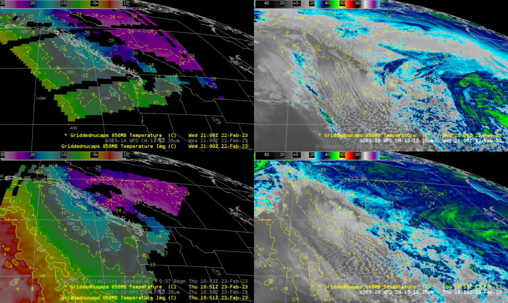
What satellite-based products could be used with this system to monitor the strength of the cold air? The 4-panel below shows gridded NUCAPS 850-mb temperature fields derived from NOAA-20 data from overpasses at 2100 UTC on 22 February and at 1051 UTC on 23 February. GOES-18 Band-13 imagery at the same time are shown. A large region of -10oC air is off the coast of Oregon late on the 22nd, and it persists through the morning of the 23rd. Use of gridded NUCAPS fields can give information about the atmosphere out over oceans where land-based (“conventional”) observations are sparse.
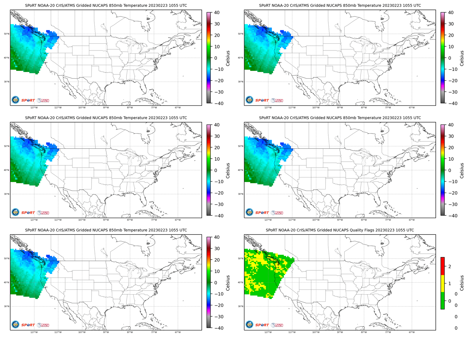
Gridded NUCAPS fields are available online. The toggle below shows the 1055 UTC 23 February 2023 gridded 850-mb Temperatures (along with NUCAPS quality flags), taken from this site. (You can also find gridded NUCAPS fields here). Here is a similar toggle from 2100 UTC on 22 February 2023.
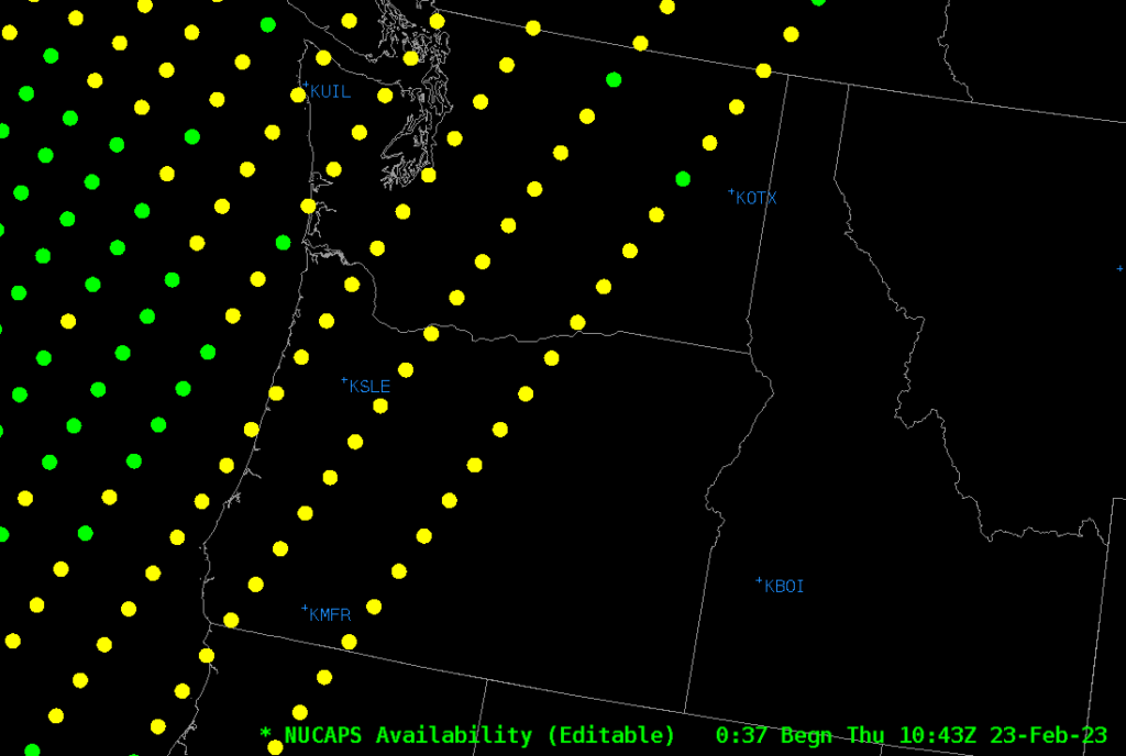
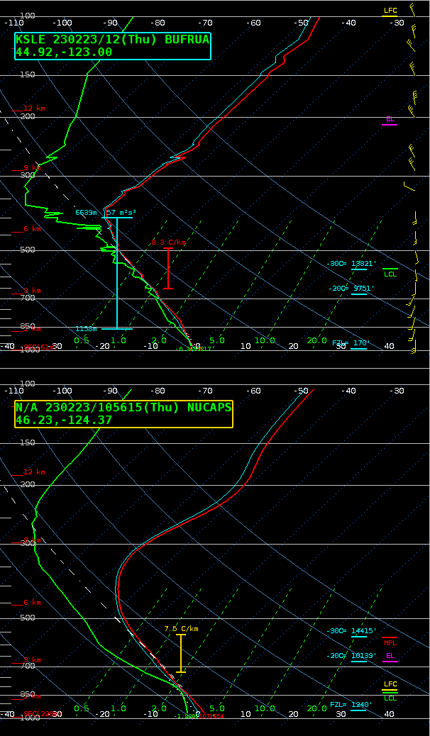
The AWIPS display of NUCAPS Sounding Availability for the morning pass on 23 February is shown below. Note the ‘green’ sounding point just off the coast of Oregon, just west of the mouth of the Columbia River. The toggle below compares the sounding there with the 1200 UTC sounding at Salem (KSLE) (Here’s a toggle of a more complete NSharp sounding window for the two soundings). The overall aspects of the two soundings are very similar, but the NUCAPS profile is smoother.
Some of the AWIPS imagery in this post was created using the TOWR-S AWIPS Cloud Instance. Thank you!
=========================================================
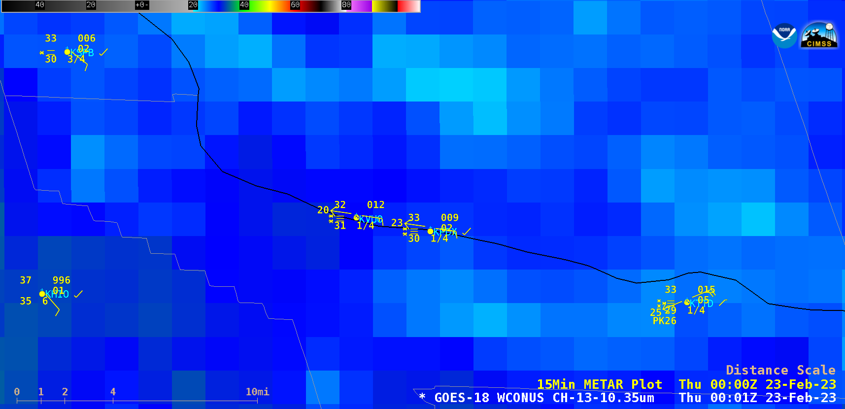
GOES-18 “Clean” Infrared Window (10.3 µm) images, with plots of 15-minute surface observations (courtesy Scott Bachmeier, CIMSS) [click to play animated GIF | MP4]
GOES-18 “Clean” Infrared Window (10.3 µm) images (above) include plots of 15-minute surface observations — which showed that the surface visibility at both Portland International Airport (KPDX) and Vancouver Pearson Field (KVUO) was restricted to 1/4 mile at times. The highest snowfall totals included 12.0 inches in the Greater Portland area and 16.0 inches in the Greater Vancouver area.
Added, 27 February 2023
On 25/26 February 2023, another system moved through. This time, however, 850-mb Temperatures were a bit warmer, as shown in the two toggles below (of 850-mb temperature and NUCAPS Quality flags), one from 2138 UTC on 25 February, before the onset of precipitation, and one from 2119 UTC on 26 February, after the cold frontal passage. Note in particular the warmer temperatures on 25 February (green enhancements vs. cyan in the imagery above from early on 23 February!) Instead of snow, Portland had cold rain on the 26th. Here is the Meteorogram that includes 26 February (from this site).
