Warm Seclusion off the US East Coast
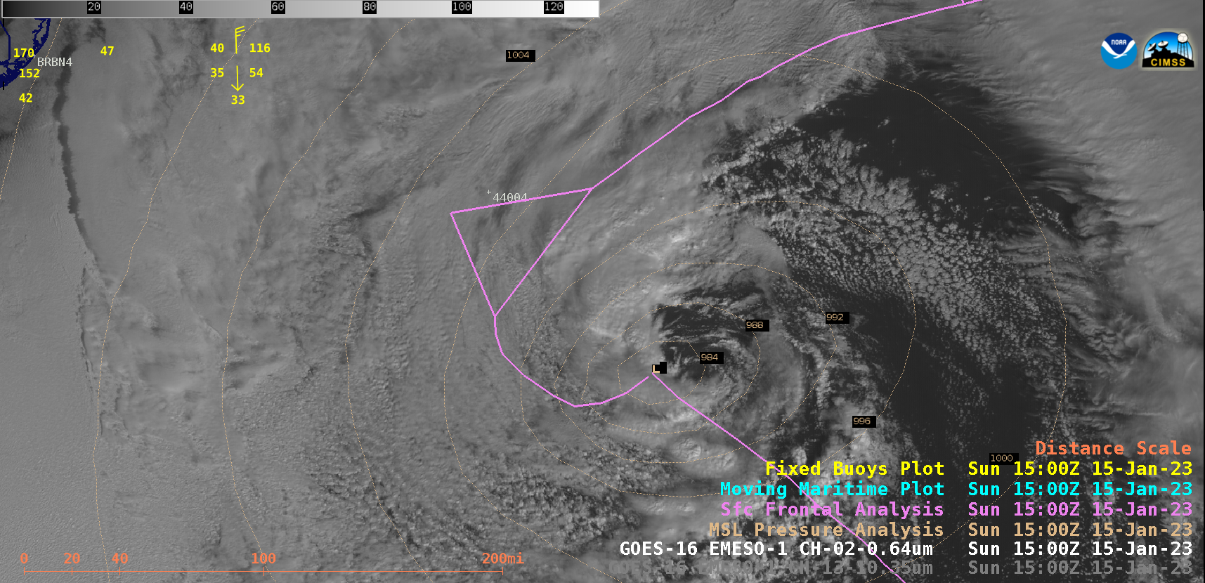
GOES-16 “Red” Visible (0.64 µm) and “Clean” Infrared Window (10.3 µm) images [click to play MP4 | animated GIF]
During the preceding nighttime hours, a comparison of Suomi-NPP VIIRS Infrared Window (11.45 µm) and Day/Night Band (0.7 µm) images valid at 0718 UTC (below) provided a view of the cyclone as it was beginning to transition to its occluded phase — and the Sea Surface Temperature derived product indicated that water temperatures in the general vicinity were in the upper 60s to low 70s F (suggesting that the system was very near the axis of the Gulf Stream). One isolated bright lightning streak was seen in the Day/Night Band image, associated with a thunderstorm located near the warm front (which exhibited a cloud-top infrared brightness temperature of -56ºC).
Suomi-NPP VIIRS Infrared Window (11.45 µm), Day/Night Band (0.7 µm) and Sea Surface Temperature derived product, valid at 0718 UTC [click to enlarge]