Widespread fog/stratus over snow cover across the Northern Plains
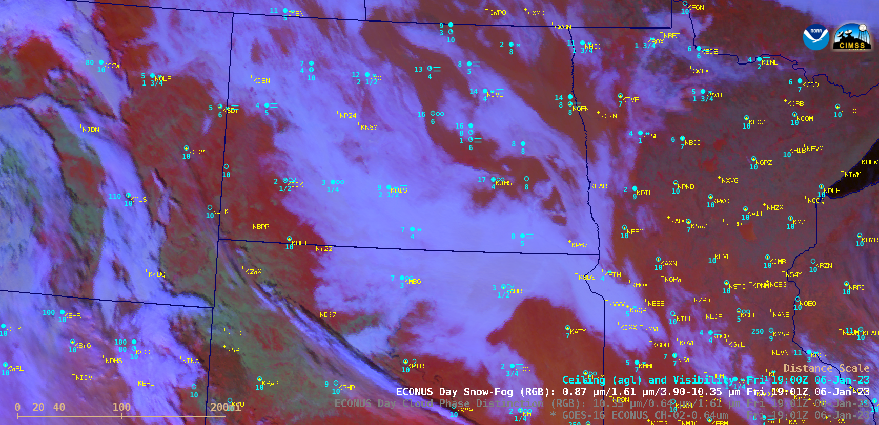
GOES-16 “Red” Visible (0.64 µm), Day Cloud Phase Distinction RGB and Day Snow-Fog RGB images (with and without hourly observations of Ceiling / Visibility / Surface Weather, plotted in cyan) [click to play MP4 animation | animated GIF]
Plots of rawinsonde data from Bismarck ND (KBIS) and Aberdeen SD (KABR) are shown below — both sites indicated that a strong and moist boundary layer temperature inversion remained in place during the day, which also helped the fog/stratus layer to persist or dissipate rather slowly. Judging from the pressure level of sharp dew point decreases, these fog/stratus features were confined to altitudes of 1200-1400 meters (3900-5000 feet) or lower.
Plots of rawinsonde data from Bismarck, North Dakota [click to enlarge]
Plots of rawinsonde data from Aberdeen, South Dakota [click to enlarge]
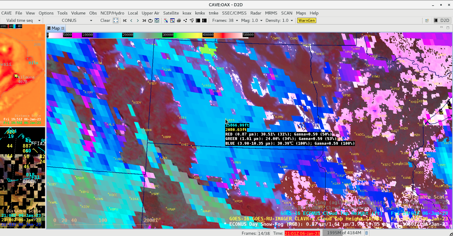
GOES-16 Day Snow-Fog RGB images at 1901 UTC, with an overlay of the corresponding CLAVRx and Operational versions of the Cloud Top Height derived product; cursor-sampled Cloud Top Height values at Bismarck ND are shown [click to enlarge]
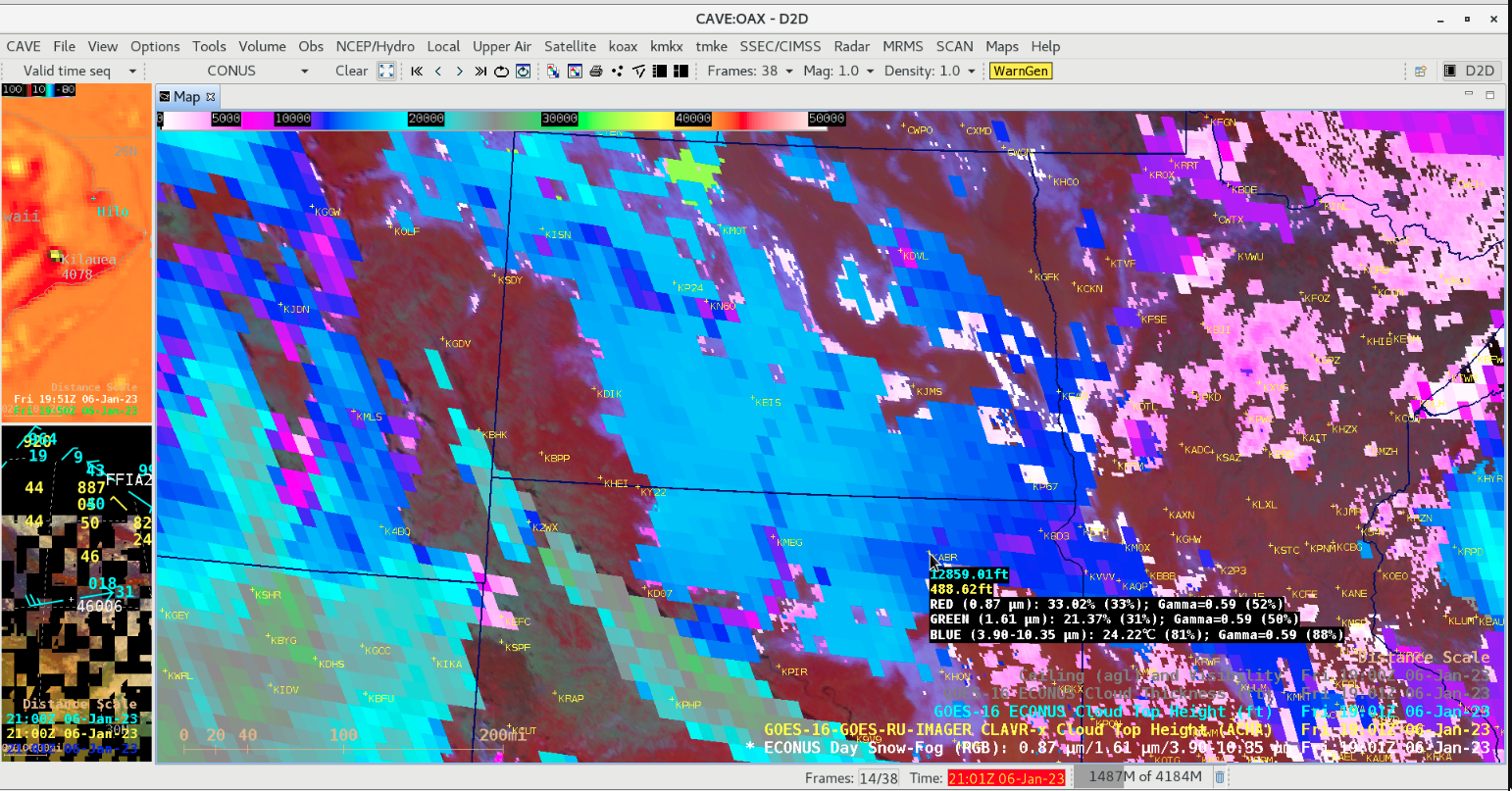
GOES-16 Day Snow-Fog RGB image at 1901 UTC, with an overlay of the corresponding CLAVRx and Operational versions of the Cloud Top Height derived product; cursor-sampled Cloud Top Height values at Aberdeen SD are shown [click to enlarge]
GOES-16 Day Snow-Fog RGB, CLAVRx Cloud Top Height and Operational Cloud Top Height at 1901 UTC [click to enlarge]