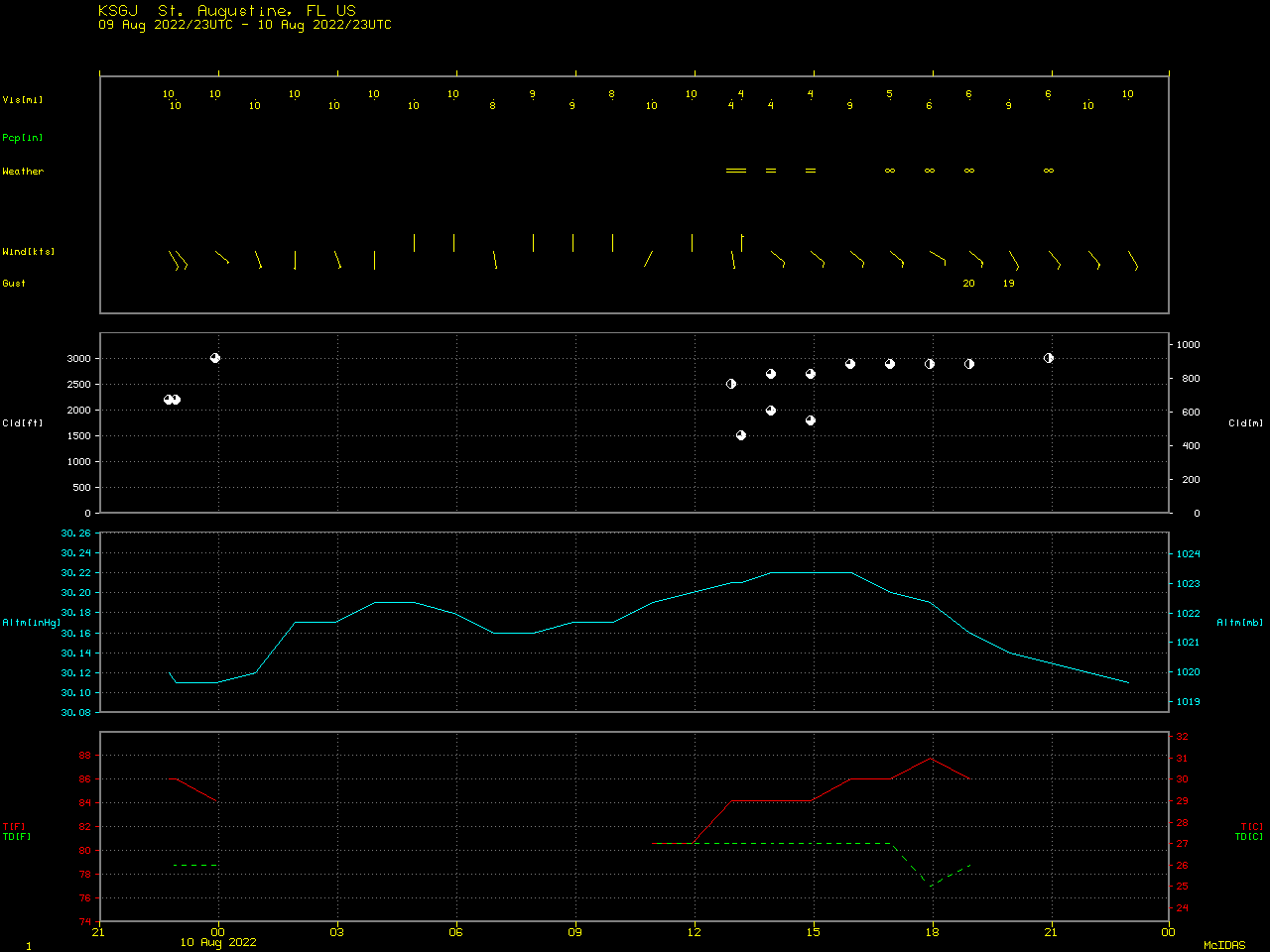
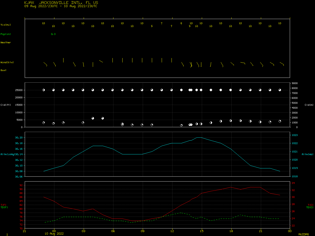
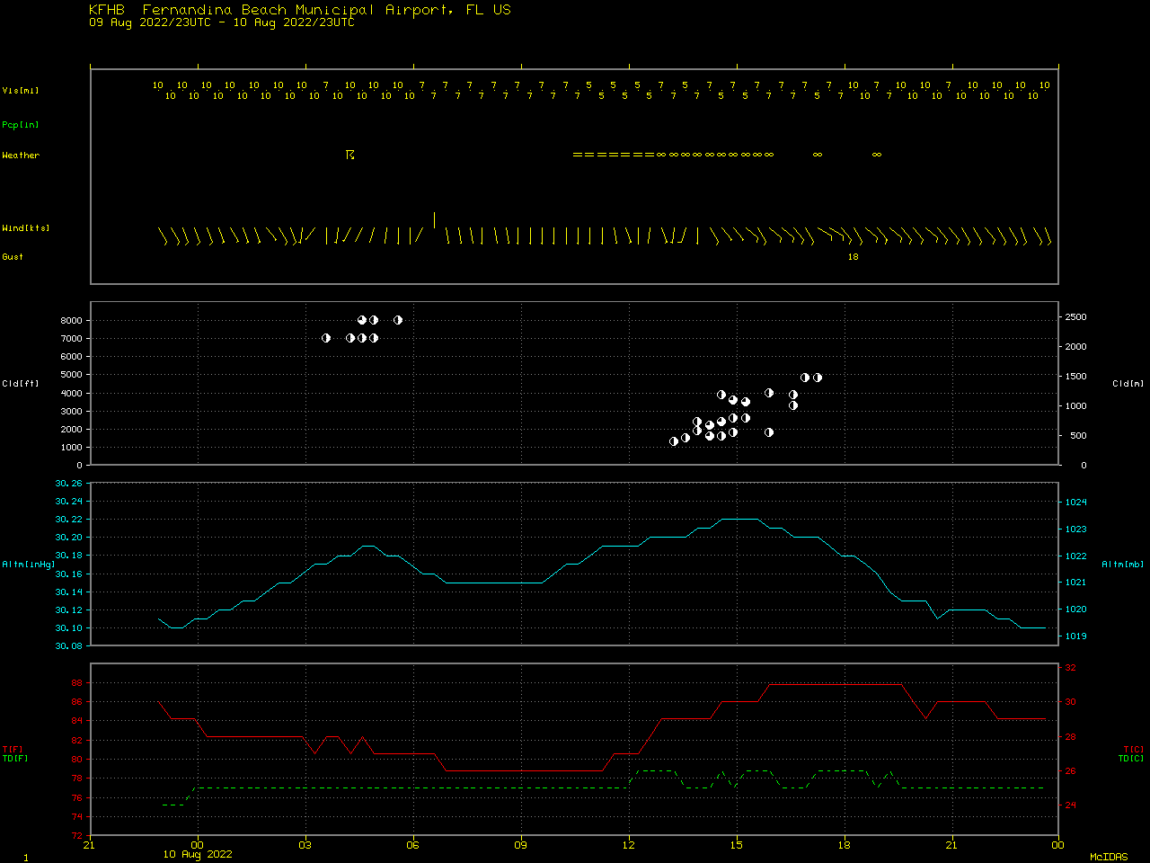
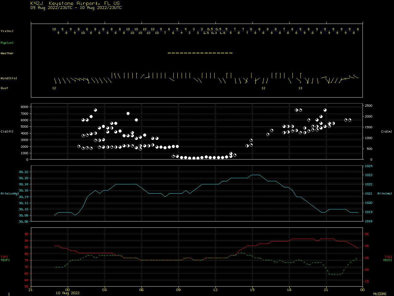
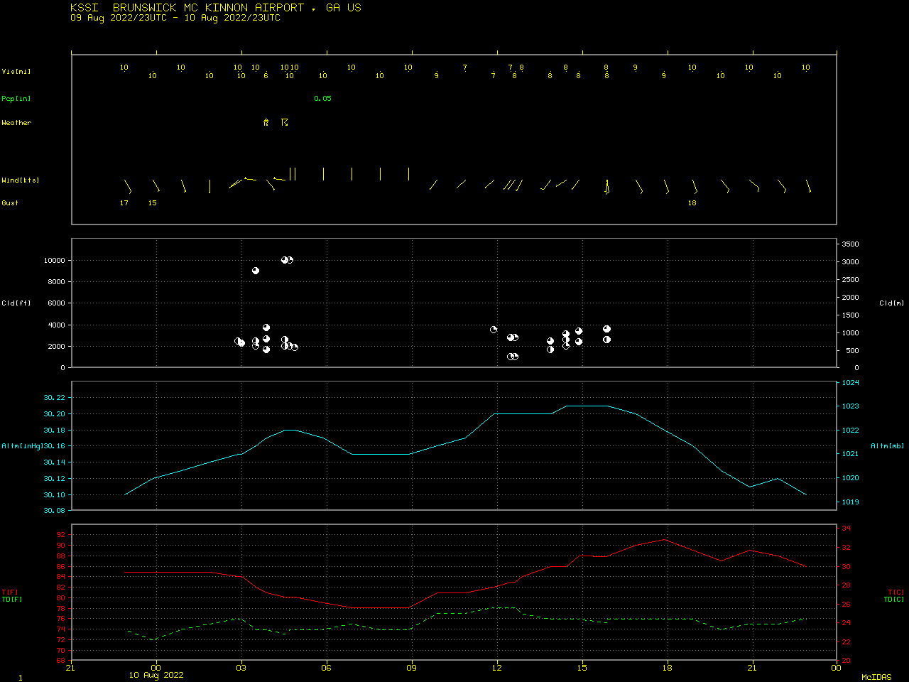
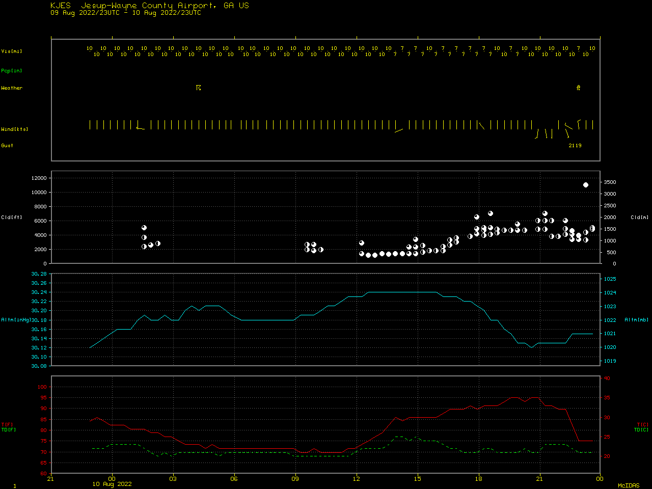
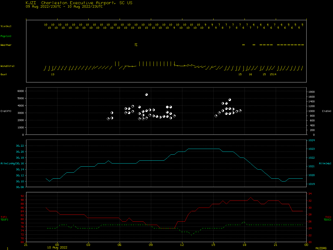
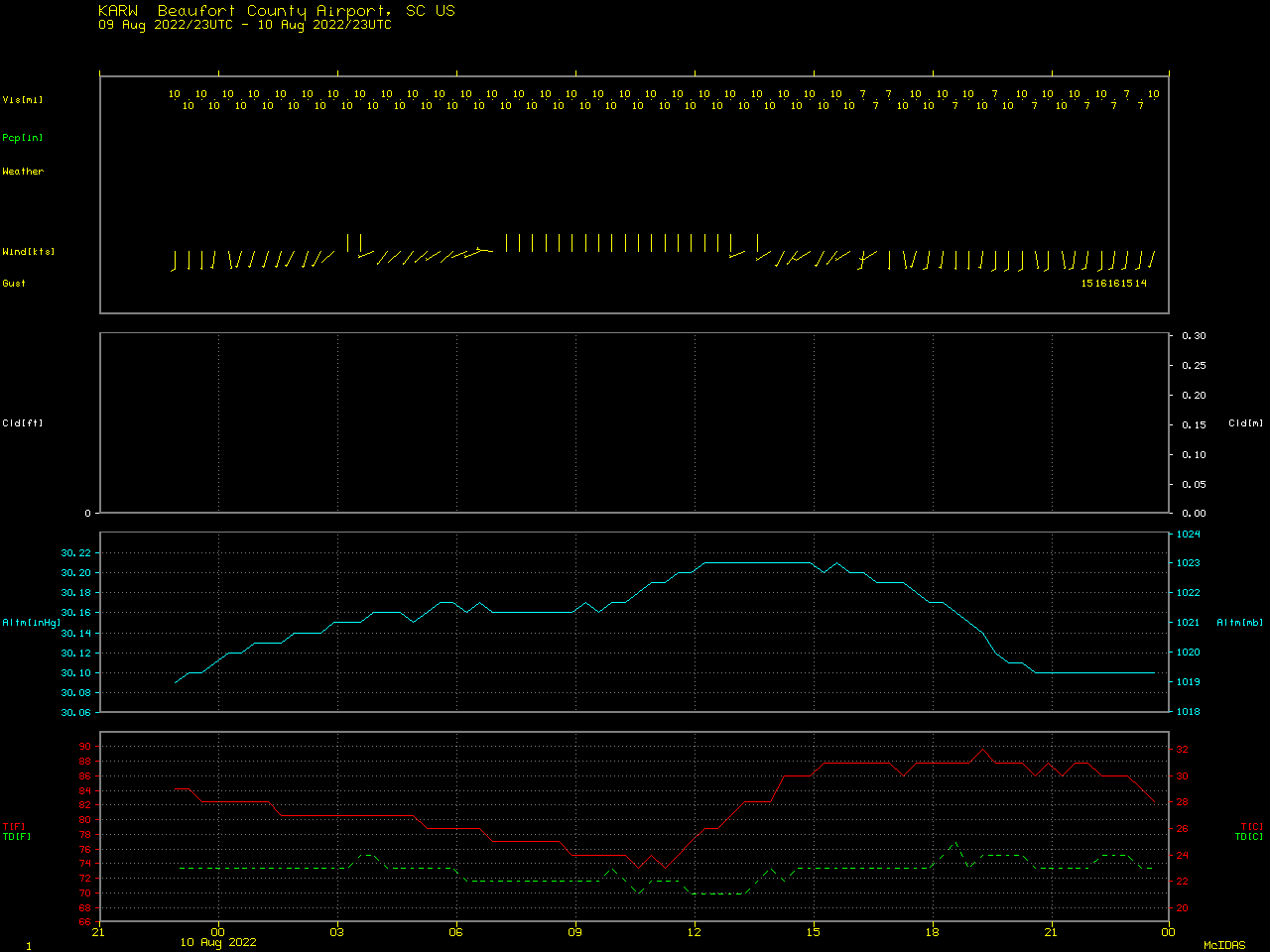
Saharan Air Layer dust reaches the Southeast US coast

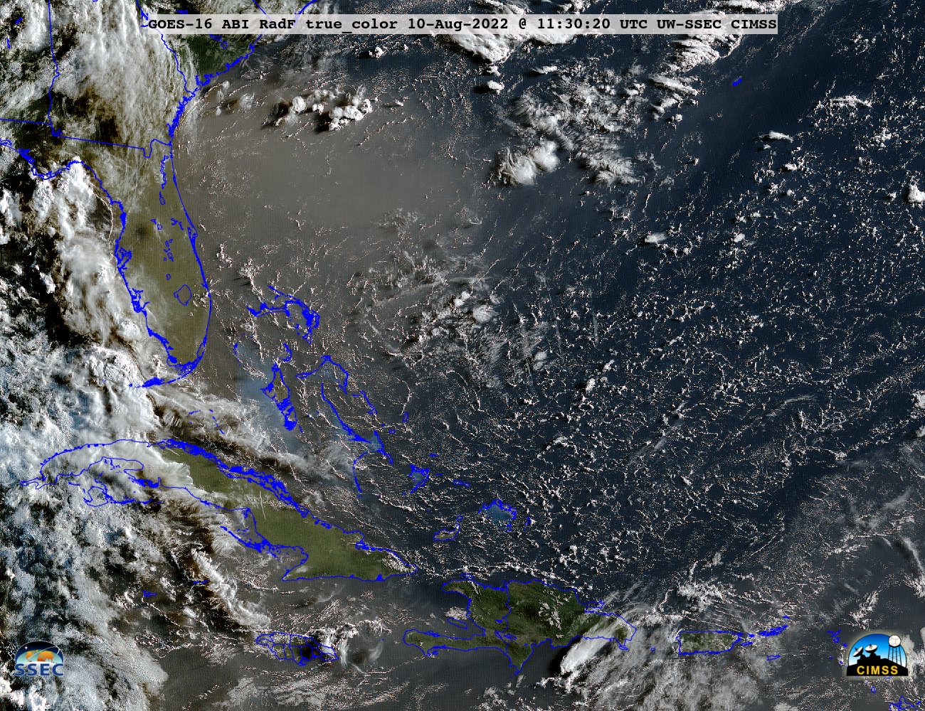
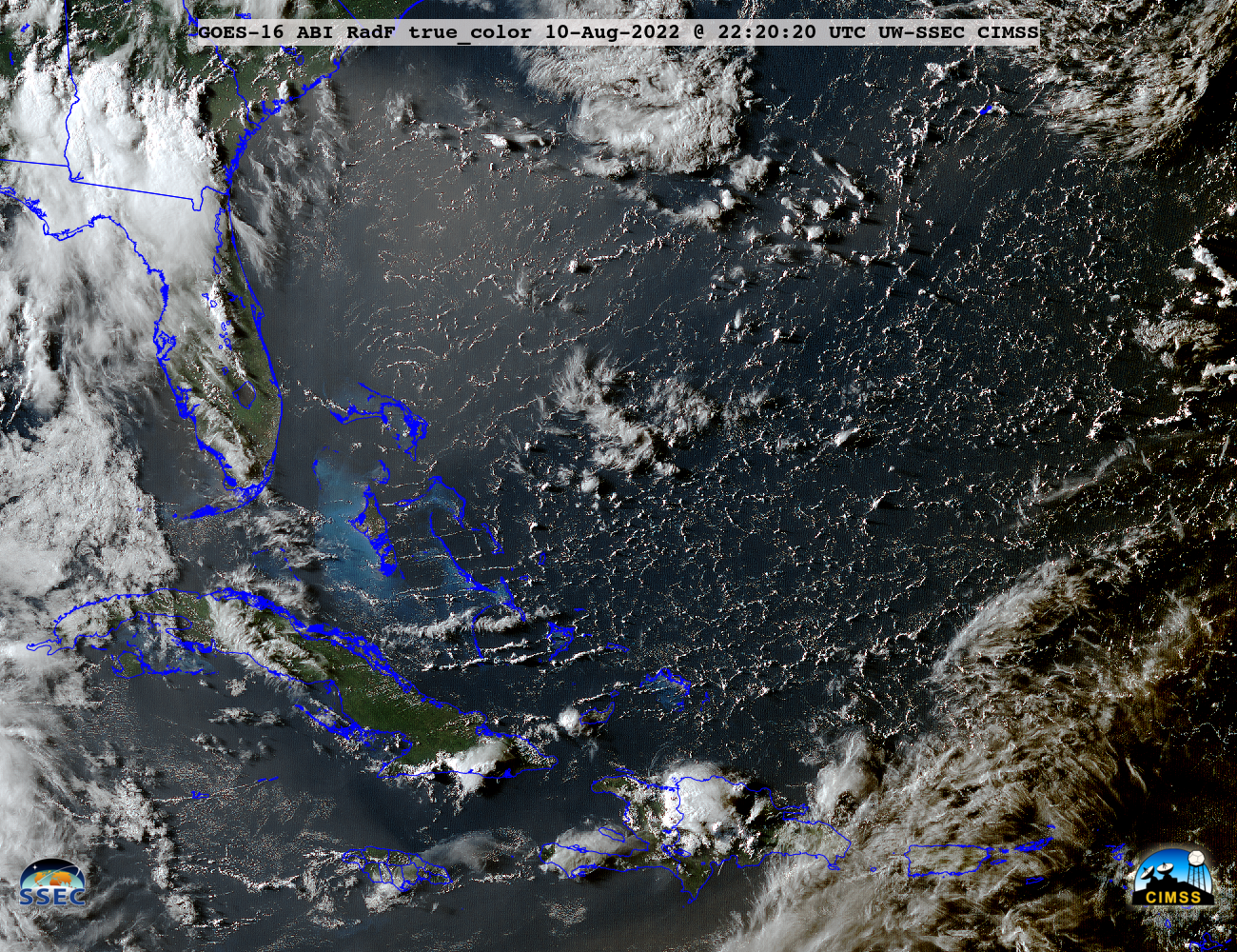
GOES-16 True Color RGB images, from 1130-2250 UTC on 08 August, 09 August and 10 August [click to play animated GIF | MP4]
The GOES-16 Aerosol Optical Depth (AOD) derived product (below) provided a quantitative measure of the density of this dust — with AOD values generally ranging from 0.5 to 0.8. Note the westward-moving semicircular region where no AOD appears every day: these are areas where the product is not created, due to contamination by sun glint off the water.
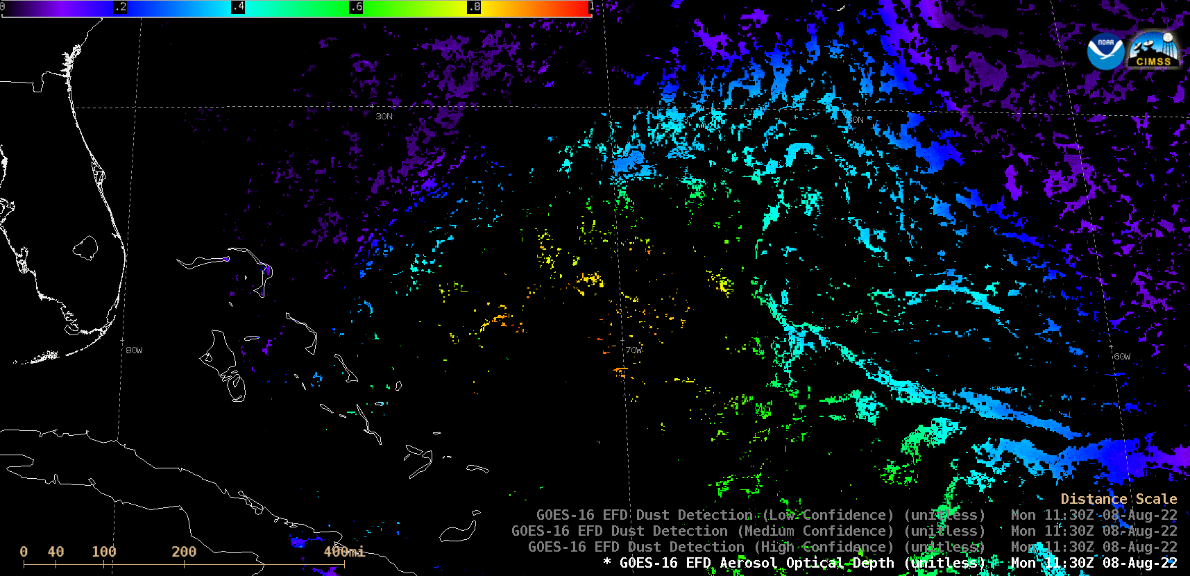
GOES-16 Aerosol Optical Depth derived product, from 1110-2230 UTC on 08 August, 09 August and 10 August [click to play animated GIF | MP4]
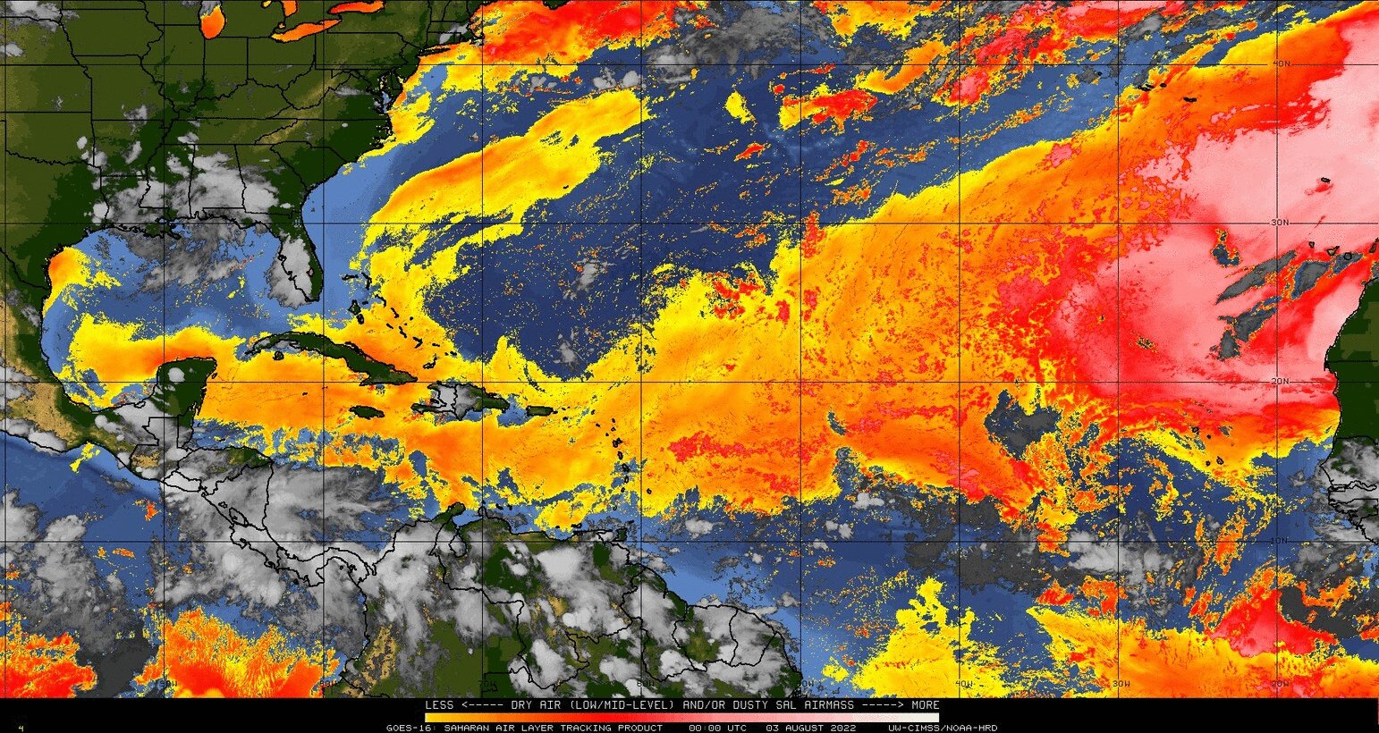
GOES-16 Split Window Difference SAL product, from 03-10 August [click to play animated GIF | MP4]