Severe thunderstorms in New Mexico and Texas

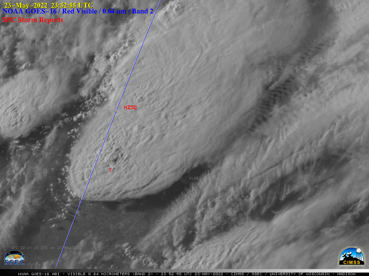
GOES-16 “Red” Visible (0.64 µm) images, with time-matched SPC Storm Reports plotted in red [click to play animated GIF | MP4]
1-minute Mesoscale Domain Sector GOES-16 (GOES-East) “Red” Visible (0.64 µm) images (above) include time-matched SPC Storm Reports — and showed the development of 2 supercell thunderstorms near the New Mexico / Texas Panhandle border late in the day on 23 May 2022. The northern storm produced hail as large as 2.50 inches in diameter, while the southern storm produced a very large tornado and damaging winds as strong as 80 mph. Signatures of Above-Anvil Cirrus Plumes (reference | VISIT training) were also seen.
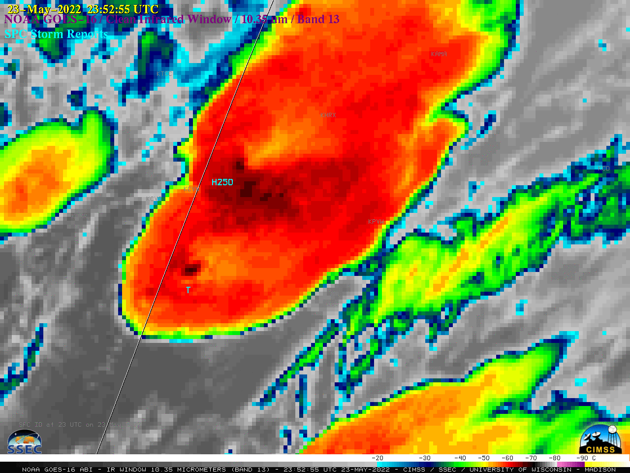
In the corresponding 1-minute GOES-16 “Clean” Infrared Window (10.35 µm) images (below), warmer AACP signatures (shades of yellow) were evident, downwind of cold overshooting tops — these pulsing overshooting tops exhibited infrared brightness temperatures as cold as -77ºC.

GOES-16 “Clean” Infrared Window (10.35 µm) images, with time-matched SPC Storm Reports plotted in cyan [click to play animated GIF | MP4]

