Hyperspectral forecasting for the Andover KS tornado

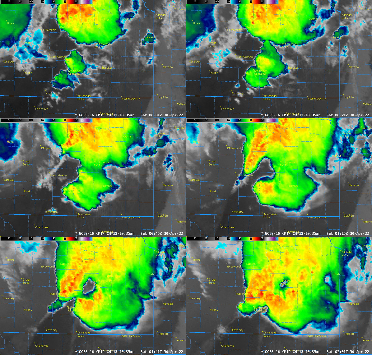
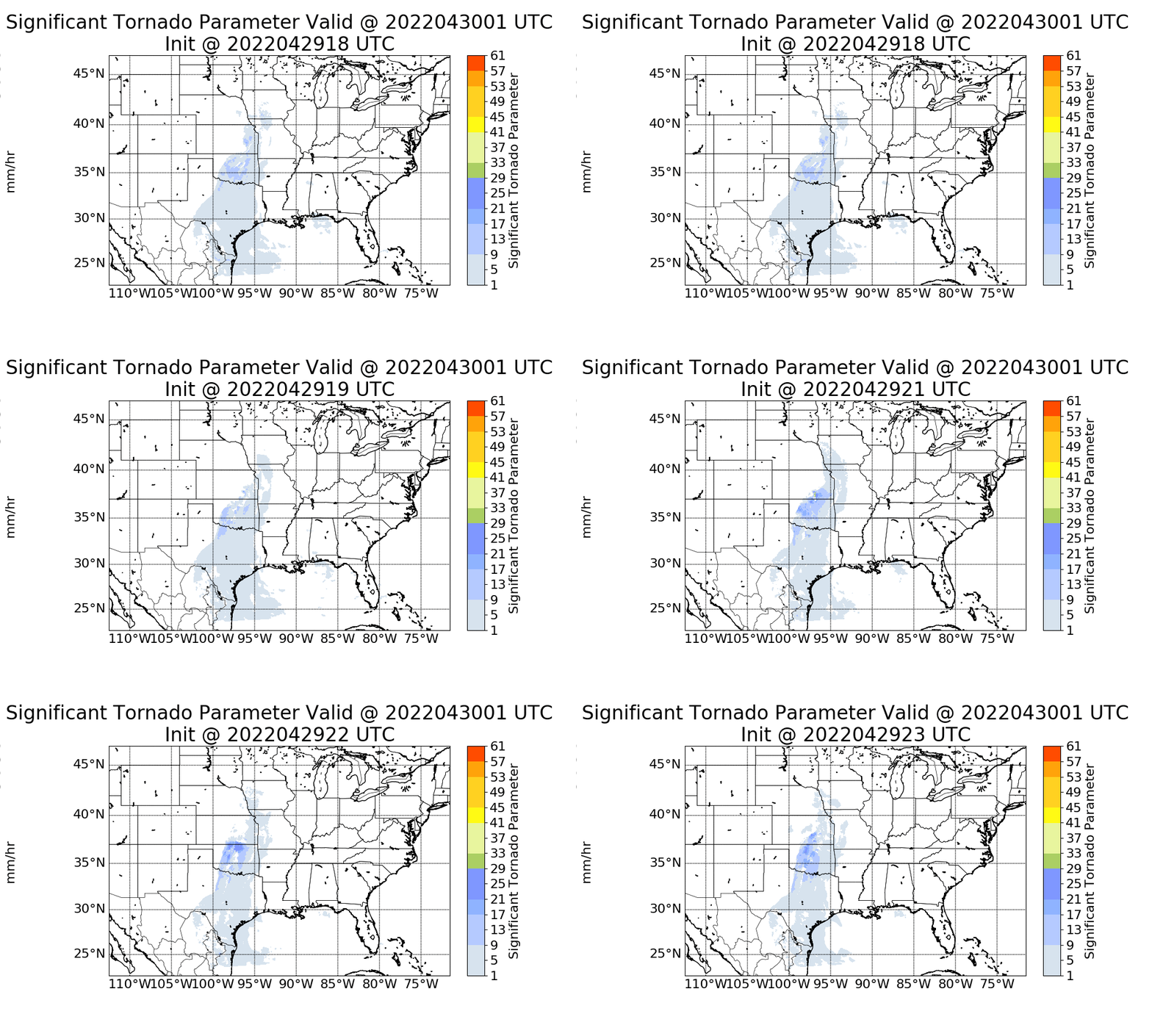
The animation above shows GOES-16 Band 13 Infrared imagery (10.3 µm) monitoring the development of the tornadic thunderstorm just east of Wichita that spawned the EF-3 Andover, KS, tornado (on the ground from 0110 through 0131 UTC) on 30 April 2022 (SPC Storm Reports; Write-up on storms from NWS Wichita). The storm responsible for the tornado was ahead of the cold front, which front is obvious in the infrared imagery to the west of Cherokee (OK) and Anthony (KS). Polar Hyperspectral Soundings (available at this website) are being demonstrated at the Hazardous Weather Testbed this year (starting in late May); how did those model products do with this isolated storm out in front of the approaching cold front? The animation below shows the Significant Tornado Parameter forecasts at 0100 UTC from forecasts starting from 1800 through 2300 UTC on 29 April. Maximum values of STP are over the southeast Kansas, especially for the forecasts initialized at 2100 and 2300 UTC. Guidance was suggesting where to focus attention on the possibility of strongest convection.

The PHSnMWnABI model outputs other variables, of course, and the updraft velocity at the Level of Free Convection (LFC) and the hourly Liquid Precipitation are shown below. Note the two separate regions of convection (based on the updraft velocities), and how a strong system is present near Wichita at 0100 UTC from the 2300 UTC initialization. The forecast model is pointing a forecaster towards the type of evolution that might happen: Convection in more than one location — with strong updrafts along the front (notable in the Lifted Index and CAPE fields — not shown) but also convection out ahead of that feature as shown in the updraft velocities in the 2300 UTC model run (shown at bottom)


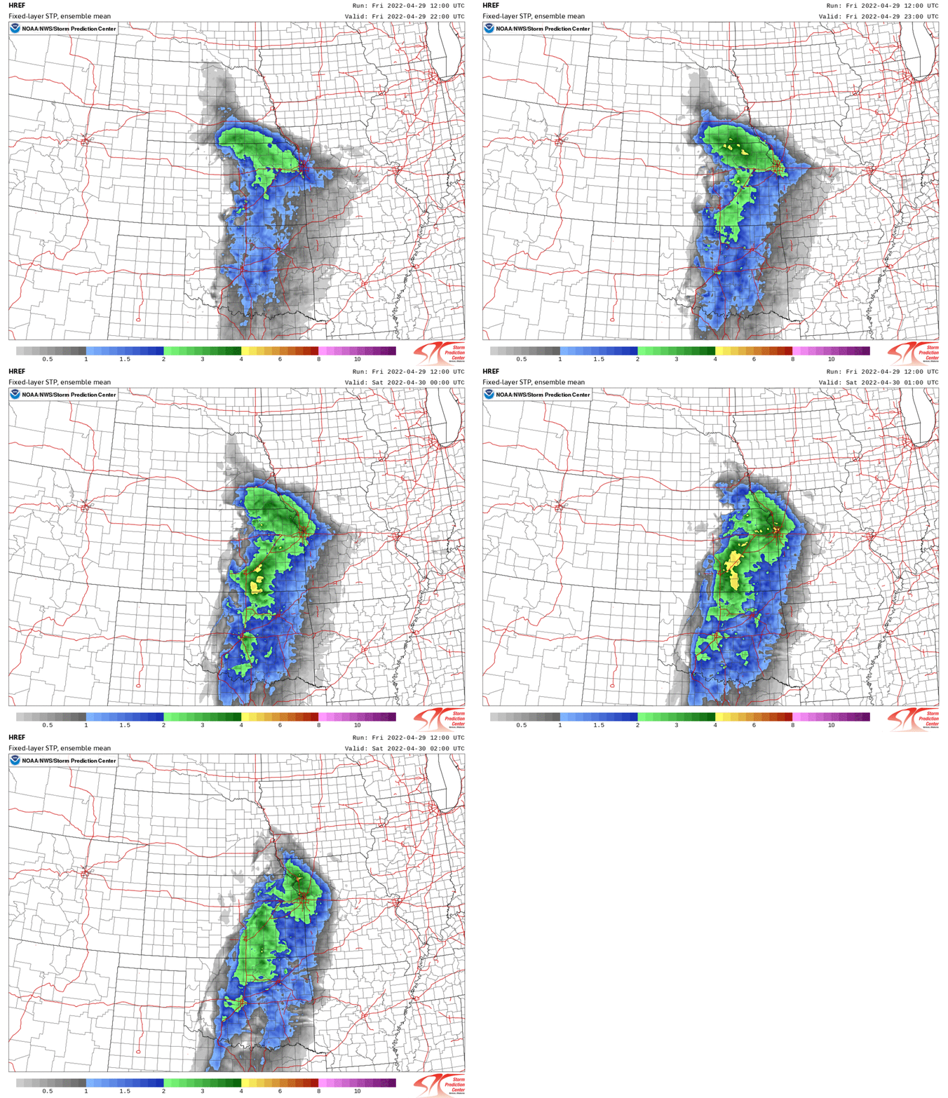
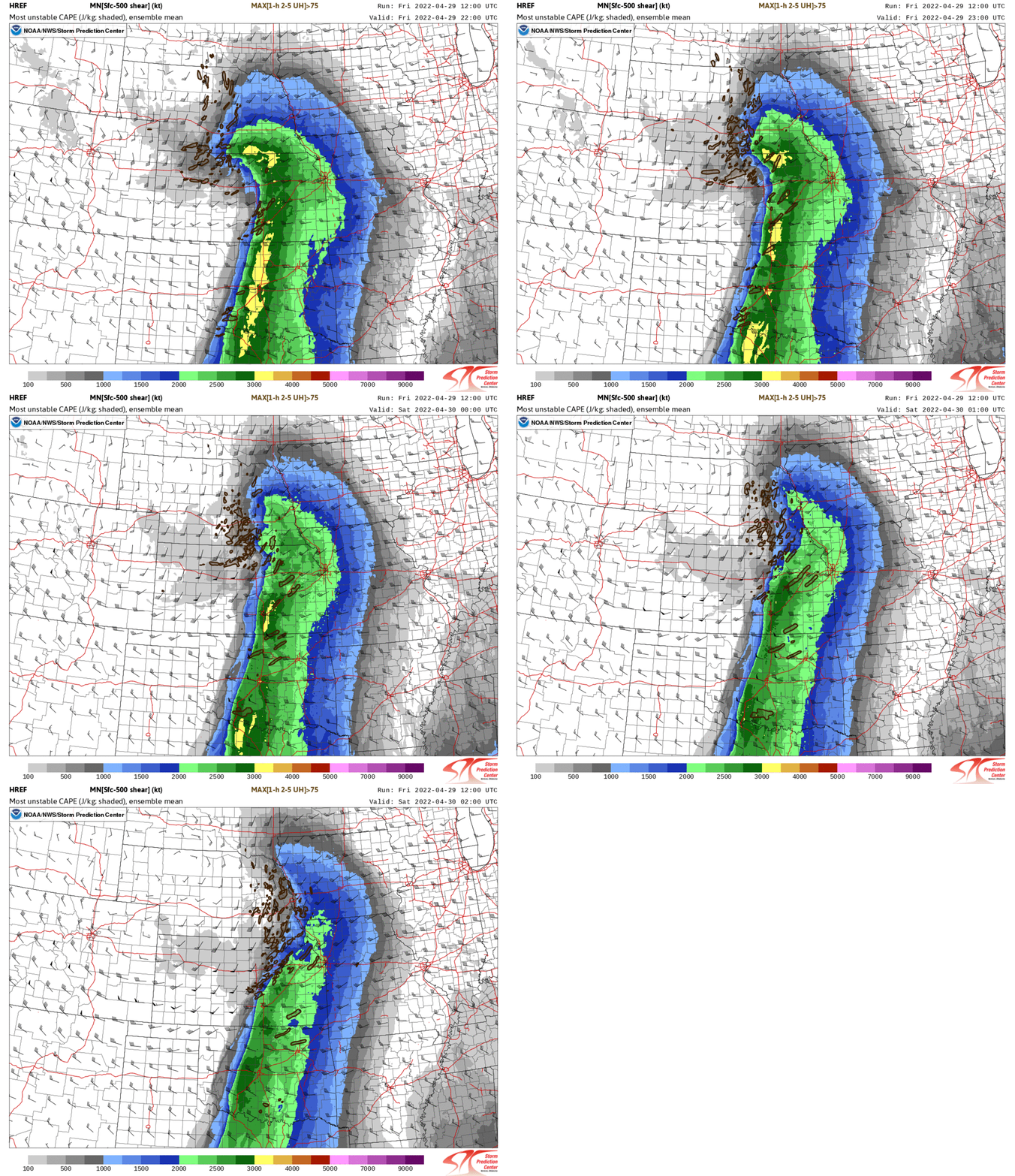
What did other forecasting models show for this event? The animation below shows ensemble mean STP from the HREF initialized at 1200 UTC on 29 April. (imagery courtesy Jim Caruso, SOO at WFO ICT). STP increases in the vicinity of the observed tornado between 0000 and 0100 UTC. HREF Ensemble Mean Most Unstable Convective Available Potential Energy (MUCAPE) has an axis over the Andover region; updraft helicity signatures are also shown.


A regression of the 4-h max probability of Tornado (here), from a 2200 UTC initialization and valid through 0200 UTC, shows highest probabilities encompassing most of Butler County (in which Andover is the most populous city). Forecast updraft helicities are greatest just north of Andover.

