Severe thunderstorms move from southern Missouri into northeastern Arkansas

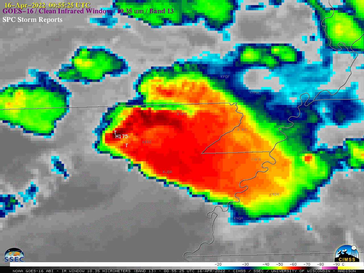
GOES-16 “Clean” Infrared Window (10.35 µm) images, with time-matched SPC Storm Reports plotted in white [click to play animated GIF | MP4]
Overlapping 1-minute Mesoscale Sectors provided 30-second GOES-16 (GOES-East) “Clean” Infrared Window (10.35 µm) images (above) — with time-matched plots of SPC Storm Reports — of thunderstorms that produced straight-line wind damage and hail as large as 4.25 inches in diameter across far southern Missouri and northeastern Arkansas after sunset on 15 April 2022. These storms intensified in the vicinity of a warm front that become quasi-stationary across the area (surface analyses). Following a storm damage survey (NWS Little Rock PNS), it was determined that damage at the reported tornado locations was caused by straight-line winds and wind-driven large hail.
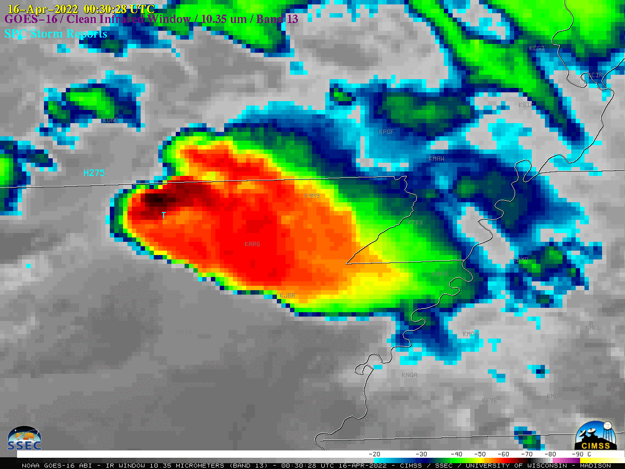
Around the time of the first tornado/wind damage report (below), an area of warmer cloud-top infrared brightness temperatures (shades of orange) began to appear immediately downwind (southeast) of the cold overshooting top (cluster of black pixels) — suggesting the presence of an Above-Anvil Cirrus Plume (reference | VISIT training).

GOES-16 “Clean” Infrared Window (10.35 µm) image at 0030 UTC, with time-matched SPC Storm Report plotted in white [clic to enlarge]
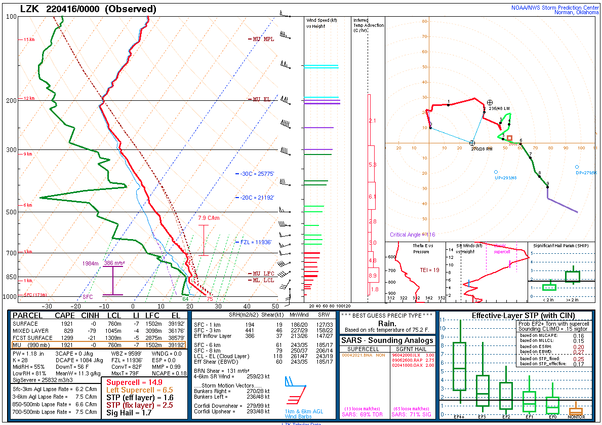
The coldest GOES-16 cloud-top infrared brightness temperatures were around -70oC, which was about 10oC colder than the tropopause / equilibrium level temperature, as seen in a plot (source) of 00 UTC rawinsonde data from Little Rock, Arkansas (below).


