Hyperspectral modeling during severe weather
Hyperspectral soundings — for example the Cross-track Infrared Sounder (CrIS) on NOAA-20/Suomi-NPP and the Infrared Atmospheric Sounding Interferometer (IASI) on MetOp — observe the atmosphere at thousands of wavelengths in the near-infrared and infrared part of the electromagnetic spectrum. The excellent spectral resolution allows for good vertical resolution of temperature and (especially) moisture in the atmosphere; Polar Hyperspectral Soundings (PHS) are created from these data to give profiles of temperature and moisture. Data fusion, described in this Smith et al. paper from 2020, relates ABI information to PHS when the polar observations are made (the technique used is a bit different from the GEO+LEO technique described in this Weisz and Menzel paper from 2019). Those relationships are subsequently carried forward in time, thereby exploiting both the excellent spectral resolution available from polar satellites and the excellent spatial and temporal resolution from ABI. Qi Zhang and Bill Smith, Sr. at Hampton University are running a model that takes advantage of this data fusion. Output from this modeling effort have been previously discussed here and here on this blog, and is available here. In the past year, the modeling effort has expanded to include microwave information (from the Advanced Technology Microwave Sounder (ATMS) on NOAA-20/Suomi-NPP) to give more accurate satellite-derived moisture information below the cloud-tops.
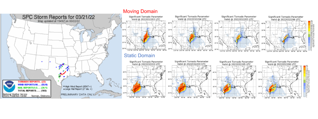
The imagery below shows forecasts of Significant Tornado Parameter from two different 3-km runs, one with a domain centered on the risk as defined by the Storm Prediction Center, one with a static domain. Note the close correlation between the region of larger values and the observed tornadoes. Results between the two forecasts are similar, but the false alarm rate is somewhat smaller in the small domain.

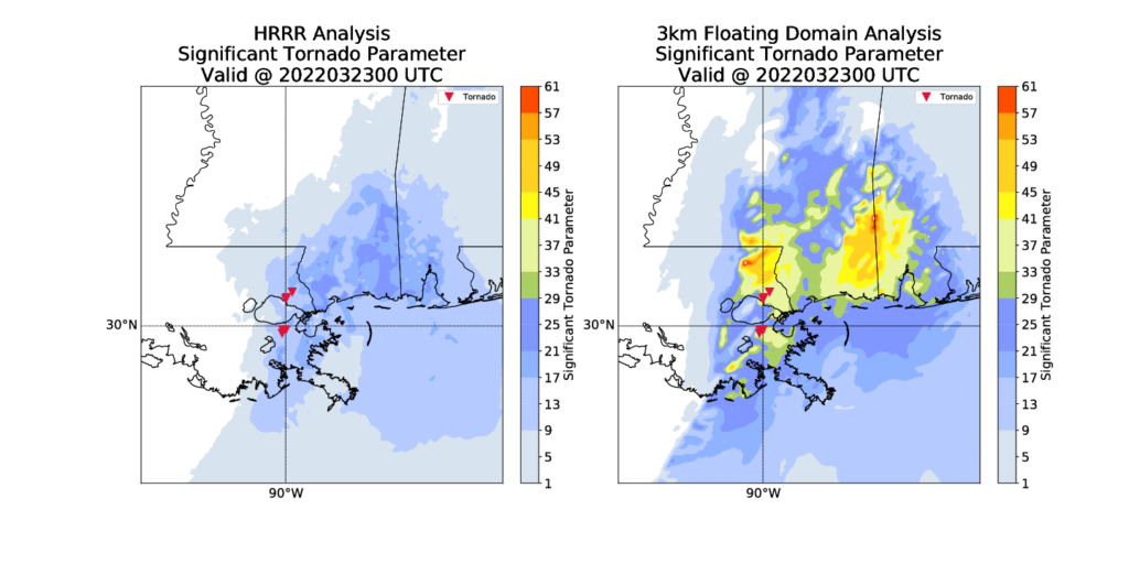
New Orleans LA was hit by a tornado (discussed here) after sunset on 22 March 2022. Tornado locations are shown by the inverted red triangles in the figures below. The Significant Tornado Parameters from the 3-km model that includes PHS data, microwave data, and ABI data has a maximum in the region of the tornado. This is useful information to have when anticipating the tornado development.

The combination of polar hyperspectral soundings with ABI data has been explored since before the launch of GOES-R, and in fact back to about 2008! Funding for this effort has been supplied in the past by both GOES-R and JPSS Risk Reduction initiatives.
In the (distant) future, when NOAA’s Geostationary Extended Observations (GeoXO) satellite system is in orbit (click here for more information on GeoXO), routine soundings of the atmosphere will allow this type of modeling effort with better initial conditions because there will be a much smaller time between the observations (from Geostationary in the future vs. from Polar Orbiters now) and the model initialization.

